Property Record
222 E 10Th St, Anderson, IN 46016
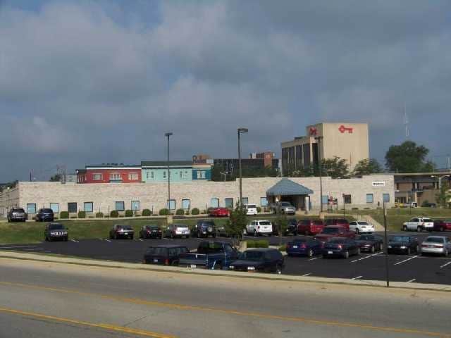

Property Detail
222 E 10Th St
48-11-12-404-002.000-003
ANDERSON RIVER CENTRE 7.4950ACRES STR: 00000 SECTION: PLAT: IN: OUT:
Officebuilding
Madison
AE The base floodplain where base flood elevations are provided. AE Zones are now used on new format FIRMs instead of A1-A30 Zones.
Indiana
2024
7.50 AC
2025
Anderson/Madison Cnty
011900
Indianapolis
39,166 SF
Indianapolis-Carmel-Greenwood, IN
NEARBY LISTINGS FOR SALE OR LEASE
DEMOGRAPHICS near 222 E 10Th St
1 mile
3 mile
5 mile
2025 Total Population
11,898
57,506
76,418
2030 Population
12,733
60,061
79,236
Pop Growth 2025-2030
+ 7.02%
+ 4.44%
+ 3.69%
Average Age
38
41
42
2025 Total Households
4,820
24,302
32,551
HH Growth 2025-2030
+ 7.43%
+ 4.55%
+ 3.77%
Median Household Inc
$40,672
$48,100
$55,176
Avg Household Size
2.20
2.20
2.20
2025 Avg HH Vehicles
1.00
2.00
2.00
Median Home Value
$81,101
$110,772
$134,466
Median Year Built
1949
1959
1962
Nearby Places
Map Layers
Map Styles
 Street
 Aerial
Layers
 Traffic
 Biking
Places
Listings with unknown addresses are not visible on the map
- Restaurants
- Banks
- Shops
- Fitness
- Groceries
Nearby Properties
Address
Land Use
TOTAL SIZE
Lot Size
Zoning
Address
Land Use
TOTAL SIZE
Lot Size
Zoning
75,580 SF
21 AC
Address
Land Use
TOTAL SIZE
Lot Size
Zoning
28,980 SF
9 AC
Address
Land Use
TOTAL SIZE
Lot Size
Zoning
27,175 SF
4.19 AC
Address
Land Use
TOTAL SIZE
Lot Size
Zoning
19,855 SF
10.64 AC
Address
Land Use
TOTAL SIZE
Lot Size
Zoning
1,431 SF
17.23 AC
Address
Land Use
TOTAL SIZE
Lot Size
Zoning
6,162 SF
27.97 AC
Address
Land Use
TOTAL SIZE
Lot Size
Zoning
86,770 SF
11.11 AC
Address
Land Use
TOTAL SIZE
Lot Size
Zoning
24,288 SF
15.20 AC
Address
Land Use
TOTAL SIZE
Lot Size
Zoning
3,094 SF
15.24 AC
Address
Land Use
TOTAL SIZE
Lot Size
Zoning
36,120 SF
22.78 AC
Address
Land Use
TOTAL SIZE
Lot Size
Zoning
148,490 SF
26 AC
Address
Land Use
TOTAL SIZE
Lot Size
Zoning
119,012 SF
14.15 AC
Address
Land Use
TOTAL SIZE
Lot Size
Zoning
122,860 SF
20.24 AC
Address
Land Use
TOTAL SIZE
Lot Size
Zoning
52,737 SF
9.53 AC
Address
Land Use
TOTAL SIZE
Lot Size
Zoning
21,454 SF
38.18 AC
Address
Land Use
TOTAL SIZE
Lot Size
Zoning
140,429 SF
18.58 AC
Address
Land Use
TOTAL SIZE
Lot Size
Zoning
59,160 SF
59.78 AC
Address
Land Use
TOTAL SIZE
Lot Size
Zoning
49,033 SF
2.08 AC
Address
Land Use
TOTAL SIZE
Lot Size
Zoning
70,286 SF
3.89 AC
Address
Land Use
TOTAL SIZE
Lot Size
Zoning
13,032 SF
12.58 AC
Address
Land Use
TOTAL SIZE
Lot Size
Zoning
70,860 SF
0.25 AC
Address
Land Use
TOTAL SIZE
Lot Size
Zoning
2,641 SF
24.33 AC
Address
Land Use
TOTAL SIZE
Lot Size
Zoning
3,704 SF
10 AC
Address
Land Use
TOTAL SIZE
Lot Size
Zoning
79,422 SF
5.37 AC
Address
Land Use
TOTAL SIZE
Lot Size
Zoning
87,171 SF
7.89 AC
Address
Land Use
TOTAL SIZE
Lot Size
Zoning
74,538 SF
6.78 AC
Address
Land Use
TOTAL SIZE
Lot Size
Zoning
48,268 SF
2.02 AC
Address
Land Use
TOTAL SIZE
Lot Size
Zoning
16,136 SF
9.39 AC
Address
Land Use
TOTAL SIZE
Lot Size
Zoning
44,107 SF
5 AC
Address
Land Use
TOTAL SIZE
Lot Size
Zoning
7,566 SF
6.15 AC
The World's #1 Commercial Real Estate Marketplace
Connect with us
© 2026 CoStar Group
The information above has been obtained from sources believed reliable. While we do not doubt its accuracy we have not verified it and make no guarantee, warranty or representation about it. It is your responsibility to independently confirm its accuracy and completeness. Any projections, opinions, assumptions, or estimates used are for example only and do not represent the current or future performance of the property. The value of this transaction to you depends on tax and other factors which should be evaluated by your tax, financial, and legal advisors. You and your advisors should conduct a careful, independent investigation of the property to determine to your satisfaction the suitability of the property for your needs.