Property Record
222 E 2400 N, Tooele, UT 84074

Property Detail
222 E 2400 N
Salt Lake City-Murray, UT
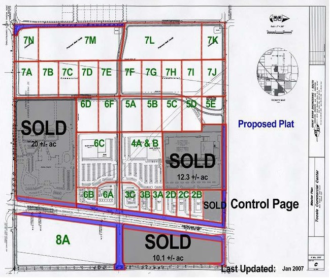
LOT 1, THE HOME DEPOT NO. 2, A SUBDIVISION OF TOOELE CITY. OUT OF 15-50-1 AND 2-143-82 FOR 2006 YEAR. $
15-064-0-0001
Tooele
Commercialnec
Utah
A Areas with a 1% annual chance of flooding and a 26% chance of flooding over the life of a 30-year mortgage.
1
2025
11.36 AC
2025
Tooele County
130706
Salt Lake City
104,851 SF
NEARBY LISTINGS FOR SALE OR LEASE
DEMOGRAPHICS near 222 E 2400 N
1 mile
3 mile
5 mile
2025 Total Population
5,613
32,294
57,635
2030 Population
6,366
36,204
64,312
Pop Growth 2025-2030
+ 13.42%
+ 12.11%
+ 11.58%
Average Age
32
34
34
2025 Total Households
1,616
9,973
17,520
HH Growth 2025-2030
+ 13.49%
+ 12.17%
+ 11.65%
Median Household Inc
$93,072
$88,738
$97,419
Avg Household Size
3.50
3.20
3.20
2025 Avg HH Vehicles
3.00
2.00
3.00
Median Home Value
$438,954
$426,503
$438,798
Median Year Built
2007
1998
1998
Nearby Places
Map Layers
Map Styles
 Street
 Aerial
Layers
 Traffic
 Biking
Places
Listings with unknown addresses are not visible on the map
- Restaurants
- Banks
- Shops
- Fitness
- Groceries
PUBLIC TRANSPORTATION
AIRPORT
Salt Lake City International
Drive
Walk
Distance
Salt Lake City International
34 min
27.6 mi
Freight Ports
Port of Stockton
Drive
Walk
Distance
Port of Stockton
701 min
684.5 mi
SALE & LEASE HISTORY
LISTING DATE
SALE/LEASE

Sep 25, 2016
For Lease
Sep 24, 2016
For Sale
Nearby Properties
Address
Land Use
TOTAL SIZE
Lot Size
Zoning
Address
Land Use
TOTAL SIZE
Lot Size
Zoning
166,140 SF
7 AC
Address
Land Use
TOTAL SIZE
Lot Size
Zoning
30,144 SF
6 AC
Address
Land Use
TOTAL SIZE
Lot Size
Zoning
3,188 SF
7.64 AC
Address
Land Use
TOTAL SIZE
Lot Size
Zoning
59,286 SF
4.84 AC
Address
Land Use
TOTAL SIZE
Lot Size
Zoning
4.90 AC
Address
Land Use
TOTAL SIZE
Lot Size
Zoning
Address
Land Use
TOTAL SIZE
Lot Size
Zoning
86,615 SF
8.87 AC
Address
Land Use
TOTAL SIZE
Lot Size
Zoning
5.34 AC
Address
Land Use
TOTAL SIZE
Lot Size
Zoning
191,115 SF
18.09 AC
Address
Land Use
TOTAL SIZE
Lot Size
Zoning
55,381 SF
4.68 AC
Address
Land Use
TOTAL SIZE
Lot Size
Zoning
60,127 SF
1.67 AC
Address
Land Use
TOTAL SIZE
Lot Size
Zoning
53,151 SF
1.18 AC
Address
Land Use
TOTAL SIZE
Lot Size
Zoning
27,277 SF
4.50 AC
Address
Land Use
TOTAL SIZE
Lot Size
Zoning
2,540 SF
2.25 AC
Address
Land Use
TOTAL SIZE
Lot Size
Zoning
24,550 SF
0.86 AC
Address
Land Use
TOTAL SIZE
Lot Size
Zoning
60,169 SF
40.57 AC
Address
Land Use
TOTAL SIZE
Lot Size
Zoning
29,667 SF
6.48 AC
Address
Land Use
TOTAL SIZE
Lot Size
Zoning
59,652 SF
2.37 AC
Address
Land Use
TOTAL SIZE
Lot Size
Zoning
Address
Land Use
TOTAL SIZE
Lot Size
Zoning
71,791 SF
10.02 AC
Address
Land Use
TOTAL SIZE
Lot Size
Zoning
37,261 SF
3.03 AC
Address
Land Use
TOTAL SIZE
Lot Size
Zoning
9,120 SF
6.67 AC
Address
Land Use
TOTAL SIZE
Lot Size
Zoning
2,797 SF
5.02 AC
Address
Land Use
TOTAL SIZE
Lot Size
Zoning
52,141 SF
5 AC
Address
Land Use
TOTAL SIZE
Lot Size
Zoning
37,148 SF
2.06 AC
Address
Land Use
TOTAL SIZE
Lot Size
Zoning
141,845 SF
8.58 AC
Address
Land Use
TOTAL SIZE
Lot Size
Zoning
30,089 SF
4.30 AC
The World's #1 Commercial Real Estate Marketplace
Connect with us
© 2026 CoStar Group
The information above has been obtained from sources believed reliable. While we do not doubt its accuracy we have not verified it and make no guarantee, warranty or representation about it. It is your responsibility to independently confirm its accuracy and completeness. Any projections, opinions, assumptions, or estimates used are for example only and do not represent the current or future performance of the property. The value of this transaction to you depends on tax and other factors which should be evaluated by your tax, financial, and legal advisors. You and your advisors should conduct a careful, independent investigation of the property to determine to your satisfaction the suitability of the property for your needs.