Property Record
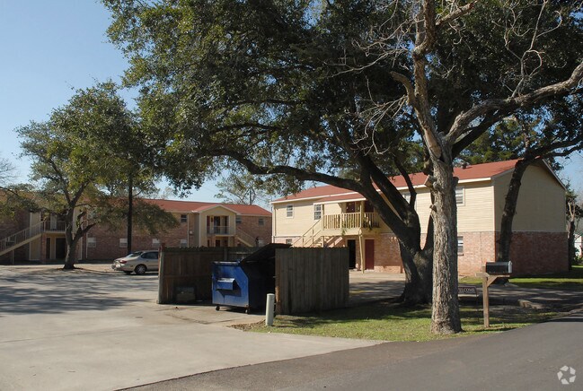
222 E Phillips Rd, Angleton, TX 77515

Property Detail
222 E Phillips Rd
0134-0342-100
A0134 E WALLER BLOCK 5 TRACT 1I1 (SD E/2) ACRES .249 (ANGLETON)
Apartment
Brazoria
0418
Texas
B and X Area of moderate flood hazard, usually the area between the limits of the 100-year and 500-year floods.
0.34 AC
2024
South Brazoria County
2025
Houston
6641004053
Houston-Pasadena-The Woodlands, TX
6,156 SF
NEARBY LISTINGS FOR SALE OR LEASE
-
-
View all Angleton listings for sale on LoopNet.com
DEMOGRAPHICS near 222 E Phillips Rd
1 mile
3 mile
5 mile
2024 Total Population
3,174
15,615
33,128
2029 Population
3,554
17,358
36,821
Pop Growth 2024-2029
+ 11.97%
+ 11.16%
+ 11.15%
Average Age
38
38
38
2024 Total Households
1,106
5,587
11,882
HH Growth 2024-2029
+ 12.30%
+ 11.47%
+ 11.64%
Median Household Inc
$104,167
$90,605
$87,845
Avg Household Size
2.80
2.70
2.70
2024 Avg HH Vehicles
2.00
2.00
2.00
Median Home Value
$239,309
$192,497
$231,331
Median Year Built
1987
1977
1984
Nearby Places
Map Layers
Map Styles
 Street
 Aerial
Transit
 Traffic
 Biking
Places
Listings with unknown addresses are not visible on the map
- Restaurants
- Banks
- Shops
- Fitness
- Groceries
Nearby Properties
Address
Land Use
TOTAL SIZE
Lot Size
Zoning
Address
Land Use
TOTAL SIZE
Lot Size
Zoning
305,581 SF
8.28 AC
Address
Land Use
TOTAL SIZE
Lot Size
Zoning
318,545 SF
50.52 AC
Address
Land Use
TOTAL SIZE
Lot Size
Zoning
92,290 SF
6.17 AC
0361
Address
Land Use
TOTAL SIZE
Lot Size
Zoning
12,221 SF
13.76 AC
0165
Address
Land Use
TOTAL SIZE
Lot Size
Zoning
266,816 SF
20.34 AC
Address
Land Use
TOTAL SIZE
Lot Size
Zoning
116,629 SF
44.43 AC
Address
Land Use
TOTAL SIZE
Lot Size
Zoning
96,487 SF
1 AC
0011
Address
Land Use
TOTAL SIZE
Lot Size
Zoning
6.52 AC
Address
Land Use
TOTAL SIZE
Lot Size
Zoning
4.60 AC
Address
Land Use
TOTAL SIZE
Lot Size
Zoning
60.29 AC
0068
Address
Land Use
TOTAL SIZE
Lot Size
Zoning
18,091 SF
29.61 AC
Address
Land Use
TOTAL SIZE
Lot Size
Zoning
77,295 SF
6.63 AC
0056
Address
Land Use
TOTAL SIZE
Lot Size
Zoning
90,957 SF
5 AC
Address
Land Use
TOTAL SIZE
Lot Size
Zoning
17,007 SF
13.60 AC
0021
Address
Land Use
TOTAL SIZE
Lot Size
Zoning
1,930 SF
30 AC
0436
Address
Land Use
TOTAL SIZE
Lot Size
Zoning
33,546 SF
13.28 AC
Address
Land Use
TOTAL SIZE
Lot Size
Zoning
112,149 SF
35.71 AC
Address
Land Use
TOTAL SIZE
Lot Size
Zoning
14.52 AC
Address
Land Use
TOTAL SIZE
Lot Size
Zoning
34,125 SF
1.67 AC
Address
Land Use
TOTAL SIZE
Lot Size
Zoning
57,828 SF
4.36 AC
Address
Land Use
TOTAL SIZE
Lot Size
Zoning
20,171 SF
35 AC
Address
Land Use
TOTAL SIZE
Lot Size
Zoning
52,544 SF
4.87 AC
0256
Address
Land Use
TOTAL SIZE
Lot Size
Zoning
19.16 AC
0008
Address
Land Use
TOTAL SIZE
Lot Size
Zoning
68,256 SF
6.13 AC
Address
Land Use
TOTAL SIZE
Lot Size
Zoning
Address
Land Use
TOTAL SIZE
Lot Size
Zoning
53,090 SF
1.96 AC
0085
Address
Land Use
TOTAL SIZE
Lot Size
Zoning
13,470 SF
0.68 AC
0066
Address
Land Use
TOTAL SIZE
Lot Size
Zoning
49,795 SF
3.53 AC
0089
Address
Land Use
TOTAL SIZE
Lot Size
Zoning
29,670 SF
21.34 AC
0149
Address
Land Use
TOTAL SIZE
Lot Size
Zoning
8.91 AC
The World's #1 Commercial Real Estate Marketplace
Connect with us
© 2026 CoStar Group
The information above has been obtained from sources believed reliable. While we do not doubt its accuracy we have not verified it and make no guarantee, warranty or representation about it. It is your responsibility to independently confirm its accuracy and completeness. Any projections, opinions, assumptions, or estimates used are for example only and do not represent the current or future performance of the property. The value of this transaction to you depends on tax and other factors which should be evaluated by your tax, financial, and legal advisors. You and your advisors should conduct a careful, independent investigation of the property to determine to your satisfaction the suitability of the property for your needs.