Property Record
222 Glenn Bridge Rd, Arden, NC 28704


Property Detail
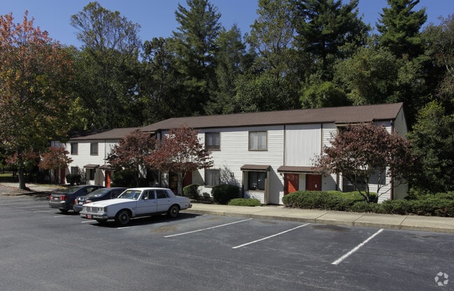
222 Glenn Bridge Rd
9644-81-5610-00000
SUBDIV: BLOCK: LOT: SECTION: PLAT: 0000-0000
Apartment
Buncombe
EMP
North Carolina
B and X Area of moderate flood hazard, usually the area between the limits of the 100-year and 500-year floods.
5.43 AC
2024
Lake Julian
2025
Asheville
002203
Asheville, NC
24,312 SF
NEARBY LISTINGS FOR SALE OR LEASE
-
-
View all Arden listings for sale on LoopNet.com
DEMOGRAPHICS near 222 Glenn Bridge Rd
1 mile
3 mile
5 mile
2025 Total Population
5,310
34,893
59,959
2030 Population
5,427
35,865
61,792
Pop Growth 2025-2030
+ 2.20%
+ 2.79%
+ 3.06%
Average Age
37
42
43
2025 Total Households
2,125
15,319
25,888
HH Growth 2025-2030
+ 2.02%
+ 2.58%
+ 2.88%
Median Household Inc
$64,859
$80,691
$82,889
Avg Household Size
2.40
2.20
2.30
2025 Avg HH Vehicles
2.00
2.00
2.00
Median Home Value
$237,096
$403,915
$437,737
Median Year Built
1996
1997
1997
Nearby Places
Map Layers
Map Styles
 Street
 Aerial
Layers
 Traffic
 Biking
Places
Listings with unknown addresses are not visible on the map
- Restaurants
- Banks
- Shops
- Fitness
- Groceries
PUBLIC TRANSPORTATION
AIRPORT
Asheville Regional
Drive
Walk
Distance
Asheville Regional
5 min
2.3 mi
Freight Ports
North Charleston Terminal
Drive
Walk
Distance
North Charleston Terminal
277 min
246.0 mi
Nearby Properties
Address
Land Use
TOTAL SIZE
Lot Size
Zoning
Address
Land Use
TOTAL SIZE
Lot Size
Zoning
346,375 SF
58.11 AC
INST
Address
Land Use
TOTAL SIZE
Lot Size
Zoning
107,063 SF
567.34 AC
AI
Address
Land Use
TOTAL SIZE
Lot Size
Zoning
118,357 SF
24.67 AC
EMP
Address
Land Use
TOTAL SIZE
Lot Size
Zoning
110,173 SF
28.13 AC
R-2
Address
Land Use
TOTAL SIZE
Lot Size
Zoning
83,129 SF
44.74 AC
EMP
Address
Land Use
TOTAL SIZE
Lot Size
Zoning
281,505 SF
38.35 AC
10000070~M
Address
Land Use
TOTAL SIZE
Lot Size
Zoning
78,745 SF
14.73 AC
HB
Address
Land Use
TOTAL SIZE
Lot Size
Zoning
85,103 SF
11.69 AC
RES EXP
Address
Land Use
TOTAL SIZE
Lot Size
Zoning
66,863 SF
7.48 AC
INST
Address
Land Use
TOTAL SIZE
Lot Size
Zoning
57,836 SF
1.09 AC
UV
Address
Land Use
TOTAL SIZE
Lot Size
Zoning
207,701 SF
458.72 AC
R-3
Address
Land Use
TOTAL SIZE
Lot Size
Zoning
107,408 SF
21.92 AC
R-3
Address
Land Use
TOTAL SIZE
Lot Size
Zoning
183,020 SF
22.84 AC
RM16
Address
Land Use
TOTAL SIZE
Lot Size
Zoning
77,056 SF
19.45 AC
EMP
Address
Land Use
TOTAL SIZE
Lot Size
Zoning
198,705 SF
32.46 AC
HB
Address
Land Use
TOTAL SIZE
Lot Size
Zoning
227,740 SF
36.18 AC
INST
Address
Land Use
TOTAL SIZE
Lot Size
Zoning
82,267 SF
14.05 AC
CI
Address
Land Use
TOTAL SIZE
Lot Size
Zoning
218,133 SF
15.39 AC
R-2
Address
Land Use
TOTAL SIZE
Lot Size
Zoning
73,420 SF
10.24 AC
RM16
Address
Land Use
TOTAL SIZE
Lot Size
Zoning
155,715 SF
36.84 AC
RM16
Address
Land Use
TOTAL SIZE
Lot Size
Zoning
80,872 SF
18.84 AC
RM16
Address
Land Use
TOTAL SIZE
Lot Size
Zoning
93,197 SF
6.32 AC
RES EXP
Address
Land Use
TOTAL SIZE
Lot Size
Zoning
71,574 SF
15.85 AC
RM16
Address
Land Use
TOTAL SIZE
Lot Size
Zoning
332,974 SF
8.38 AC
EMP
Address
Land Use
TOTAL SIZE
Lot Size
Zoning
63,030 SF
5.70 AC
RES EXP
Address
Land Use
TOTAL SIZE
Lot Size
Zoning
78,783 SF
9 AC
PS
Address
Land Use
TOTAL SIZE
Lot Size
Zoning
3,466 SF
11.32 AC
10000832~M
Address
Land Use
TOTAL SIZE
Lot Size
Zoning
4,839 SF
9.46 AC
10002512~C
Address
Land Use
TOTAL SIZE
Lot Size
Zoning
48,343 SF
11.67 AC
RM16
Address
Land Use
TOTAL SIZE
Lot Size
Zoning
92,772 SF
12.30 AC
R-2
The World's #1 Commercial Real Estate Marketplace
Connect with us
© 2026 CoStar Group
The information above has been obtained from sources believed reliable. While we do not doubt its accuracy we have not verified it and make no guarantee, warranty or representation about it. It is your responsibility to independently confirm its accuracy and completeness. Any projections, opinions, assumptions, or estimates used are for example only and do not represent the current or future performance of the property. The value of this transaction to you depends on tax and other factors which should be evaluated by your tax, financial, and legal advisors. You and your advisors should conduct a careful, independent investigation of the property to determine to your satisfaction the suitability of the property for your needs.