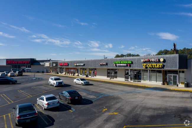
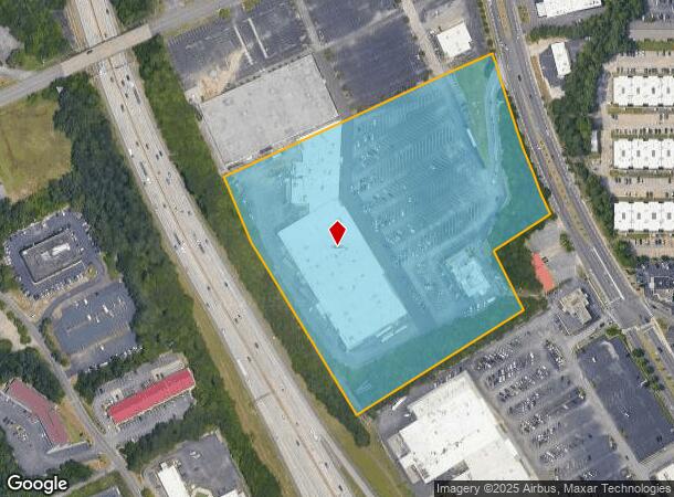
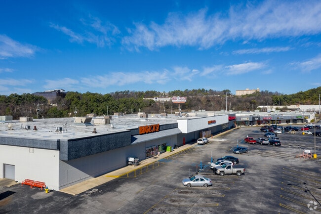
Property Record
222 Green Springs Hwy, Birmingham, AL 35209
NEARBY LISTINGS FOR SALE OR LEASE
Property Detail
222 Green Springs Hwy
29-00-14-3-002-002.000
P O B 20S FT S E OF THE INTER OF N LINE S W 1/4 SEC 14 T 18 S R 3 W & S W LINE GREEN SPRINGS HWY TH S E 510S FT ALG HWY TH S W 200S FT TH S E 200S FT TH S W 588S FT TO I-65 TH N W 810S FT ALG I-65 TH N E 886S FT TO P O B SECT 14 TWSP 18S RANGE 3W
Supermarket
Jefferson
X
Alabama
01073C0554J
14 AC
2023
Vulcan/Oxmoor
2024
Birmingham
005800
Birmingham-Hoover, AL
114,981 SF
DEMOGRAPHICS near 222 Green Springs Hwy
1 Mile
3 Mile
5 Mile
2024 Total Population
10,398
81,675
188,859
2029 Population
10,247
81,362
187,318
Pop Growth 2024-2029
(1.45%)
(0.38%)
(0.82%)
Average Age
34
37
39
2024 Total Households
5,312
34,921
81,626
HH Growth 2024-2029
(0.92%)
(0.22%)
(0.74%)
Median Household Inc
$49,221
$47,715
$50,074
Avg Household Size
1.90
2.10
2.10
2024 Avg HH Vehicles
2.00
2.00
2.00
Median Home Value
$350,853
$290,876
$271,803
Median Year Built
1979
1972
1967
Nearby Places
Map Layers
Map Styles
 Street
 Aerial
- Restaurants
- Banks
- Shops
- Fitness
- Groceries
PUBLIC TRANSPORTATION
COMMUTER RAIL
DRIVE
WALK
Distance
9 min
4.6 mi
AIRPORT
Birmingham-Shuttlesworth International
DRIVE
WALK
Distance
Birmingham-Shuttlesworth International
17 min
9.6 mi
SALE & LEASE HISTORY
LISTING DATE
SALE/LEASE

May 02, 2017
For Lease
Nearby Properties
Address
Land Use
TOTAL SIZE
Lot Size
Zoning
Address
Land Use
TOTAL SIZE
Lot Size
Zoning
978,879 SF
43.50 AC
I3
Address
Land Use
TOTAL SIZE
Lot Size
Zoning
239,334 SF
4.42 AC
B6
Address
Land Use
TOTAL SIZE
Lot Size
Zoning
203,878 SF
12.58 AC
B6
Address
Land Use
TOTAL SIZE
Lot Size
Zoning
31,980 SF
99.92 AC
I3/P
Address
Land Use
TOTAL SIZE
Lot Size
Zoning
242,746 SF
20.96 AC
MXDE
Address
Land Use
TOTAL SIZE
Lot Size
Zoning
334,805 SF
32.50 AC
MXD/
Address
Land Use
TOTAL SIZE
Lot Size
Zoning
200,927 SF
19 AC
PMUD
Address
Land Use
TOTAL SIZE
Lot Size
Zoning
1,666 SF
1.69 AC
M1
Address
Land Use
TOTAL SIZE
Lot Size
Zoning
209,765 SF
19.20 AC
I-3
Address
Land Use
TOTAL SIZE
Lot Size
Zoning
186,070 SF
16.60 AC
QB2
Address
Land Use
TOTAL SIZE
Lot Size
Zoning
109,819 SF
2.91 AC
M2
Address
Land Use
TOTAL SIZE
Lot Size
Zoning
32,948 SF
0.48 AC
B3
Address
Land Use
TOTAL SIZE
Lot Size
Zoning
30,453 SF
0.44 AC
B2
Address
Land Use
TOTAL SIZE
Lot Size
Zoning
329,064 SF
9 AC
I3
Address
Land Use
TOTAL SIZE
Lot Size
Zoning
156,986 SF
1.29 AC
M1
Address
Land Use
TOTAL SIZE
Lot Size
Zoning
311,982 SF
30 AC
R6
Address
Land Use
TOTAL SIZE
Lot Size
Zoning
97,377 SF
1.63 AC
M1
Address
Land Use
TOTAL SIZE
Lot Size
Zoning
69,981 SF
4.90 AC
B2
Address
Land Use
TOTAL SIZE
Lot Size
Zoning
33,209 SF
3.11 AC
C4B
Address
Land Use
TOTAL SIZE
Lot Size
Zoning
282,421 SF
24.33 AC
R7
Address
Land Use
TOTAL SIZE
Lot Size
Zoning
92,332 SF
8.40 AC
Address
Land Use
TOTAL SIZE
Lot Size
Zoning
331,413 SF
14.46 AC
R6
Address
Land Use
TOTAL SIZE
Lot Size
Zoning
65,685 SF
9.50 AC
B2
Address
Land Use
TOTAL SIZE
Lot Size
Zoning
265,418 SF
26.55 AC
R2
Address
Land Use
TOTAL SIZE
Lot Size
Zoning
62,516 SF
1.37 AC
I3
Address
Land Use
TOTAL SIZE
Lot Size
Zoning
52,922 SF
B3
Address
Land Use
TOTAL SIZE
Lot Size
Zoning
133,396 SF
19 AC
QR6
Address
Land Use
TOTAL SIZE
Lot Size
Zoning
38,963 SF
0.24 AC
C4B
Address
Land Use
TOTAL SIZE
Lot Size
Zoning
403,758 SF
22.36 AC
R3
The World's #1 Commercial Real Estate Marketplace
Connect with us
© 2025 CoStar Group
The information above has been obtained from sources believed reliable. While we do not doubt its accuracy we have not verified it and make no guarantee, warranty or representation about it. It is your responsibility to independently confirm its accuracy and completeness. Any projections, opinions, assumptions, or estimates used are for example only and do not represent the current or future performance of the property. The value of this transaction to you depends on tax and other factors which should be evaluated by your tax, financial, and legal advisors. You and your advisors should conduct a careful, independent investigation of the property to determine to your satisfaction the suitability of the property for your needs.