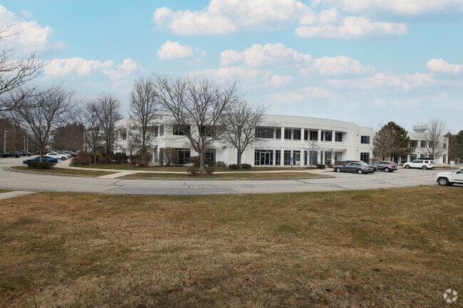
Property Record
222 International Dr, Portsmouth, NH 03801


NEARBY LISTINGS FOR SALE OR LEASE
Property Detail
222 International Dr
PRSM-000312-000001
Rockingham
Commercialnec
New Hampshire
X
20.53 AC
33015C0260F
Rockingham
2024
Boston
2024
Boston-Cambridge-Newton, MA-NH
107400
DEMOGRAPHICS near 222 International Dr
1 Mile
3 Mile
5 Mile
2024 Total Population
1,001
23,690
46,026
2029 Population
1,023
24,787
48,138
Pop Growth 2024-2029
+ 2.20%
+ 4.63%
+ 4.59%
Average Age
42
44
44
2024 Total Households
407
10,982
20,622
HH Growth 2024-2029
+ 2.21%
+ 4.61%
+ 4.56%
Median Household Inc
$88,829
$99,382
$102,556
Avg Household Size
2.30
2.10
2.20
2024 Avg HH Vehicles
2.00
2.00
2.00
Median Home Value
$400,649
$593,234
$571,938
Median Year Built
1954
1955
1969
Nearby Places
Map Layers
Map Styles
 Street
 Aerial
- Restaurants
- Banks
- Shops
- Fitness
- Groceries
PUBLIC TRANSPORTATION
AIRPORT
Portsmouth International at Pease
DRIVE
WALK
Distance
Portsmouth International at Pease
4 min
1.2 mi
Freight Ports
Portland, ME
DRIVE
WALK
Distance
Portland, ME
66 min
54.9 mi
SALE & LEASE HISTORY
LISTING DATE
SALE/LEASE

Sep 25, 2016
For Lease
Dec 16, 2019
For Lease
Nearby Properties
Address
Land Use
TOTAL SIZE
Lot Size
Zoning
Address
Land Use
TOTAL SIZE
Lot Size
Zoning
54.20 AC
M
Address
Land Use
TOTAL SIZE
Lot Size
Zoning
58.25 AC
COMM
Address
Land Use
TOTAL SIZE
Lot Size
Zoning
6.20 AC
G1
Address
Land Use
TOTAL SIZE
Lot Size
Zoning
152,028 SF
CD5
Address
Land Use
TOTAL SIZE
Lot Size
Zoning
144,226 SF
5.72 AC
M
Address
Land Use
TOTAL SIZE
Lot Size
Zoning
1,575 SF
52.95 AC
COMM
Address
Land Use
TOTAL SIZE
Lot Size
Zoning
Address
Land Use
TOTAL SIZE
Lot Size
Zoning
22.33 AC
MU-N
Address
Land Use
TOTAL SIZE
Lot Size
Zoning
1,288 AC
GBW
Address
Land Use
TOTAL SIZE
Lot Size
Zoning
102,617 SF
1.27 AC
CD5
Address
Land Use
TOTAL SIZE
Lot Size
Zoning
57,711 SF
1.44 AC
CD4
Address
Land Use
TOTAL SIZE
Lot Size
Zoning
136,711 SF
1.85 AC
CD5
Address
Land Use
TOTAL SIZE
Lot Size
Zoning
19.26 AC
G1
Address
Land Use
TOTAL SIZE
Lot Size
Zoning
11.30 AC
G1
Address
Land Use
TOTAL SIZE
Lot Size
Zoning
4.73 AC
CD4-W
Address
Land Use
TOTAL SIZE
Lot Size
Zoning
86,293 SF
0.64 AC
CD5
Address
Land Use
TOTAL SIZE
Lot Size
Zoning
15.94 AC
G1
Address
Land Use
TOTAL SIZE
Lot Size
Zoning
48.95 AC
WIND
Address
Land Use
TOTAL SIZE
Lot Size
Zoning
3.78 AC
COMM
Address
Land Use
TOTAL SIZE
Lot Size
Zoning
114,194 SF
G1
Address
Land Use
TOTAL SIZE
Lot Size
Zoning
11.23 AC
OR
Address
Land Use
TOTAL SIZE
Lot Size
Zoning
127,896 SF
20.32 AC
ABC
Address
Land Use
TOTAL SIZE
Lot Size
Zoning
33.39 AC
IND
Address
Land Use
TOTAL SIZE
Lot Size
Zoning
205,891 SF
LI
Address
Land Use
TOTAL SIZE
Lot Size
Zoning
64.76 AC
WIND
Address
Land Use
TOTAL SIZE
Lot Size
Zoning
15.20 AC
G1
Address
Land Use
TOTAL SIZE
Lot Size
Zoning
18.49 AC
GRB
Address
Land Use
TOTAL SIZE
Lot Size
Zoning
23.29 AC
G1
Address
Land Use
TOTAL SIZE
Lot Size
Zoning
17.11 AC
ABC
Address
Land Use
TOTAL SIZE
Lot Size
Zoning
77,523 SF
CD5
The World's #1 Commercial Real Estate Marketplace
Connect with us
© 2026 CoStar Group
The information above has been obtained from sources believed reliable. While we do not doubt its accuracy we have not verified it and make no guarantee, warranty or representation about it. It is your responsibility to independently confirm its accuracy and completeness. Any projections, opinions, assumptions, or estimates used are for example only and do not represent the current or future performance of the property. The value of this transaction to you depends on tax and other factors which should be evaluated by your tax, financial, and legal advisors. You and your advisors should conduct a careful, independent investigation of the property to determine to your satisfaction the suitability of the property for your needs.