Property Record
222 Rip Wiley Rd, Fitzgerald, GA 31750
NEARBY LISTINGS FOR SALE OR LEASE
-
-
View all Fitzgerald listings for lease on LoopNet.com
Property Detail
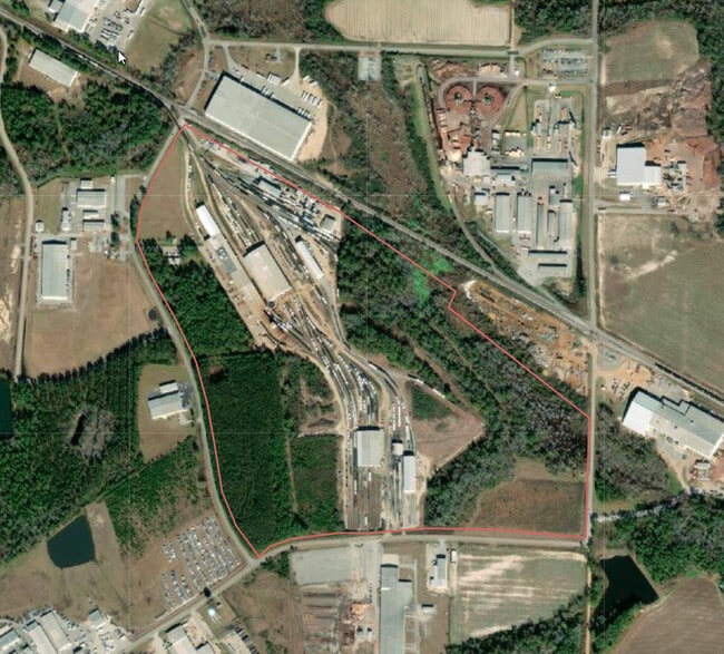
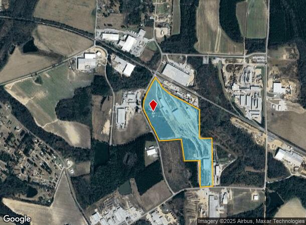
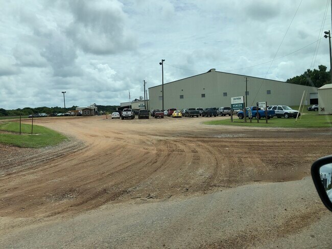
222 Rip Wiley Rd
6-10-90
LL 265 & 266/4
Officebuilding
Ben Hill
X
Georgia
13017C0154B
50.88 AC
2024
Georgia South Area
2024
Other Market Areas
960501
Fitzgerald, GA
2,996 SF
DEMOGRAPHICS near 222 Rip Wiley Rd
1 Mile
3 Mile
5 Mile
2024 Total Population
398
7,976
14,368
2029 Population
399
7,948
14,218
Pop Growth 2024-2029
+ 0.25%
(0.35%)
(1.04%)
Average Age
40
40
40
2024 Total Households
161
3,298
5,904
HH Growth 2024-2029
+ 0.62%
(0.27%)
(1.00%)
Median Household Inc
$28,529
$30,473
$34,070
Avg Household Size
2.50
2.30
2.40
2024 Avg HH Vehicles
1.00
1.00
1.00
Median Home Value
$216,000
$86,436
$92,769
Median Year Built
1987
1982
1979
Nearby Places
Map Layers
Map Styles
 Street
 Aerial
- Restaurants
- Banks
- Shops
- Fitness
- Groceries
SALE & LEASE HISTORY
LISTING DATE
SALE/LEASE

Aug 18, 2021
For Lease
Nearby Properties
Address
Land Use
TOTAL SIZE
Lot Size
Zoning
Address
Land Use
TOTAL SIZE
Lot Size
Zoning
394,188 SF
53.21 AC
RESIDENTIA
Address
Land Use
TOTAL SIZE
Lot Size
Zoning
14.49 AC
RESIDENTIA
Address
Land Use
TOTAL SIZE
Lot Size
Zoning
90,021 SF
15 AC
COMMERCIAL
Address
Land Use
TOTAL SIZE
Lot Size
Zoning
48,210 SF
19.95 AC
Address
Land Use
TOTAL SIZE
Lot Size
Zoning
163,510 SF
17.77 AC
Address
Land Use
TOTAL SIZE
Lot Size
Zoning
142,878 SF
12.43 AC
Address
Land Use
TOTAL SIZE
Lot Size
Zoning
211,200 SF
17.34 AC
INDUSTRIAL
Address
Land Use
TOTAL SIZE
Lot Size
Zoning
100,000 SF
5.79 AC
RURAL
Address
Land Use
TOTAL SIZE
Lot Size
Zoning
100,000 SF
2.54 AC
Address
Land Use
TOTAL SIZE
Lot Size
Zoning
99,444 SF
22.70 AC
RESIDENTIA
Address
Land Use
TOTAL SIZE
Lot Size
Zoning
63,940 SF
48.24 AC
Address
Land Use
TOTAL SIZE
Lot Size
Zoning
173,620 SF
52.47 AC
RESIDENTIA
Address
Land Use
TOTAL SIZE
Lot Size
Zoning
102,187 SF
6.90 AC
RESIDENTIA
Address
Land Use
TOTAL SIZE
Lot Size
Zoning
217.98 AC
Address
Land Use
TOTAL SIZE
Lot Size
Zoning
1,782 SF
5 AC
Address
Land Use
TOTAL SIZE
Lot Size
Zoning
61,290 SF
28 AC
COMMERCIAL
Address
Land Use
TOTAL SIZE
Lot Size
Zoning
79,084 SF
42.13 AC
INDUSTRIAL
Address
Land Use
TOTAL SIZE
Lot Size
Zoning
14,133 SF
51.52 AC
INDUSTRIAL
Address
Land Use
TOTAL SIZE
Lot Size
Zoning
259,958 SF
40.59 AC
INDUSTRIAL
Address
Land Use
TOTAL SIZE
Lot Size
Zoning
32,800 SF
4.21 AC
Address
Land Use
TOTAL SIZE
Lot Size
Zoning
60,000 SF
26.15 AC
RESIDENTIA
Address
Land Use
TOTAL SIZE
Lot Size
Zoning
97,500 SF
28.05 AC
INDUSTRIAL
Address
Land Use
TOTAL SIZE
Lot Size
Zoning
7,200 SF
10 AC
RESIDENTIA
The World's #1 Commercial Real Estate Marketplace
Connect with us
© 2025 CoStar Group
The information above has been obtained from sources believed reliable. While we do not doubt its accuracy we have not verified it and make no guarantee, warranty or representation about it. It is your responsibility to independently confirm its accuracy and completeness. Any projections, opinions, assumptions, or estimates used are for example only and do not represent the current or future performance of the property. The value of this transaction to you depends on tax and other factors which should be evaluated by your tax, financial, and legal advisors. You and your advisors should conduct a careful, independent investigation of the property to determine to your satisfaction the suitability of the property for your needs.