Property Record
222 Scheller Ave, Morgan Hill, CA 95037
Property Detail
222 Scheller Ave
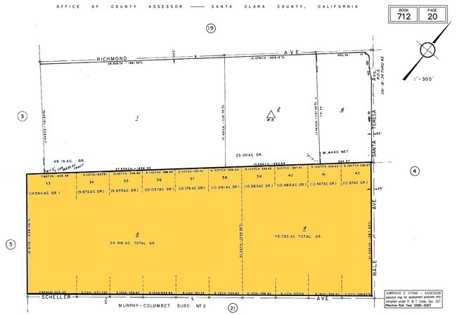
712-20-004
SANTA CLARA
Orchard
California
A-40A
17
AE The base floodplain where base flood elevations are provided. AE Zones are now used on new format FIRMs instead of A1-A30 Zones.
42.09 AC
2024
South San Jose
2025
South Bay/San Jose
512312
San Jose-Sunnyvale-Santa Clara, CA
NEARBY LISTINGS FOR SALE OR LEASE
DEMOGRAPHICS near 222 Scheller Ave
1 mile
3 mile
5 mile
2025 Total Population
363
1,496
30,849
2030 Population
351
1,451
31,490
Pop Growth 2025-2030
(3.31%)
(3.01%)
+ 2.08%
Average Age
42
42
41
2025 Total Households
100
420
9,784
HH Growth 2025-2030
(4.00%)
(3.10%)
+ 2.12%
Median Household Inc
$99,999
$104,902
$162,410
Avg Household Size
3.30
3.20
3.10
2025 Avg HH Vehicles
3.00
3.00
2.00
Median Home Value
$1,096,667
$1,099,746
$1,061,763
Median Year Built
1977
1977
1981
Nearby Places
Map Layers
Map Styles
 Street
 Aerial
Transit
 Traffic
 Biking
Places
Listings with unknown addresses are not visible on the map
- Restaurants
- Banks
- Shops
- Fitness
- Groceries
PUBLIC TRANSPORTATION
COMMUTER RAIL
Morgan Hill Caltrain Station Southbound (South Santa Clara County Connector - Caltrain (Caltrain))
Drive
Walk
Distance
Morgan Hill Caltrain Station Southbound (South Santa Clara County Connector - Caltrain (Caltrain))
11 min
5.8 mi
Blossom Hill Caltrain Station Southbound (South Santa Clara County Connector - Caltrain (Caltrain))
Drive
Walk
Distance
Blossom Hill Caltrain Station Southbound (South Santa Clara County Connector - Caltrain (Caltrain))
13 min
7.1 mi
AIRPORT
Norman Y Mineta San Jose International
Drive
Walk
Distance
Norman Y Mineta San Jose International
27 min
20.9 mi
Freight Ports
Port of Redwood City
Drive
Walk
Distance
Port of Redwood City
49 min
38.9 mi
Nearby Properties
Address
Land Use
TOTAL SIZE
Lot Size
Zoning
Address
Land Use
TOTAL SIZE
Lot Size
Zoning
620,000 SF
200.12 AC
A--PD
Address
Land Use
TOTAL SIZE
Lot Size
Zoning
108,631 SF
13.90 AC
A-20A
Address
Land Use
TOTAL SIZE
Lot Size
Zoning
14,322 SF
34.37 AC
HS
Address
Land Use
TOTAL SIZE
Lot Size
Zoning
132.94 AC
A
Address
Land Use
TOTAL SIZE
Lot Size
Zoning
3.06 AC
R1B1
Address
Land Use
TOTAL SIZE
Lot Size
Zoning
14.16 AC
SS-2
Address
Land Use
TOTAL SIZE
Lot Size
Zoning
16,233 SF
118 AC
A(PD)
Address
Land Use
TOTAL SIZE
Lot Size
Zoning
15,895 SF
138.61 AC
A-40A
Address
Land Use
TOTAL SIZE
Lot Size
Zoning
36.87 AC
A-40A
Address
Land Use
TOTAL SIZE
Lot Size
Zoning
46.86 AC
A
Address
Land Use
TOTAL SIZE
Lot Size
Zoning
75,873 SF
11.48 AC
A-40A
Address
Land Use
TOTAL SIZE
Lot Size
Zoning
2.46 AC
A
Address
Land Use
TOTAL SIZE
Lot Size
Zoning
79.35 AC
A-40A
Address
Land Use
TOTAL SIZE
Lot Size
Zoning
25.23 AC
A-40A
Address
Land Use
TOTAL SIZE
Lot Size
Zoning
66.60 AC
A-40A
Address
Land Use
TOTAL SIZE
Lot Size
Zoning
66.05 AC
A-40A
Address
Land Use
TOTAL SIZE
Lot Size
Zoning
60 AC
A-40A
Address
Land Use
TOTAL SIZE
Lot Size
Zoning
35.68 AC
A-PD
Address
Land Use
TOTAL SIZE
Lot Size
Zoning
75 AC
A
Address
Land Use
TOTAL SIZE
Lot Size
Zoning
410,000 SF
966.07 AC
A--PD
Address
Land Use
TOTAL SIZE
Lot Size
Zoning
50.49 AC
A-40A
Address
Land Use
TOTAL SIZE
Lot Size
Zoning
44.61 AC
R1-1
Address
Land Use
TOTAL SIZE
Lot Size
Zoning
14.23 AC
A-40A
Address
Land Use
TOTAL SIZE
Lot Size
Zoning
38.88 AC
AW
Address
Land Use
TOTAL SIZE
Lot Size
Zoning
3,000 SF
5.94 AC
M4H
Address
Land Use
TOTAL SIZE
Lot Size
Zoning
103.97 AC
A-40A
Address
Land Use
TOTAL SIZE
Lot Size
Zoning
22.81 AC
A-40
Address
Land Use
TOTAL SIZE
Lot Size
Zoning
244 AC
A140
Address
Land Use
TOTAL SIZE
Lot Size
Zoning
9.81 AC
AW
The World's #1 Commercial Real Estate Marketplace
Connect with us
© 2026 CoStar Group
The information above has been obtained from sources believed reliable. While we do not doubt its accuracy we have not verified it and make no guarantee, warranty or representation about it. It is your responsibility to independently confirm its accuracy and completeness. Any projections, opinions, assumptions, or estimates used are for example only and do not represent the current or future performance of the property. The value of this transaction to you depends on tax and other factors which should be evaluated by your tax, financial, and legal advisors. You and your advisors should conduct a careful, independent investigation of the property to determine to your satisfaction the suitability of the property for your needs.