Property Record
222 W Main St, Pensacola, FL 32502


NEARBY LISTINGS FOR SALE OR LEASE
Property Detail
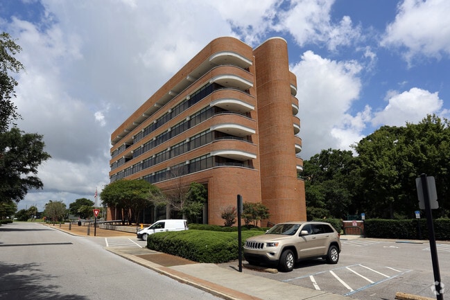
222 W Main St
Pensacola-Ferry Pass-Brent, FL
Old City Tract
00-0S-00-9001-020-007
ALL BLK 2 & BLK 12 OLD CITY TRACT OR 1695 P 594 ALSO ADJ VAC R/W OF ZARRAGOSSA ST LYING ON E R/W LI OF REUS ST & W R/W LI OF BARCELONA ST (NKA SPRING ST) ORD # 22-77
Officebuilding
Escambia
AE
Florida
12033C0390G
20
0
6.15 AC
2025
Downtown Pensacola
000100
Pensacola
93,700 SF
DEMOGRAPHICS near 222 W Main St
1 Mile
3 Mile
5 Mile
2024 Total Population
5,315
40,045
101,934
2029 Population
5,582
41,574
105,484
Pop Growth 2024-2029
+ 5.02%
+ 3.82%
+ 3.48%
Average Age
43
41
39
2024 Total Households
2,575
17,178
40,893
HH Growth 2024-2029
+ 5.20%
+ 3.84%
+ 3.61%
Median Household Inc
$42,194
$40,747
$44,581
Avg Household Size
1.90
2.10
2.20
2024 Avg HH Vehicles
1.00
1.00
2.00
Median Home Value
$315,877
$214,464
$195,739
Median Year Built
1962
1958
1967
Nearby Places
Map Layers
Map Styles
 Street
 Aerial
- Restaurants
- Banks
- Shops
- Fitness
- Groceries
PUBLIC TRANSPORTATION
AIRPORT
Pensacola International
DRIVE
WALK
Distance
Pensacola International
14 min
6.4 mi
Freight Ports
Port of Mobile
DRIVE
WALK
Distance
Port of Mobile
71 min
60.2 mi
Nearby Properties
Address
Land Use
TOTAL SIZE
Lot Size
Zoning
Address
Land Use
TOTAL SIZE
Lot Size
Zoning
544,835 SF
3.29 AC
C-2,C-2A
Address
Land Use
TOTAL SIZE
Lot Size
Zoning
365,037 SF
5.79 AC
C-3
Address
Land Use
TOTAL SIZE
Lot Size
Zoning
296,361 SF
13.03 AC
GRD
Address
Land Use
TOTAL SIZE
Lot Size
Zoning
368,724 SF
3.17 AC
C-2A
Address
Land Use
TOTAL SIZE
Lot Size
Zoning
56,970 SF
5.94 AC
WRD
Address
Land Use
TOTAL SIZE
Lot Size
Zoning
289,397 SF
12.38 AC
PUB
Address
Land Use
TOTAL SIZE
Lot Size
Zoning
353,428 SF
30.10 AC
M-1
Address
Land Use
TOTAL SIZE
Lot Size
Zoning
327,045 SF
7.47 AC
C-2A
Address
Land Use
TOTAL SIZE
Lot Size
Zoning
96,686 SF
1.06 AC
C-2A
Address
Land Use
TOTAL SIZE
Lot Size
Zoning
114,000 SF
3.23 AC
C-2,C-2A
Address
Land Use
TOTAL SIZE
Lot Size
Zoning
178,451 SF
3.88 AC
GRD
Address
Land Use
TOTAL SIZE
Lot Size
Zoning
99,623 SF
1.87 AC
C-2A
Address
Land Use
TOTAL SIZE
Lot Size
Zoning
258,438 SF
48.49 AC
PUB
Address
Land Use
TOTAL SIZE
Lot Size
Zoning
282,738 SF
14.64 AC
PUB
Address
Land Use
TOTAL SIZE
Lot Size
Zoning
145,264 SF
9.84 AC
SSD
Address
Land Use
TOTAL SIZE
Lot Size
Zoning
115,500 SF
3.48 AC
C-2
Address
Land Use
TOTAL SIZE
Lot Size
Zoning
130,830 SF
26.30 AC
M-2
Address
Land Use
TOTAL SIZE
Lot Size
Zoning
75,877 SF
1.55 AC
WRD
Address
Land Use
TOTAL SIZE
Lot Size
Zoning
166,204 SF
0.97 AC
C-2A
Address
Land Use
TOTAL SIZE
Lot Size
Zoning
55,337 SF
0.95 AC
C-2A,HC-2
Address
Land Use
TOTAL SIZE
Lot Size
Zoning
130,516 SF
4.55 AC
R-2
Address
Land Use
TOTAL SIZE
Lot Size
Zoning
81,549 SF
0.46 AC
WRD
Address
Land Use
TOTAL SIZE
Lot Size
Zoning
50,521 SF
2.36 AC
C-2A
Address
Land Use
TOTAL SIZE
Lot Size
Zoning
73,923 SF
2.87 AC
GRD
Address
Land Use
TOTAL SIZE
Lot Size
Zoning
56,354 SF
3.25 AC
HC-1
Address
Land Use
TOTAL SIZE
Lot Size
Zoning
254,937 SF
39.66 AC
R-1AA
Address
Land Use
TOTAL SIZE
Lot Size
Zoning
146,790 SF
8.83 AC
C-1,C-3
Address
Land Use
TOTAL SIZE
Lot Size
Zoning
37,028 SF
1.94 AC
C-2A,HC-1
Address
Land Use
TOTAL SIZE
Lot Size
Zoning
64,383 SF
0.70 AC
C-2A
Address
Land Use
TOTAL SIZE
Lot Size
Zoning
138,840 SF
4.52 AC
HC/LI,HDMU
The World's #1 Commercial Real Estate Marketplace
Connect with us
© 2026 CoStar Group
The information above has been obtained from sources believed reliable. While we do not doubt its accuracy we have not verified it and make no guarantee, warranty or representation about it. It is your responsibility to independently confirm its accuracy and completeness. Any projections, opinions, assumptions, or estimates used are for example only and do not represent the current or future performance of the property. The value of this transaction to you depends on tax and other factors which should be evaluated by your tax, financial, and legal advisors. You and your advisors should conduct a careful, independent investigation of the property to determine to your satisfaction the suitability of the property for your needs.