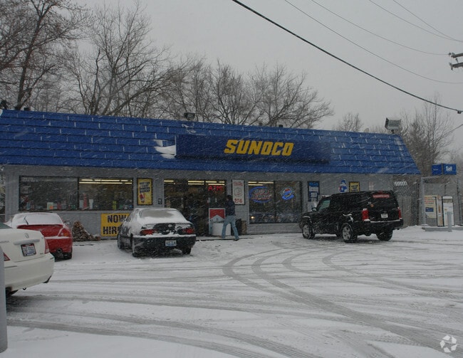
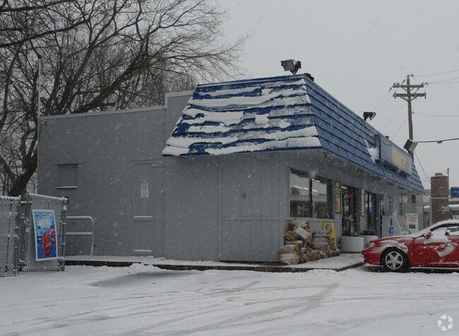
Property Record
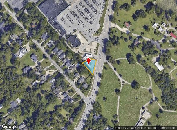
2220 Dixie Hwy, Ft Mitchell, KY 41017
NEARBY LISTINGS FOR SALE OR LEASE
Property Detail
2220 Dixie Hwy
028-30-05-019.00
175X175 IRREG ON DIXIE HGWY
Servicestationmarket
Kenton
X
Kentucky
21037C0025E
0.28 AC
2025
Cincinnati Intl Airport
2025
Cincinnati/Dayton
064700
Cincinnati, OH-KY-IN
DEMOGRAPHICS near 2220 Dixie Hwy
1 Mile
3 Mile
5 Mile
2024 Total Population
8,829
64,924
209,673
2029 Population
8,983
66,496
213,977
Pop Growth 2024-2029
+ 1.74%
+ 2.42%
+ 2.05%
Average Age
39
40
39
2024 Total Households
3,543
27,536
90,208
HH Growth 2024-2029
+ 1.72%
+ 2.39%
+ 2.14%
Median Household Inc
$94,057
$66,993
$61,855
Avg Household Size
2.40
2.30
2.20
2024 Avg HH Vehicles
2.00
2.00
2.00
Median Home Value
$303,986
$246,017
$196,690
Median Year Built
1964
1968
1965
Nearby Places
Map Layers
Map Styles
 Street
 Aerial
- Restaurants
- Banks
- Shops
- Fitness
- Groceries
PUBLIC TRANSPORTATION
COMMUTER RAIL
Cincinnati Union Terminal (Cardinal - Amtrak)
DRIVE
WALK
Distance
Cincinnati Union Terminal (Cardinal - Amtrak)
11 min
6.2 mi
AIRPORT
Cincinnati/Northern Kentucky International
DRIVE
WALK
Distance
Cincinnati/Northern Kentucky International
20 min
9.4 mi
Freight Ports
Port of Toledo
DRIVE
WALK
Distance
Port of Toledo
247 min
210.8 mi
Nearby Properties
Address
Land Use
TOTAL SIZE
Lot Size
Zoning
Address
Land Use
TOTAL SIZE
Lot Size
Zoning
Address
Land Use
TOTAL SIZE
Lot Size
Zoning
Address
Land Use
TOTAL SIZE
Lot Size
Zoning
46.68 AC
Address
Land Use
TOTAL SIZE
Lot Size
Zoning
19.43 AC
Address
Land Use
TOTAL SIZE
Lot Size
Zoning
475,250 SF
37.16 AC
Address
Land Use
TOTAL SIZE
Lot Size
Zoning
9,962 SF
712 AC
Address
Land Use
TOTAL SIZE
Lot Size
Zoning
441,907 SF
Address
Land Use
TOTAL SIZE
Lot Size
Zoning
12.85 AC
Address
Land Use
TOTAL SIZE
Lot Size
Zoning
21.55 AC
Address
Land Use
TOTAL SIZE
Lot Size
Zoning
20.02 AC
Address
Land Use
TOTAL SIZE
Lot Size
Zoning
12.13 AC
Address
Land Use
TOTAL SIZE
Lot Size
Zoning
Address
Land Use
TOTAL SIZE
Lot Size
Zoning
30.11 AC
Address
Land Use
TOTAL SIZE
Lot Size
Zoning
20.49 AC
Address
Land Use
TOTAL SIZE
Lot Size
Zoning
24.80 AC
Address
Land Use
TOTAL SIZE
Lot Size
Zoning
15.05 AC
Address
Land Use
TOTAL SIZE
Lot Size
Zoning
Address
Land Use
TOTAL SIZE
Lot Size
Zoning
16.52 AC
Address
Land Use
TOTAL SIZE
Lot Size
Zoning
99.35 AC
Address
Land Use
TOTAL SIZE
Lot Size
Zoning
57,030 SF
7 AC
Address
Land Use
TOTAL SIZE
Lot Size
Zoning
12.60 AC
Address
Land Use
TOTAL SIZE
Lot Size
Zoning
Address
Land Use
TOTAL SIZE
Lot Size
Zoning
85,726 SF
15.07 AC
Address
Land Use
TOTAL SIZE
Lot Size
Zoning
7.82 AC
Address
Land Use
TOTAL SIZE
Lot Size
Zoning
Address
Land Use
TOTAL SIZE
Lot Size
Zoning
176,588 SF
24.35 AC
Address
Land Use
TOTAL SIZE
Lot Size
Zoning
Address
Land Use
TOTAL SIZE
Lot Size
Zoning
Address
Land Use
TOTAL SIZE
Lot Size
Zoning
Address
Land Use
TOTAL SIZE
Lot Size
Zoning
61,013 SF
6.73 AC
The World's #1 Commercial Real Estate Marketplace
Connect with us
© 2026 CoStar Group
The information above has been obtained from sources believed reliable. While we do not doubt its accuracy we have not verified it and make no guarantee, warranty or representation about it. It is your responsibility to independently confirm its accuracy and completeness. Any projections, opinions, assumptions, or estimates used are for example only and do not represent the current or future performance of the property. The value of this transaction to you depends on tax and other factors which should be evaluated by your tax, financial, and legal advisors. You and your advisors should conduct a careful, independent investigation of the property to determine to your satisfaction the suitability of the property for your needs.