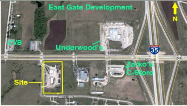
Property Record
2220 E Logan St, Ottawa, KS 66067

Property Detail
2220 E Logan St
099-31-0-00-00-001.02-0
S31, T16, R20E, ACRES 4.5, TR BEG 60E & 115S NW/C NE4 S599.6 E330 N599.6 W330 TO POB LESS ROW
Warehouse
Franklin
C2
Kansas
B and X Area of moderate flood hazard, usually the area between the limits of the 100-year and 500-year floods.
4.55 AC
0
Ottawa
2025
Kansas City
954200
Ottawa, KS
4,000 SF
NEARBY LISTINGS FOR SALE OR LEASE
-
-
View all Ottawa listings for sale on LoopNet.com
DEMOGRAPHICS near 2220 E Logan St
1 mile
3 mile
5 mile
2025 Total Population
669
12,480
14,460
2030 Population
682
12,694
14,692
Pop Growth 2025-2030
+ 1.94%
+ 1.71%
+ 1.60%
Average Age
41
39
39
2025 Total Households
277
4,971
5,806
HH Growth 2025-2030
+ 1.81%
+ 1.77%
+ 1.67%
Median Household Inc
$66,562
$62,384
$62,882
Avg Household Size
2.40
2.40
2.40
2025 Avg HH Vehicles
3.00
2.00
2.00
Median Home Value
$136,628
$162,849
$171,322
Median Year Built
1976
1965
1969
Nearby Places
Map Layers
Map Styles
 Street
 Aerial
Transit
 Traffic
 Biking
Places
Listings with unknown addresses are not visible on the map
- Restaurants
- Banks
- Shops
- Fitness
- Groceries
Nearby Properties
Address
Land Use
TOTAL SIZE
Lot Size
Zoning
Address
Land Use
TOTAL SIZE
Lot Size
Zoning
115,413 SF
7.63 AC
O1
Address
Land Use
TOTAL SIZE
Lot Size
Zoning
35,262 SF
33.20 AC
R
Address
Land Use
TOTAL SIZE
Lot Size
Zoning
5,470 SF
39.70 AC
RS
Address
Land Use
TOTAL SIZE
Lot Size
Zoning
63,811 SF
17.60 AC
MH
Address
Land Use
TOTAL SIZE
Lot Size
Zoning
1,124,676 SF
208.76 AC
I1SX
Address
Land Use
TOTAL SIZE
Lot Size
Zoning
52,556 SF
26.31 AC
C2
Address
Land Use
TOTAL SIZE
Lot Size
Zoning
79,735 SF
3.20 AC
C3
Address
Land Use
TOTAL SIZE
Lot Size
Zoning
17,373 SF
82.20 AC
I1
Address
Land Use
TOTAL SIZE
Lot Size
Zoning
50,753 SF
7.30 AC
R
Address
Land Use
TOTAL SIZE
Lot Size
Zoning
14,606 SF
5.04 AC
RS
Address
Land Use
TOTAL SIZE
Lot Size
Zoning
15,895 SF
1.06 AC
R1
Address
Land Use
TOTAL SIZE
Lot Size
Zoning
29,808 SF
10.30 AC
R
Address
Land Use
TOTAL SIZE
Lot Size
Zoning
285,548 SF
26.93 AC
I1
Address
Land Use
TOTAL SIZE
Lot Size
Zoning
49,756 SF
4.16 AC
C2
Address
Land Use
TOTAL SIZE
Lot Size
Zoning
33,454 SF
1.36 AC
R2
Address
Land Use
TOTAL SIZE
Lot Size
Zoning
21,707 SF
1.12 AC
C3
Address
Land Use
TOTAL SIZE
Lot Size
Zoning
31,788 SF
1.55 AC
C3
Address
Land Use
TOTAL SIZE
Lot Size
Zoning
1.60 AC
Address
Land Use
TOTAL SIZE
Lot Size
Zoning
90,000 SF
41.40 AC
I2
Address
Land Use
TOTAL SIZE
Lot Size
Zoning
Address
Land Use
TOTAL SIZE
Lot Size
Zoning
27,933 SF
0.69 AC
C3
Address
Land Use
TOTAL SIZE
Lot Size
Zoning
18,978 SF
2.17 AC
R
Address
Land Use
TOTAL SIZE
Lot Size
Zoning
11,456 SF
10.05 AC
RE
Address
Land Use
TOTAL SIZE
Lot Size
Zoning
24,478 SF
3.30 AC
R
Address
Land Use
TOTAL SIZE
Lot Size
Zoning
13,901 SF
0.95 AC
C1
Address
Land Use
TOTAL SIZE
Lot Size
Zoning
32.37 AC
R1
Address
Land Use
TOTAL SIZE
Lot Size
Zoning
15,000 SF
11.91 AC
RS
Address
Land Use
TOTAL SIZE
Lot Size
Zoning
58,274 SF
6.94 AC
C2
Address
Land Use
TOTAL SIZE
Lot Size
Zoning
53,366 SF
5.18 AC
C2
Address
Land Use
TOTAL SIZE
Lot Size
Zoning
12,000 SF
0.34 AC
R2
The World's #1 Commercial Real Estate Marketplace
Connect with us
© 2026 CoStar Group
The information above has been obtained from sources believed reliable. While we do not doubt its accuracy we have not verified it and make no guarantee, warranty or representation about it. It is your responsibility to independently confirm its accuracy and completeness. Any projections, opinions, assumptions, or estimates used are for example only and do not represent the current or future performance of the property. The value of this transaction to you depends on tax and other factors which should be evaluated by your tax, financial, and legal advisors. You and your advisors should conduct a careful, independent investigation of the property to determine to your satisfaction the suitability of the property for your needs.