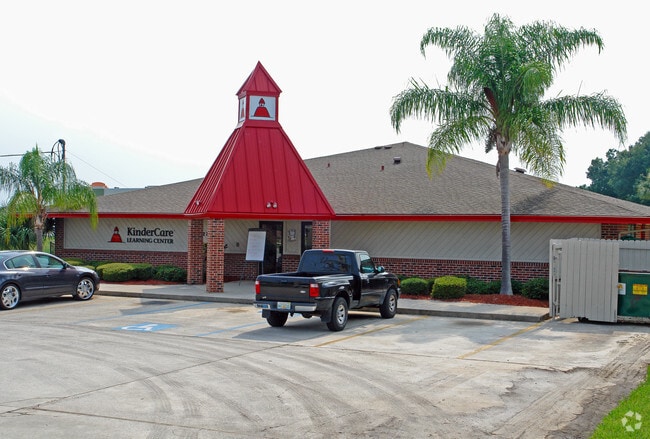
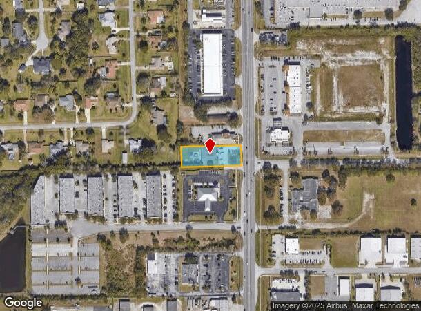
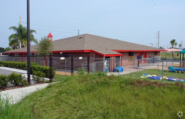
Property Record
2220 N Wickham Rd, Melbourne, FL 32935
NEARBY LISTINGS FOR SALE OR LEASE
Property Detail
2220 N Wickham Rd
27-36-12-00-00759.0-0000.00
PT OF W 300 FT OF E 350 FT OF S 300 FT OF SE 1/4 AS DES IN ORB 2414 PG 371
Daycare
Brevard
X
Florida
12009C0518G
0.69 AC
2024
Brevard County
2025
Orlando
064129
Palm Bay-Melbourne-Titusville, FL
6,262 SF
DEMOGRAPHICS near 2220 N Wickham Rd
1 Mile
3 Mile
5 Mile
2024 Total Population
9,800
55,997
99,633
2029 Population
10,588
60,802
108,582
Pop Growth 2024-2029
+ 8.04%
+ 8.58%
+ 8.98%
Average Age
42
43
45
2024 Total Households
4,603
24,280
42,643
HH Growth 2024-2029
+ 7.76%
+ 8.32%
+ 8.79%
Median Household Inc
$65,353
$65,979
$71,202
Avg Household Size
2.10
2.20
2.20
2024 Avg HH Vehicles
2.00
2.00
2.00
Median Home Value
$253,867
$251,911
$281,234
Median Year Built
1985
1984
1984
Nearby Places
Map Layers
Map Styles
 Street
 Aerial
- Restaurants
- Banks
- Shops
- Fitness
- Groceries
PUBLIC TRANSPORTATION
AIRPORT
Melbourne Orlando International
DRIVE
WALK
Distance
Melbourne Orlando International
14 min
6.1 mi
Freight Ports
Port Canaveral
DRIVE
WALK
Distance
Port Canaveral
41 min
22.6 mi
Nearby Properties
Address
Land Use
TOTAL SIZE
Lot Size
Zoning
Address
Land Use
TOTAL SIZE
Lot Size
Zoning
676,548 SF
117.62 AC
I1
Address
Land Use
TOTAL SIZE
Lot Size
Zoning
438,381 SF
25.66 AC
R2
Address
Land Use
TOTAL SIZE
Lot Size
Zoning
265,272 SF
21.17 AC
M1
Address
Land Use
TOTAL SIZE
Lot Size
Zoning
265,062 SF
14.75 AC
M1
Address
Land Use
TOTAL SIZE
Lot Size
Zoning
363,826 SF
25.61 AC
RA
Address
Land Use
TOTAL SIZE
Lot Size
Zoning
236,982 SF
39.26 AC
EU2
Address
Land Use
TOTAL SIZE
Lot Size
Zoning
672 SF
57.80 AC
I1
Address
Land Use
TOTAL SIZE
Lot Size
Zoning
360,921 SF
85.76 AC
R2
Address
Land Use
TOTAL SIZE
Lot Size
Zoning
269,111 SF
21.79 AC
PUD
Address
Land Use
TOTAL SIZE
Lot Size
Zoning
328,357 SF
34.11 AC
I1
Address
Land Use
TOTAL SIZE
Lot Size
Zoning
296,436 SF
28.05 AC
Address
Land Use
TOTAL SIZE
Lot Size
Zoning
216,446 SF
14.09 AC
R2
Address
Land Use
TOTAL SIZE
Lot Size
Zoning
222,779 SF
22.58 AC
R2
Address
Land Use
TOTAL SIZE
Lot Size
Zoning
188,237 SF
13.97 AC
R2
Address
Land Use
TOTAL SIZE
Lot Size
Zoning
253,120 SF
16.02 AC
R2
Address
Land Use
TOTAL SIZE
Lot Size
Zoning
207,405 SF
28.05 AC
R26
Address
Land Use
TOTAL SIZE
Lot Size
Zoning
74,716 SF
366.45 AC
M1
Address
Land Use
TOTAL SIZE
Lot Size
Zoning
198,876 SF
64.32 AC
M1
Address
Land Use
TOTAL SIZE
Lot Size
Zoning
175,610 SF
10.01 AC
CCP(15)
Address
Land Use
TOTAL SIZE
Lot Size
Zoning
159,590 SF
26.66 AC
R26
Address
Land Use
TOTAL SIZE
Lot Size
Zoning
146,527 SF
42.12 AC
M-1
Address
Land Use
TOTAL SIZE
Lot Size
Zoning
188,093 SF
13.11 AC
R2
Address
Land Use
TOTAL SIZE
Lot Size
Zoning
227,172 SF
26.78 AC
BU1
Address
Land Use
TOTAL SIZE
Lot Size
Zoning
131,585 SF
10 AC
R2
Address
Land Use
TOTAL SIZE
Lot Size
Zoning
218,739 SF
11.23 AC
R2
Address
Land Use
TOTAL SIZE
Lot Size
Zoning
200,878 SF
16.41 AC
R2
Address
Land Use
TOTAL SIZE
Lot Size
Zoning
132,340 SF
14.58 AC
R2
Address
Land Use
TOTAL SIZE
Lot Size
Zoning
142,230 SF
13.33 AC
C1
Address
Land Use
TOTAL SIZE
Lot Size
Zoning
102,972 SF
18 AC
R2(6)
Address
Land Use
TOTAL SIZE
Lot Size
Zoning
81,720 SF
13.20 AC
The World's #1 Commercial Real Estate Marketplace
Connect with us
© 2025 CoStar Group
The information above has been obtained from sources believed reliable. While we do not doubt its accuracy we have not verified it and make no guarantee, warranty or representation about it. It is your responsibility to independently confirm its accuracy and completeness. Any projections, opinions, assumptions, or estimates used are for example only and do not represent the current or future performance of the property. The value of this transaction to you depends on tax and other factors which should be evaluated by your tax, financial, and legal advisors. You and your advisors should conduct a careful, independent investigation of the property to determine to your satisfaction the suitability of the property for your needs.