Property Record
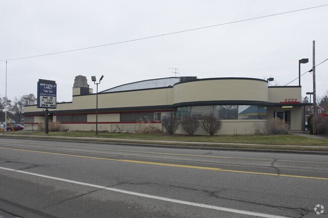
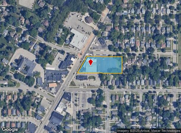
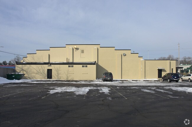
2220 Plainfield Ave Ne, Grand Rapids, MI 49505
NEARBY LISTINGS FOR SALE OR LEASE
Property Detail
2220 Plainfield Ave Ne
Grand Rapids-Wyoming, MI
C Kent Jakeway Add
41-14-07-432-001
LOTS 12, 13, 14, 15, 16, 17, 18, 19 & 20* C KENT JAKEWAY ADDITION
Bowlingalley
Kent
X
Michigan
26081C0294D
12-20
2024
1.41 AC
2025
Central Grand Rapids
000400
West Michigan
16,535 SF
DEMOGRAPHICS near 2220 Plainfield Ave Ne
1 Mile
3 Mile
5 Mile
2024 Total Population
13,791
95,207
200,071
2029 Population
13,837
95,421
200,994
Pop Growth 2024-2029
+ 0.33%
+ 0.22%
+ 0.46%
Average Age
39
37
37
2024 Total Households
5,829
41,966
82,028
HH Growth 2024-2029
+ 0.36%
+ 0.31%
+ 0.53%
Median Household Inc
$68,473
$60,511
$65,383
Avg Household Size
2.30
2.20
2.30
2024 Avg HH Vehicles
2.00
2.00
2.00
Median Home Value
$197,290
$209,930
$231,058
Median Year Built
1950
1956
1958
Nearby Places
Map Layers
Map Styles
 Street
 Aerial
- Restaurants
- Banks
- Shops
- Fitness
- Groceries
PUBLIC TRANSPORTATION
COMMUTER RAIL
Grand Rapids Vernon J. Ehlers Station (Pere Marquette - Amtrak)
DRIVE
WALK
Distance
Grand Rapids Vernon J. Ehlers Station (Pere Marquette - Amtrak)
7 min
3.7 mi
AIRPORT
Gerald R Ford International
DRIVE
WALK
Distance
Gerald R Ford International
24 min
16.5 mi
Freight Ports
Port Milwaukee
DRIVE
WALK
Distance
Port Milwaukee
309 min
265.5 mi
Nearby Properties
Address
Land Use
TOTAL SIZE
Lot Size
Zoning
Address
Land Use
TOTAL SIZE
Lot Size
Zoning
226,925 SF
1.32 AC
TN-CC
Address
Land Use
TOTAL SIZE
Lot Size
Zoning
557,931 SF
2.12 AC
TN-CC
Address
Land Use
TOTAL SIZE
Lot Size
Zoning
537,080 SF
46.61 AC
RPUD - 2
Address
Land Use
TOTAL SIZE
Lot Size
Zoning
546,366 SF
28.40 AC
MH
Address
Land Use
TOTAL SIZE
Lot Size
Zoning
211,760 SF
TN-CC
Address
Land Use
TOTAL SIZE
Lot Size
Zoning
768,153 SF
3.20 AC
TN-CC
Address
Land Use
TOTAL SIZE
Lot Size
Zoning
347,500 SF
1.51 AC
TN-CC
Address
Land Use
TOTAL SIZE
Lot Size
Zoning
491,288 SF
2.79 AC
SD-PRD
Address
Land Use
TOTAL SIZE
Lot Size
Zoning
451,792 SF
32.60 AC
ARM - MULT
Address
Land Use
TOTAL SIZE
Lot Size
Zoning
Address
Land Use
TOTAL SIZE
Lot Size
Zoning
281,488 SF
1.20 AC
TN-CC
Address
Land Use
TOTAL SIZE
Lot Size
Zoning
257,381 SF
7.08 AC
SD-PRD
Address
Land Use
TOTAL SIZE
Lot Size
Zoning
145,306 SF
0.75 AC
TN-CC
Address
Land Use
TOTAL SIZE
Lot Size
Zoning
Address
Land Use
TOTAL SIZE
Lot Size
Zoning
201,100 SF
0.90 AC
TN-CC
Address
Land Use
TOTAL SIZE
Lot Size
Zoning
18.07 AC
MON-LDR
Address
Land Use
TOTAL SIZE
Lot Size
Zoning
94,556 SF
1.03 AC
TN-TCC
Address
Land Use
TOTAL SIZE
Lot Size
Zoning
21.77 AC
MCN-MDR
Address
Land Use
TOTAL SIZE
Lot Size
Zoning
47,370 SF
8.18 AC
MON-LDR
Address
Land Use
TOTAL SIZE
Lot Size
Zoning
366,447 SF
2.71 AC
TN-CC
Address
Land Use
TOTAL SIZE
Lot Size
Zoning
18.65 AC
MCN-MDR
Address
Land Use
TOTAL SIZE
Lot Size
Zoning
363,503 SF
2.20 AC
TN-CC
Address
Land Use
TOTAL SIZE
Lot Size
Zoning
68,560 SF
2.76 AC
TN-TCC
Address
Land Use
TOTAL SIZE
Lot Size
Zoning
Address
Land Use
TOTAL SIZE
Lot Size
Zoning
254,941 SF
0.79 AC
TN-CC
Address
Land Use
TOTAL SIZE
Lot Size
Zoning
109,482 SF
1.35 AC
SD-PRD
Address
Land Use
TOTAL SIZE
Lot Size
Zoning
310,790 SF
0.66 AC
TN-CC
Address
Land Use
TOTAL SIZE
Lot Size
Zoning
33.06 AC
R-3
Address
Land Use
TOTAL SIZE
Lot Size
Zoning
0.92 AC
TN-CC
Address
Land Use
TOTAL SIZE
Lot Size
Zoning
3.31 AC
TN-CC
The World's #1 Commercial Real Estate Marketplace
Connect with us
© 2025 CoStar Group
The information above has been obtained from sources believed reliable. While we do not doubt its accuracy we have not verified it and make no guarantee, warranty or representation about it. It is your responsibility to independently confirm its accuracy and completeness. Any projections, opinions, assumptions, or estimates used are for example only and do not represent the current or future performance of the property. The value of this transaction to you depends on tax and other factors which should be evaluated by your tax, financial, and legal advisors. You and your advisors should conduct a careful, independent investigation of the property to determine to your satisfaction the suitability of the property for your needs.