Property Record
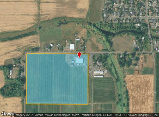
2220 Sw Lafollett Rd, Cornelius, OR 97113

Property Detail
2220 Sw Lafollett Rd
R0429922
ACRES 31.40, POTENTIAL ADDL TAX LIABILITY
Farms
Washington
X
Oregon
41067C0314E
31.40 AC
2024
Westside Outlying
2026
Portland
032903
Portland-Vancouver-Hillsboro, OR-WA
NEARBY LISTINGS FOR SALE OR LEASE
DEMOGRAPHICS near 2220 Sw Lafollett Rd
1 mile
3 mile
5 mile
2024 Total Population
5,079
33,836
71,865
2029 Population
5,124
34,308
72,315
Pop Growth 2024-2029
+ 0.89%
+ 1.39%
+ 0.63%
Average Age
38
38
38
2024 Total Households
1,523
11,052
23,820
HH Growth 2024-2029
+ 0.98%
+ 1.50%
+ 0.67%
Median Household Inc
$70,302
$63,657
$76,805
Avg Household Size
3.30
2.90
2.90
2024 Avg HH Vehicles
2.00
2.00
2.00
Median Home Value
$402,408
$382,475
$433,152
Median Year Built
1979
1978
1982
Nearby Places
Map Layers
Map Styles
 Street
 Aerial
Transit
 Traffic
 Biking
Places
Listings with unknown addresses are not visible on the map
- Restaurants
- Banks
- Shops
- Fitness
- Groceries
PUBLIC TRANSPORTATION
AIRPORT
Portland International
Drive
Walk
Distance
Portland International
58 min
38.3 mi
Freight Ports
Port of Portland
Drive
Walk
Distance
Port of Portland
41 min
27.3 mi
SALE & LEASE HISTORY
LISTING DATE
SALE/LEASE

Jan 21, 2019
For Sale
Feb 12, 2018
For Lease
Nearby Properties
Address
Land Use
TOTAL SIZE
Lot Size
Zoning
Address
Land Use
TOTAL SIZE
Lot Size
Zoning
608,403 SF
30.03 AC
RMH
Address
Land Use
TOTAL SIZE
Lot Size
Zoning
79,574 SF
16.54 AC
GI
Address
Land Use
TOTAL SIZE
Lot Size
Zoning
13.80 AC
GI
Address
Land Use
TOTAL SIZE
Lot Size
Zoning
108.84 AC
GI
Address
Land Use
TOTAL SIZE
Lot Size
Zoning
154,371 SF
15.63 AC
C2
Address
Land Use
TOTAL SIZE
Lot Size
Zoning
46,175 SF
28.39 AC
INST
Address
Land Use
TOTAL SIZE
Lot Size
Zoning
2.83 AC
GMU
Address
Land Use
TOTAL SIZE
Lot Size
Zoning
169,980 SF
14 AC
GMU
Address
Land Use
TOTAL SIZE
Lot Size
Zoning
37,000 SF
29.09 AC
INST
Address
Land Use
TOTAL SIZE
Lot Size
Zoning
65,500 SF
9.67 AC
R7
Address
Land Use
TOTAL SIZE
Lot Size
Zoning
0.05 AC
LI
Address
Land Use
TOTAL SIZE
Lot Size
Zoning
20.48 AC
LI
Address
Land Use
TOTAL SIZE
Lot Size
Zoning
222,852 SF
11.17 AC
RMH
Address
Land Use
TOTAL SIZE
Lot Size
Zoning
72,365 SF
11.25 AC
R7
Address
Land Use
TOTAL SIZE
Lot Size
Zoning
61,520 SF
2.02 AC
RMH
Address
Land Use
TOTAL SIZE
Lot Size
Zoning
46,000 SF
7.68 AC
INST
Address
Land Use
TOTAL SIZE
Lot Size
Zoning
59,902 SF
1.40 AC
RMH
Address
Land Use
TOTAL SIZE
Lot Size
Zoning
137,200 SF
9.52 AC
INST
Address
Land Use
TOTAL SIZE
Lot Size
Zoning
176,108 SF
0.44 AC
CC
Address
Land Use
TOTAL SIZE
Lot Size
Zoning
7.35 AC
Address
Land Use
TOTAL SIZE
Lot Size
Zoning
69,792 SF
7.75 AC
INST
Address
Land Use
TOTAL SIZE
Lot Size
Zoning
1,224 SF
32.69 AC
R-7
Address
Land Use
TOTAL SIZE
Lot Size
Zoning
Address
Land Use
TOTAL SIZE
Lot Size
Zoning
1,210 SF
4.50 AC
CC
Address
Land Use
TOTAL SIZE
Lot Size
Zoning
47,110 SF
2.57 AC
RMH
Address
Land Use
TOTAL SIZE
Lot Size
Zoning
90,000 SF
5.39 AC
INST
Address
Land Use
TOTAL SIZE
Lot Size
Zoning
3.34 AC
GI
Address
Land Use
TOTAL SIZE
Lot Size
Zoning
27.09 AC
CC
Address
Land Use
TOTAL SIZE
Lot Size
Zoning
84,858 SF
1.39 AC
TCT
Address
Land Use
TOTAL SIZE
Lot Size
Zoning
39,200 SF
3.14 AC
RMH
The World's #1 Commercial Real Estate Marketplace
Connect with us
© 2026 CoStar Group
The information above has been obtained from sources believed reliable. While we do not doubt its accuracy we have not verified it and make no guarantee, warranty or representation about it. It is your responsibility to independently confirm its accuracy and completeness. Any projections, opinions, assumptions, or estimates used are for example only and do not represent the current or future performance of the property. The value of this transaction to you depends on tax and other factors which should be evaluated by your tax, financial, and legal advisors. You and your advisors should conduct a careful, independent investigation of the property to determine to your satisfaction the suitability of the property for your needs.