Property Record
22203 State Highway 16 S, Von Ormy, TX 78073

Property Detail
22203 State Highway 16 S
San Antonio-New Braunfels, TX
CB 4194 P-3C (1.662 AC) ABS 1200 2024-RESURVEY PER DEED 20230177770 (1.662 ACRES CONVEYED - PID 183040) EXE 9-22-2023. SEE SURVEY MAP ATTACHED. (CR 61083) JF/GIS/10-13-2023.
04194-000-0033
BEXAR
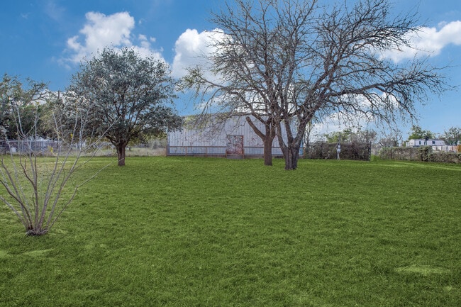
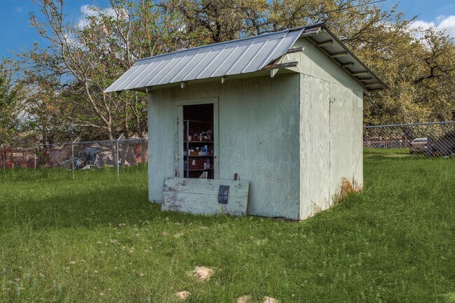
Warehouse
Texas
B and X Area of moderate flood hazard, usually the area between the limits of the 100-year and 500-year floods.
33
2025
1.66 AC
2025
South
162003
San Antonio
5,000 SF
NEARBY LISTINGS FOR SALE OR LEASE
-
-
View all Von Ormy listings for sale on LoopNet.com
DEMOGRAPHICS near 22203 State Highway 16 S
1 mile
3 mile
5 mile
2025 Total Population
2,683
8,987
16,512
2030 Population
2,892
9,625
17,676
Pop Growth 2025-2030
+ 7.79%
+ 7.10%
+ 7.05%
Average Age
36
37
37
2025 Total Households
780
2,612
4,948
HH Growth 2025-2030
+ 7.95%
+ 7.20%
+ 7.15%
Median Household Inc
$65,645
$69,925
$70,091
Avg Household Size
3.40
3.20
3.20
2025 Avg HH Vehicles
2.00
2.00
2.00
Median Home Value
$149,387
$133,555
$152,813
Median Year Built
1999
1997
1997
Nearby Places
Map Layers
Map Styles
 Street
 Aerial
Layers
 Traffic
 Biking
Places
Listings with unknown addresses are not visible on the map
- Restaurants
- Banks
- Shops
- Fitness
- Groceries
PUBLIC TRANSPORTATION
AIRPORT
San Antonio International
Drive
Walk
Distance
San Antonio International
38 min
26.1 mi
SALE & LEASE HISTORY
LISTING DATE
SALE/LEASE

Mar 09, 2023
For Sale
Dec 19, 2018
For Sale
Nearby Properties
Address
Land Use
TOTAL SIZE
Lot Size
Zoning
Address
Land Use
TOTAL SIZE
Lot Size
Zoning
677.68 AC
Address
Land Use
TOTAL SIZE
Lot Size
Zoning
678.76 AC
Address
Land Use
TOTAL SIZE
Lot Size
Zoning
486.11 AC
Address
Land Use
TOTAL SIZE
Lot Size
Zoning
43,512 SF
29.75 AC
Address
Land Use
TOTAL SIZE
Lot Size
Zoning
1,482 SF
82.44 AC
Address
Land Use
TOTAL SIZE
Lot Size
Zoning
400 SF
361.41 AC
Address
Land Use
TOTAL SIZE
Lot Size
Zoning
10,440 SF
13.90 AC
Address
Land Use
TOTAL SIZE
Lot Size
Zoning
15,422 SF
918.80 AC
Address
Land Use
TOTAL SIZE
Lot Size
Zoning
488 SF
329.28 AC
Address
Land Use
TOTAL SIZE
Lot Size
Zoning
184.42 AC
Address
Land Use
TOTAL SIZE
Lot Size
Zoning
18,833 SF
49.62 AC
Address
Land Use
TOTAL SIZE
Lot Size
Zoning
Address
Land Use
TOTAL SIZE
Lot Size
Zoning
257 AC
Address
Land Use
TOTAL SIZE
Lot Size
Zoning
126.51 AC
Address
Land Use
TOTAL SIZE
Lot Size
Zoning
3,376 SF
58.72 AC
Address
Land Use
TOTAL SIZE
Lot Size
Zoning
1,032 SF
167 AC
Address
Land Use
TOTAL SIZE
Lot Size
Zoning
177.40 AC
Address
Land Use
TOTAL SIZE
Lot Size
Zoning
Address
Land Use
TOTAL SIZE
Lot Size
Zoning
5,040 SF
2.90 AC
Address
Land Use
TOTAL SIZE
Lot Size
Zoning
342.46 AC
Address
Land Use
TOTAL SIZE
Lot Size
Zoning
184.98 AC
Address
Land Use
TOTAL SIZE
Lot Size
Zoning
137.65 AC
Address
Land Use
TOTAL SIZE
Lot Size
Zoning
146.20 AC
Address
Land Use
TOTAL SIZE
Lot Size
Zoning
9,100 SF
1.83 AC
Address
Land Use
TOTAL SIZE
Lot Size
Zoning
6,058 SF
60.84 AC
Address
Land Use
TOTAL SIZE
Lot Size
Zoning
12,171 SF
15 AC
Address
Land Use
TOTAL SIZE
Lot Size
Zoning
6,500 SF
9.51 AC
Address
Land Use
TOTAL SIZE
Lot Size
Zoning
832 SF
148.89 AC
Address
Land Use
TOTAL SIZE
Lot Size
Zoning
2,108 SF
80.13 AC
Address
Land Use
TOTAL SIZE
Lot Size
Zoning
93.48 AC
The World's #1 Commercial Real Estate Marketplace
Connect with us
© 2026 CoStar Group
The information above has been obtained from sources believed reliable. While we do not doubt its accuracy we have not verified it and make no guarantee, warranty or representation about it. It is your responsibility to independently confirm its accuracy and completeness. Any projections, opinions, assumptions, or estimates used are for example only and do not represent the current or future performance of the property. The value of this transaction to you depends on tax and other factors which should be evaluated by your tax, financial, and legal advisors. You and your advisors should conduct a careful, independent investigation of the property to determine to your satisfaction the suitability of the property for your needs.