Property Record
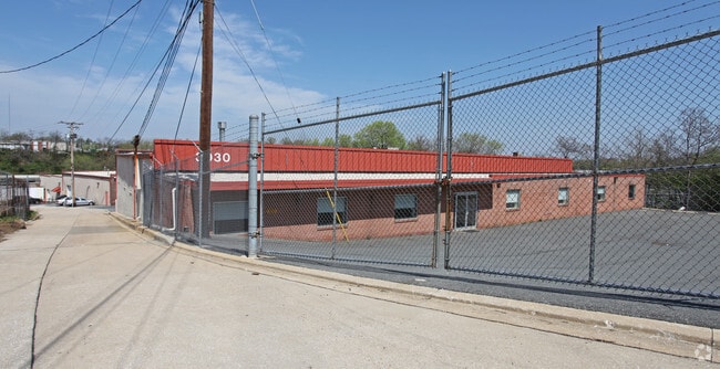
3030 Nieman Ave, Baltimore, MD 21230


NEARBY LISTINGS FOR SALE OR LEASE
-
-
-
-
-
-
-
-
-
-
-
-
-
-
No Photo
-
View all Baltimore listings for sale on LoopNet.com
Property Detail
3030 Nieman Ave
7492C-481
1.077 ACRES
Warehouse
Baltimore City
X
Maryland
2400100395G
481
2024
1.08 AC
2025
Baltimore SW
250205
Baltimore
24,519 SF
Baltimore-Columbia-Towson, MD
DEMOGRAPHICS near 3030 Nieman Ave
1 Mile
3 Mile
5 Mile
2024 Total Population
13,066
145,634
404,907
2029 Population
12,509
143,052
398,279
Pop Growth 2024-2029
(4.26%)
(1.77%)
(1.64%)
Average Age
37
38
38
2024 Total Households
4,702
59,578
172,433
HH Growth 2024-2029
(4.27%)
(2.09%)
(2.04%)
Median Household Inc
$48,727
$52,408
$57,005
Avg Household Size
2.70
2.40
2.20
2024 Avg HH Vehicles
1.00
1.00
1.00
Median Home Value
$159,702
$204,473
$239,357
Median Year Built
1955
1952
1952
Nearby Places
Map Layers
Map Styles
 Street
 Aerial
- Restaurants
- Banks
- Shops
- Fitness
- Groceries
PUBLIC TRANSPORTATION
COMMUTER RAIL
DRIVE
WALK
Distance
8 min
3.2 mi
DRIVE
WALK
Distance
8 min
3.2 mi
AIRPORT
Baltimore/Washington International Thurgood Marshall
DRIVE
WALK
Distance
Baltimore/Washington International Thurgood Marshall
15 min
7.8 mi
Ronald Reagan Washington Ntl
DRIVE
WALK
Distance
Ronald Reagan Washington Ntl
62 min
40.2 mi
Freight Ports
Port of Baltimore
DRIVE
WALK
Distance
Port of Baltimore
11 min
4.4 mi
Nearby Properties
Address
Land Use
TOTAL SIZE
Lot Size
Zoning
Address
Land Use
TOTAL SIZE
Lot Size
Zoning
1,871,691 SF
6.77 AC
C-5DC
Address
Land Use
TOTAL SIZE
Lot Size
Zoning
20.26 AC
C-5DC
Address
Land Use
TOTAL SIZE
Lot Size
Zoning
308,887 SF
3.98 AC
C-5DC
Address
Land Use
TOTAL SIZE
Lot Size
Zoning
21.27 AC
C-5DC
Address
Land Use
TOTAL SIZE
Lot Size
Zoning
739,000 SF
2.79 AC
C-5DC
Address
Land Use
TOTAL SIZE
Lot Size
Zoning
1,396,807 SF
32.73 AC
R-6
Address
Land Use
TOTAL SIZE
Lot Size
Zoning
2,182,087 SF
95.52 AC
DR5.5
Address
Land Use
TOTAL SIZE
Lot Size
Zoning
400,000 SF
13.98 AC
0B051
Address
Land Use
TOTAL SIZE
Lot Size
Zoning
911,487 SF
5.27 AC
C-5DC
Address
Land Use
TOTAL SIZE
Lot Size
Zoning
381,152 SF
3.46 AC
C-5DC
Address
Land Use
TOTAL SIZE
Lot Size
Zoning
289,515 SF
1.10 AC
BSC
Address
Land Use
TOTAL SIZE
Lot Size
Zoning
656,306 SF
1.10 AC
C-5DC
Address
Land Use
TOTAL SIZE
Lot Size
Zoning
642,817 SF
1.91 AC
PC-2
Address
Land Use
TOTAL SIZE
Lot Size
Zoning
625,217 SF
2.12 AC
C-5DC
Address
Land Use
TOTAL SIZE
Lot Size
Zoning
520,407 SF
16.85 AC
H
Address
Land Use
TOTAL SIZE
Lot Size
Zoning
363,350 SF
3.22 AC
C-5DC
Address
Land Use
TOTAL SIZE
Lot Size
Zoning
465,042 SF
2.37 AC
OR-2
Address
Land Use
TOTAL SIZE
Lot Size
Zoning
22,912 SF
0.55 AC
C-5DC
Address
Land Use
TOTAL SIZE
Lot Size
Zoning
522,990 SF
2.31 AC
TOD-4
Address
Land Use
TOTAL SIZE
Lot Size
Zoning
309,558 SF
3.01 AC
C-2
Address
Land Use
TOTAL SIZE
Lot Size
Zoning
344,199 SF
1 AC
C-5DC
Address
Land Use
TOTAL SIZE
Lot Size
Zoning
315,605 SF
1.80 AC
Address
Land Use
TOTAL SIZE
Lot Size
Zoning
77,580 SF
1.68 AC
C-5DC
Address
Land Use
TOTAL SIZE
Lot Size
Zoning
208,941 SF
1.59 AC
C-5DC
Address
Land Use
TOTAL SIZE
Lot Size
Zoning
154,000 SF
3.35 AC
C-5IH
Address
Land Use
TOTAL SIZE
Lot Size
Zoning
442,145 SF
2.30 AC
C-2
Address
Land Use
TOTAL SIZE
Lot Size
Zoning
306,578 SF
1.06 AC
BSC
Address
Land Use
TOTAL SIZE
Lot Size
Zoning
523,800 SF
28.02 AC
I-1
Address
Land Use
TOTAL SIZE
Lot Size
Zoning
321,500 SF
26.79 AC
C-5DC
Address
Land Use
TOTAL SIZE
Lot Size
Zoning
168,488 SF
0.64 AC
C-5DC
The World's #1 Commercial Real Estate Marketplace
Connect with us
© 2026 CoStar Group
The information above has been obtained from sources believed reliable. While we do not doubt its accuracy we have not verified it and make no guarantee, warranty or representation about it. It is your responsibility to independently confirm its accuracy and completeness. Any projections, opinions, assumptions, or estimates used are for example only and do not represent the current or future performance of the property. The value of this transaction to you depends on tax and other factors which should be evaluated by your tax, financial, and legal advisors. You and your advisors should conduct a careful, independent investigation of the property to determine to your satisfaction the suitability of the property for your needs.