Property Record
2222 E 146Th St, Carmel, IN 46033

Save to a Folder
{{folder.Name}}
{{folder.ListingIds.length}} Properties
{{folder.ListingIds.length}} Property
Create a New Folder
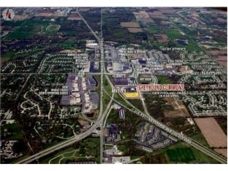
Property Detail
2222 E 146Th St
29-10-18-000-015.302-015
ACREAGE 12.36, SECTION 18, TOWNSHIP 18, RANGE 4
Theater
Hamilton
B and X Area of moderate flood hazard, usually the area between the limits of the 100-year and 500-year floods.
Indiana
2024
12.36 AC
2025
Carmel
110405
Indianapolis
68,434 SF
Indianapolis-Carmel-Greenwood, IN
NEARBY LISTINGS FOR SALE OR LEASE
DEMOGRAPHICS near 2222 E 146Th St
1 mile
3 mile
5 mile
2025 Total Population
7,440
76,953
164,195
2030 Population
8,027
82,452
177,106
Pop Growth 2025-2030
+ 7.89%
+ 7.15%
+ 7.86%
Average Age
39
40
40
2025 Total Households
2,713
30,099
62,228
HH Growth 2025-2030
+ 8.07%
+ 7.57%
+ 8.07%
Median Household Inc
$133,993
$118,771
$124,376
Avg Household Size
2.70
2.50
2.60
2025 Avg HH Vehicles
2.00
2.00
2.00
Median Home Value
$498,072
$459,167
$464,462
Median Year Built
1999
2001
2003
Nearby Places
Map Layers
Map Styles
 Street
 Aerial
Layers
 Traffic
 Biking
Places
Listings with unknown addresses are not visible on the map
- Restaurants
- Banks
- Shops
- Fitness
- Groceries
PUBLIC TRANSPORTATION
AIRPORT
Indianapolis International
Drive
Walk
Distance
Indianapolis International
52 min
32.7 mi
Freight Ports
Port of Toledo
Drive
Walk
Distance
Port of Toledo
258 min
214.4 mi
SALE & LEASE HISTORY
LISTING DATE
SALE/LEASE

Sep 25, 2016
For Lease
Nearby Properties
Address
Land Use
TOTAL SIZE
Lot Size
Zoning
Address
Land Use
TOTAL SIZE
Lot Size
Zoning
435,973 SF
Address
Land Use
TOTAL SIZE
Lot Size
Zoning
342,574 SF
5.64 AC
Address
Land Use
TOTAL SIZE
Lot Size
Zoning
504,699 SF
40 AC
Address
Land Use
TOTAL SIZE
Lot Size
Zoning
272,700 SF
2.10 AC
Address
Land Use
TOTAL SIZE
Lot Size
Zoning
417,894 SF
15.22 AC
Address
Land Use
TOTAL SIZE
Lot Size
Zoning
383,016 SF
16.62 AC
Address
Land Use
TOTAL SIZE
Lot Size
Zoning
298,290 SF
2.80 AC
Address
Land Use
TOTAL SIZE
Lot Size
Zoning
412,120 SF
12.16 AC
Address
Land Use
TOTAL SIZE
Lot Size
Zoning
359,968 SF
13.65 AC
Address
Land Use
TOTAL SIZE
Lot Size
Zoning
393,106 SF
13.37 AC
Address
Land Use
TOTAL SIZE
Lot Size
Zoning
261,387 SF
1.92 AC
Address
Land Use
TOTAL SIZE
Lot Size
Zoning
261,335 SF
4.28 AC
Address
Land Use
TOTAL SIZE
Lot Size
Zoning
236,320 SF
20.74 AC
Address
Land Use
TOTAL SIZE
Lot Size
Zoning
115,160 SF
2.35 AC
Address
Land Use
TOTAL SIZE
Lot Size
Zoning
280,428 SF
12.81 AC
Address
Land Use
TOTAL SIZE
Lot Size
Zoning
357,660 SF
22.37 AC
Address
Land Use
TOTAL SIZE
Lot Size
Zoning
296,315 SF
17.65 AC
Address
Land Use
TOTAL SIZE
Lot Size
Zoning
318,922 SF
31.70 AC
Address
Land Use
TOTAL SIZE
Lot Size
Zoning
245,922 SF
19.03 AC
Address
Land Use
TOTAL SIZE
Lot Size
Zoning
360,178 SF
36 AC
Address
Land Use
TOTAL SIZE
Lot Size
Zoning
153,374 SF
1.17 AC
Address
Land Use
TOTAL SIZE
Lot Size
Zoning
212,140 SF
5.47 AC
Address
Land Use
TOTAL SIZE
Lot Size
Zoning
188,239 SF
11.15 AC
Address
Land Use
TOTAL SIZE
Lot Size
Zoning
210,424 SF
14.10 AC
Address
Land Use
TOTAL SIZE
Lot Size
Zoning
228,713 SF
7.06 AC
Address
Land Use
TOTAL SIZE
Lot Size
Zoning
297,641 SF
70.35 AC
Address
Land Use
TOTAL SIZE
Lot Size
Zoning
115,284 SF
0.49 AC
Address
Land Use
TOTAL SIZE
Lot Size
Zoning
173,884 SF
14.07 AC
Address
Land Use
TOTAL SIZE
Lot Size
Zoning
186,668 SF
19.09 AC
Address
Land Use
TOTAL SIZE
Lot Size
Zoning
141,394 SF
3.74 AC
The World's #1 Commercial Real Estate Marketplace
Connect with us
© 2026 CoStar Group
The information above has been obtained from sources believed reliable. While we do not doubt its accuracy we have not verified it and make no guarantee, warranty or representation about it. It is your responsibility to independently confirm its accuracy and completeness. Any projections, opinions, assumptions, or estimates used are for example only and do not represent the current or future performance of the property. The value of this transaction to you depends on tax and other factors which should be evaluated by your tax, financial, and legal advisors. You and your advisors should conduct a careful, independent investigation of the property to determine to your satisfaction the suitability of the property for your needs.