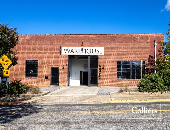
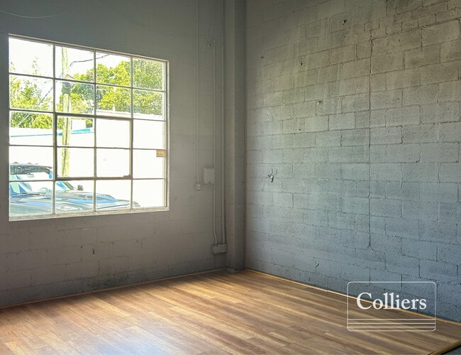
Property Record
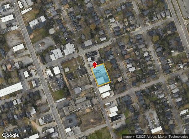
2238 Sumter St, Columbia, SC 29201
NEARBY LISTINGS FOR SALE OR LEASE
Property Detail
2238 Sumter St
09016-03-12
Bellevue
Commercialnec
LOT 7 9 11 13 BLK E 200X145.2X200X145.2 #SU BELLEVUE #PR C-93 C-96
X
Richland
45063C0168J
South Carolina
2025
0.72 AC
2024
North Columbia
000700
Columbia
15,976 SF
Columbia, SC
DEMOGRAPHICS near 2238 Sumter St
1 mile
3 mile
5 mile
2024 Total Population
7,877
85,791
174,795
2029 Population
7,998
88,470
180,725
Pop Growth 2024-2029
+ 1.54%
+ 3.12%
+ 3.39%
Average Age
34
35
37
2024 Total Households
3,660
37,414
76,332
HH Growth 2024-2029
+ 1.09%
+ 3.33%
+ 3.66%
Median Household Inc
$46,057
$40,539
$44,632
Avg Household Size
1.80
2.00
2.00
2024 Avg HH Vehicles
1.00
1.00
2.00
Median Home Value
$246,707
$195,959
$181,763
Median Year Built
1961
1966
1969
Nearby Places
Map Layers
Map Styles
 Street
 Aerial
Transit
 Traffic
 Biking
Places
Listings with unknown addresses are not visible on the map
- Restaurants
- Banks
- Shops
- Fitness
- Groceries
PUBLIC TRANSPORTATION
COMMUTER RAIL
Columbia Amtrak Station (Silver Star - Amtrak)
Drive
Walk
Distance
Columbia Amtrak Station (Silver Star - Amtrak)
5 min
2.1 mi
AIRPORT
Columbia Metro
Drive
Walk
Distance
Columbia Metro
23 min
11.6 mi
Freight Ports
North Charleston Terminal
Drive
Walk
Distance
North Charleston Terminal
123 min
107.9 mi
SALE & LEASE HISTORY
LISTING DATE
SALE/LEASE

Oct 26, 2020
For Lease
Oct 07, 2024
For Lease
Jan 22, 2024
For Lease
Nearby Properties
Address
Land Use
TOTAL SIZE
Lot Size
Zoning
Address
Land Use
TOTAL SIZE
Lot Size
Zoning
501,365 SF
13.28 AC
O-I
Address
Land Use
TOTAL SIZE
Lot Size
Zoning
106,284 SF
10.83 AC
C-5
Address
Land Use
TOTAL SIZE
Lot Size
Zoning
100 SF
15.17 AC
C-1
Address
Land Use
TOTAL SIZE
Lot Size
Zoning
456,218 SF
1 AC
DAC
Address
Land Use
TOTAL SIZE
Lot Size
Zoning
413,000 SF
3.48 AC
MC
Address
Land Use
TOTAL SIZE
Lot Size
Zoning
160,510 SF
0.26 AC
DAC
Address
Land Use
TOTAL SIZE
Lot Size
Zoning
311,754 SF
1.78 AC
DAC
Address
Land Use
TOTAL SIZE
Lot Size
Zoning
440,418 SF
7.23 AC
M-1
Address
Land Use
TOTAL SIZE
Lot Size
Zoning
375,417 SF
3.92 AC
INS-GEN
Address
Land Use
TOTAL SIZE
Lot Size
Zoning
30,100 SF
3.45 AC
M-2
Address
Land Use
TOTAL SIZE
Lot Size
Zoning
2.07 AC
DAC
Address
Land Use
TOTAL SIZE
Lot Size
Zoning
204,154 SF
1.37 AC
DAC
Address
Land Use
TOTAL SIZE
Lot Size
Zoning
530,349 SF
0.75 AC
DAC
Address
Land Use
TOTAL SIZE
Lot Size
Zoning
119,738 SF
10.30 AC
EC
Address
Land Use
TOTAL SIZE
Lot Size
Zoning
100 SF
9.81 AC
MC
Address
Land Use
TOTAL SIZE
Lot Size
Zoning
353,447 SF
0.53 AC
DAC
Address
Land Use
TOTAL SIZE
Lot Size
Zoning
20,434 SF
17.20 AC
C-1
Address
Land Use
TOTAL SIZE
Lot Size
Zoning
383,491 SF
2.36 AC
C-3
Address
Land Use
TOTAL SIZE
Lot Size
Zoning
311,168 SF
3.98 AC
MC
Address
Land Use
TOTAL SIZE
Lot Size
Zoning
494,384 SF
1.67 AC
MC
Address
Land Use
TOTAL SIZE
Lot Size
Zoning
291,996 SF
0.78 AC
DAC
Address
Land Use
TOTAL SIZE
Lot Size
Zoning
354,235 SF
0.80 AC
DAC
Address
Land Use
TOTAL SIZE
Lot Size
Zoning
490,633 SF
13.20 AC
RM-2
Address
Land Use
TOTAL SIZE
Lot Size
Zoning
163,868 SF
4.35 AC
CAC
Address
Land Use
TOTAL SIZE
Lot Size
Zoning
90,588 SF
3.72 AC
DAC
Address
Land Use
TOTAL SIZE
Lot Size
Zoning
85,065 SF
2.43 AC
C-1
Address
Land Use
TOTAL SIZE
Lot Size
Zoning
100 SF
0.52 AC
C-1
Address
Land Use
TOTAL SIZE
Lot Size
Zoning
100 SF
4.49 AC
INS-GEN
Address
Land Use
TOTAL SIZE
Lot Size
Zoning
221,186 SF
1.31 AC
DAC
Address
Land Use
TOTAL SIZE
Lot Size
Zoning
319,842 SF
0.78 AC
DAC
The World's #1 Commercial Real Estate Marketplace
Connect with us
© 2026 CoStar Group
The information above has been obtained from sources believed reliable. While we do not doubt its accuracy we have not verified it and make no guarantee, warranty or representation about it. It is your responsibility to independently confirm its accuracy and completeness. Any projections, opinions, assumptions, or estimates used are for example only and do not represent the current or future performance of the property. The value of this transaction to you depends on tax and other factors which should be evaluated by your tax, financial, and legal advisors. You and your advisors should conduct a careful, independent investigation of the property to determine to your satisfaction the suitability of the property for your needs.