Property Record
2222 Sycamore Ln, Davis, CA 95616


NEARBY LISTINGS FOR SALE OR LEASE
Property Detail
2222 Sycamore Ln
035-311-003-000
Parcel Map 3021
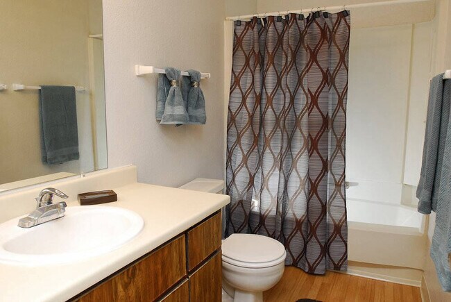
Apartment
Yolo
X
California
06113C0584G
2.58 AC
2024
Senda Nueva
2025
Sacramento
010510
Sacramento-Roseville-Folsom, CA
DEMOGRAPHICS near 2222 Sycamore Ln
1 mile
3 mile
5 mile
2024 Total Population
18,723
71,706
84,066
2029 Population
19,051
73,031
85,522
Pop Growth 2024-2029
+ 1.75%
+ 1.85%
+ 1.73%
Average Age
36
33
34
2024 Total Households
7,058
24,490
29,131
HH Growth 2024-2029
+ 1.66%
+ 1.94%
+ 1.80%
Median Household Inc
$78,367
$71,154
$77,495
Avg Household Size
2.50
2.40
2.50
2024 Avg HH Vehicles
2.00
2.00
2.00
Median Home Value
$790,110
$766,741
$794,678
Median Year Built
1979
1981
1982
Nearby Places
Map Layers
Map Styles
 Street
 Aerial
Transit
 Traffic
 Biking
Places
Listings with unknown addresses are not visible on the map
- Restaurants
- Banks
- Shops
- Fitness
- Groceries
PUBLIC TRANSPORTATION
COMMUTER RAIL
Davis (California Zephyr - Amtrak, Capitol Corridor - Amtrak, Coast Starlight - Amtrak)
Drive
Walk
Distance
Davis (California Zephyr - Amtrak, Capitol Corridor - Amtrak, Coast Starlight - Amtrak)
8 min
2.6 mi
AIRPORT
Sacramento International
Drive
Walk
Distance
Sacramento International
27 min
19.0 mi
Freight Ports
Port of Stockton
Drive
Walk
Distance
Port of Stockton
73 min
60.5 mi
Nearby Properties
Address
Land Use
TOTAL SIZE
Lot Size
Zoning
Address
Land Use
TOTAL SIZE
Lot Size
Zoning
11.18 AC
P-D
Address
Land Use
TOTAL SIZE
Lot Size
Zoning
40,000 SF
16.56 AC
A1
Address
Land Use
TOTAL SIZE
Lot Size
Zoning
5.92 AC
P-D
Address
Land Use
TOTAL SIZE
Lot Size
Zoning
29,376 SF
0.14 AC
PD
Address
Land Use
TOTAL SIZE
Lot Size
Zoning
185,271 SF
1.01 AC
RHD
Address
Land Use
TOTAL SIZE
Lot Size
Zoning
0.20 AC
I
Address
Land Use
TOTAL SIZE
Lot Size
Zoning
209,988 SF
0.11 AC
PD
Address
Land Use
TOTAL SIZE
Lot Size
Zoning
168,279 SF
0.09 AC
R-M
Address
Land Use
TOTAL SIZE
Lot Size
Zoning
110,839 SF
0.26 AC
R3M
Address
Land Use
TOTAL SIZE
Lot Size
Zoning
134,214 SF
5.99 AC
PD
Address
Land Use
TOTAL SIZE
Lot Size
Zoning
174,228 SF
0.16 AC
PD
Address
Land Use
TOTAL SIZE
Lot Size
Zoning
4.40 AC
PD
Address
Land Use
TOTAL SIZE
Lot Size
Zoning
1.37 AC
PD
Address
Land Use
TOTAL SIZE
Lot Size
Zoning
2.52 AC
I
Address
Land Use
TOTAL SIZE
Lot Size
Zoning
152,916 SF
0.17 AC
PD
Address
Land Use
TOTAL SIZE
Lot Size
Zoning
13,068 SF
8.25 AC
PD
Address
Land Use
TOTAL SIZE
Lot Size
Zoning
1.74 AC
CH
Address
Land Use
TOTAL SIZE
Lot Size
Zoning
68,428 SF
0.29 AC
PD
Address
Land Use
TOTAL SIZE
Lot Size
Zoning
1.93 AC
PD
Address
Land Use
TOTAL SIZE
Lot Size
Zoning
61,829 SF
1.31 AC
CC
Address
Land Use
TOTAL SIZE
Lot Size
Zoning
12,361 SF
0.59 AC
PD
Address
Land Use
TOTAL SIZE
Lot Size
Zoning
70,954 SF
3.73 AC
PD
Address
Land Use
TOTAL SIZE
Lot Size
Zoning
79,719 SF
3.50 AC
PD
Address
Land Use
TOTAL SIZE
Lot Size
Zoning
59,200 SF
2.34 AC
R3M
Address
Land Use
TOTAL SIZE
Lot Size
Zoning
2.03 AC
I-R
Address
Land Use
TOTAL SIZE
Lot Size
Zoning
158,000 SF
0.13 AC
PD
Address
Land Use
TOTAL SIZE
Lot Size
Zoning
61,624 SF
3.66 AC
PD
Address
Land Use
TOTAL SIZE
Lot Size
Zoning
94,720 SF
3.93 AC
R3M
Address
Land Use
TOTAL SIZE
Lot Size
Zoning
0.23 AC
PD
Address
Land Use
TOTAL SIZE
Lot Size
Zoning
184,200 SF
0.13 AC
PD
The World's #1 Commercial Real Estate Marketplace
Connect with us
© 2026 CoStar Group
The information above has been obtained from sources believed reliable. While we do not doubt its accuracy we have not verified it and make no guarantee, warranty or representation about it. It is your responsibility to independently confirm its accuracy and completeness. Any projections, opinions, assumptions, or estimates used are for example only and do not represent the current or future performance of the property. The value of this transaction to you depends on tax and other factors which should be evaluated by your tax, financial, and legal advisors. You and your advisors should conduct a careful, independent investigation of the property to determine to your satisfaction the suitability of the property for your needs.