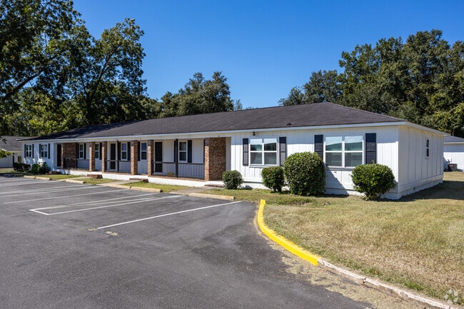
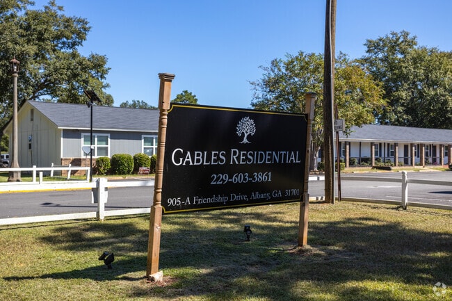
Property Record
2224 Habersham Rd, Albany, GA 31701


NEARBY LISTINGS FOR SALE OR LEASE
Property Detail
2224 Habersham Rd
00212-00001-33N
Oakridge Area West
Apartment
WILLOW WOOD APTS
AE
Dougherty
13095C0116E
Georgia
2025
22.30 AC
2024
Albany/Southwest
010602
Other Market Areas
104,580 SF
Albany, GA
DEMOGRAPHICS near 2224 Habersham Rd
1 Mile
3 Mile
5 Mile
2024 Total Population
3,038
27,239
57,378
2029 Population
2,882
26,215
54,990
Pop Growth 2024-2029
(5.13%)
(3.76%)
(4.16%)
Average Age
38
38
38
2024 Total Households
1,179
11,063
23,881
HH Growth 2024-2029
(5.00%)
(3.84%)
(4.31%)
Median Household Inc
$28,610
$33,611
$39,194
Avg Household Size
2.40
2.30
2.30
2024 Avg HH Vehicles
1.00
1.00
1.00
Median Home Value
$64,736
$69,460
$92,211
Median Year Built
1973
1968
1971
Nearby Places
Map Layers
Map Styles
 Street
 Aerial
- Restaurants
- Banks
- Shops
- Fitness
- Groceries
PUBLIC TRANSPORTATION
AIRPORT
Southwest Georgia Regional
DRIVE
WALK
Distance
Southwest Georgia Regional
7 min
2.6 mi
Freight Ports
Port of Panama City
DRIVE
WALK
Distance
Port of Panama City
226 min
156.4 mi
Nearby Properties
Address
Land Use
TOTAL SIZE
Lot Size
Zoning
Address
Land Use
TOTAL SIZE
Lot Size
Zoning
1.77 AC
C2
Address
Land Use
TOTAL SIZE
Lot Size
Zoning
15.20 AC
C2
Address
Land Use
TOTAL SIZE
Lot Size
Zoning
2.53 AC
C2
Address
Land Use
TOTAL SIZE
Lot Size
Zoning
1.75 AC
C2
Address
Land Use
TOTAL SIZE
Lot Size
Zoning
0.83 AC
C2
Address
Land Use
TOTAL SIZE
Lot Size
Zoning
77,688 SF
2.93 AC
C3
Address
Land Use
TOTAL SIZE
Lot Size
Zoning
70,596 SF
2.38 AC
C2
Address
Land Use
TOTAL SIZE
Lot Size
Zoning
232,840 SF
49.88 AC
M1
Address
Land Use
TOTAL SIZE
Lot Size
Zoning
5,200 SF
883.86 AC
Address
Land Use
TOTAL SIZE
Lot Size
Zoning
0.54 AC
C2
Address
Land Use
TOTAL SIZE
Lot Size
Zoning
9,676 SF
10.73 AC
R6
Address
Land Use
TOTAL SIZE
Lot Size
Zoning
9.37 AC
C3
Address
Land Use
TOTAL SIZE
Lot Size
Zoning
204,625 SF
27.28 AC
M1
Address
Land Use
TOTAL SIZE
Lot Size
Zoning
0.52 AC
C2
Address
Land Use
TOTAL SIZE
Lot Size
Zoning
28,713 SF
9.96 AC
C3
Address
Land Use
TOTAL SIZE
Lot Size
Zoning
30,336 SF
19.19 AC
R6
Address
Land Use
TOTAL SIZE
Lot Size
Zoning
146,281 SF
17.87 AC
M1
Address
Land Use
TOTAL SIZE
Lot Size
Zoning
127,194 SF
15.01 AC
C2
Address
Land Use
TOTAL SIZE
Lot Size
Zoning
30,026 SF
34.47 AC
M1
Address
Land Use
TOTAL SIZE
Lot Size
Zoning
14,336 SF
8.91 AC
R6
Address
Land Use
TOTAL SIZE
Lot Size
Zoning
109,570 SF
18.45 AC
Address
Land Use
TOTAL SIZE
Lot Size
Zoning
16,800 SF
4.76 AC
C2
Address
Land Use
TOTAL SIZE
Lot Size
Zoning
1.54 AC
C3
Address
Land Use
TOTAL SIZE
Lot Size
Zoning
56,008 SF
24.76 AC
Address
Land Use
TOTAL SIZE
Lot Size
Zoning
34,746 SF
3.14 AC
C3
Address
Land Use
TOTAL SIZE
Lot Size
Zoning
47,844 SF
10.16 AC
C3
Address
Land Use
TOTAL SIZE
Lot Size
Zoning
42,560 SF
11.48 AC
R6
Address
Land Use
TOTAL SIZE
Lot Size
Zoning
22,141 SF
8.37 AC
AG
Address
Land Use
TOTAL SIZE
Lot Size
Zoning
21,402 SF
5.32 AC
M1
Address
Land Use
TOTAL SIZE
Lot Size
Zoning
133,840 SF
10 AC
M1
The World's #1 Commercial Real Estate Marketplace
Connect with us
© 2026 CoStar Group
The information above has been obtained from sources believed reliable. While we do not doubt its accuracy we have not verified it and make no guarantee, warranty or representation about it. It is your responsibility to independently confirm its accuracy and completeness. Any projections, opinions, assumptions, or estimates used are for example only and do not represent the current or future performance of the property. The value of this transaction to you depends on tax and other factors which should be evaluated by your tax, financial, and legal advisors. You and your advisors should conduct a careful, independent investigation of the property to determine to your satisfaction the suitability of the property for your needs.