Property Record
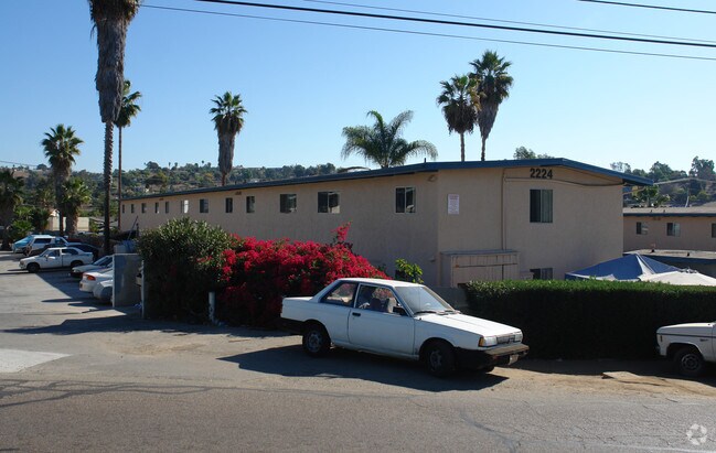
2224 Primrose Ave, Vista, CA 92083


NEARBY LISTINGS FOR SALE OR LEASE
Property Detail
2224 Primrose Ave
San Diego-Chula Vista-Carlsbad, CA
Charles Victor Hall
184-134-36
BLK F LOT 18 (EX ST WID)PAR B PER DOC77-306188 IN LOT 3&IN TR 002056
Multifamilydwelling
San Diego
X
California
06073C0787H
18,3
2024
0.52 AC
2025
Vista
019902
San Diego
9,900 SF
DEMOGRAPHICS near 2224 Primrose Ave
1 Mile
3 Mile
5 Mile
2024 Total Population
12,675
87,745
243,423
2029 Population
12,580
87,257
241,361
Pop Growth 2024-2029
(0.75%)
(0.56%)
(0.85%)
Average Age
38
39
39
2024 Total Households
4,164
29,397
80,279
HH Growth 2024-2029
(0.77%)
(0.68%)
(1.02%)
Median Household Inc
$77,468
$89,567
$94,615
Avg Household Size
3.00
2.90
2.90
2024 Avg HH Vehicles
2.00
2.00
2.00
Median Home Value
$695,555
$709,953
$729,995
Median Year Built
1982
1984
1986
Nearby Places
Map Layers
Map Styles
 Street
 Aerial
- Restaurants
- Banks
- Shops
- Fitness
- Groceries
PUBLIC TRANSPORTATION
TRANSIT/SUBWAY
Buena Creek (Sprinter - San Diego North County Transit District (Coaster/Sprinter/Breeze))
DRIVE
WALK
Distance
Buena Creek (Sprinter - San Diego North County Transit District (Coaster/Sprinter/Breeze))
1 min
7 min
0.4 mi
COMMUTER RAIL
Carlsbad Poinsettia (Coaster - San Diego North County Transit District (Coaster/Sprinter/Breeze))
DRIVE
WALK
Distance
Carlsbad Poinsettia (Coaster - San Diego North County Transit District (Coaster/Sprinter/Breeze))
19 min
9.9 mi
AIRPORT
San Diego International
DRIVE
WALK
Distance
San Diego International
51 min
38.5 mi
Freight Ports
Port of San Diego
DRIVE
WALK
Distance
Port of San Diego
53 min
40.7 mi
Nearby Properties
Address
Land Use
TOTAL SIZE
Lot Size
Zoning
Address
Land Use
TOTAL SIZE
Lot Size
Zoning
24.15 AC
RM-B
Address
Land Use
TOTAL SIZE
Lot Size
Zoning
18.90 AC
R-M
Address
Land Use
TOTAL SIZE
Lot Size
Zoning
5.25 AC
SPA
Address
Land Use
TOTAL SIZE
Lot Size
Zoning
5.37 AC
SPA
Address
Land Use
TOTAL SIZE
Lot Size
Zoning
11.87 AC
R-M
Address
Land Use
TOTAL SIZE
Lot Size
Zoning
9.41 AC
SPI
Address
Land Use
TOTAL SIZE
Lot Size
Zoning
16.91 AC
C
Address
Land Use
TOTAL SIZE
Lot Size
Zoning
11.08 AC
SPI
Address
Land Use
TOTAL SIZE
Lot Size
Zoning
11.49 AC
P-M
Address
Land Use
TOTAL SIZE
Lot Size
Zoning
14.91 AC
SPI
Address
Land Use
TOTAL SIZE
Lot Size
Zoning
9.80 AC
I
Address
Land Use
TOTAL SIZE
Lot Size
Zoning
27.30 AC
SPI
Address
Land Use
TOTAL SIZE
Lot Size
Zoning
19.68 AC
SPI
Address
Land Use
TOTAL SIZE
Lot Size
Zoning
9.99 AC
MU-1
Address
Land Use
TOTAL SIZE
Lot Size
Zoning
4.65 AC
SPI
Address
Land Use
TOTAL SIZE
Lot Size
Zoning
7.33 AC
R-M
Address
Land Use
TOTAL SIZE
Lot Size
Zoning
9.11 AC
SPI
Address
Land Use
TOTAL SIZE
Lot Size
Zoning
8.07 AC
SPI
Address
Land Use
TOTAL SIZE
Lot Size
Zoning
Address
Land Use
TOTAL SIZE
Lot Size
Zoning
5.85 AC
SPA
Address
Land Use
TOTAL SIZE
Lot Size
Zoning
99,840 SF
5.20 AC
SPI
Address
Land Use
TOTAL SIZE
Lot Size
Zoning
9.75 AC
RU
Address
Land Use
TOTAL SIZE
Lot Size
Zoning
15.59 AC
SPI
Address
Land Use
TOTAL SIZE
Lot Size
Zoning
6.64 AC
SPI
Address
Land Use
TOTAL SIZE
Lot Size
Zoning
10.69 AC
R-3-10
Address
Land Use
TOTAL SIZE
Lot Size
Zoning
90,400 SF
4.86 AC
SPI
Address
Land Use
TOTAL SIZE
Lot Size
Zoning
5.61 AC
SPI
Address
Land Use
TOTAL SIZE
Lot Size
Zoning
90,400 SF
4.38 AC
SPI
Address
Land Use
TOTAL SIZE
Lot Size
Zoning
4.79 AC
SR
Address
Land Use
TOTAL SIZE
Lot Size
Zoning
1.92 AC
C-2
The World's #1 Commercial Real Estate Marketplace
Connect with us
© 2026 CoStar Group
The information above has been obtained from sources believed reliable. While we do not doubt its accuracy we have not verified it and make no guarantee, warranty or representation about it. It is your responsibility to independently confirm its accuracy and completeness. Any projections, opinions, assumptions, or estimates used are for example only and do not represent the current or future performance of the property. The value of this transaction to you depends on tax and other factors which should be evaluated by your tax, financial, and legal advisors. You and your advisors should conduct a careful, independent investigation of the property to determine to your satisfaction the suitability of the property for your needs.