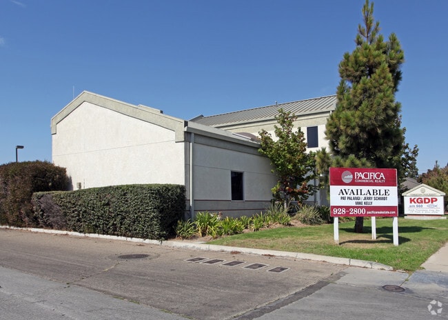
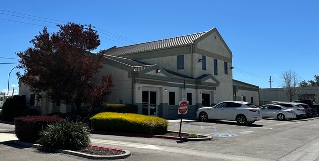
Property Record
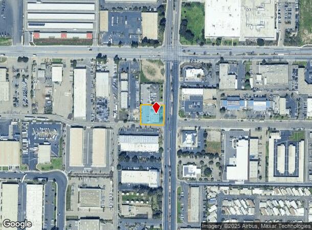
2225 Skyway Dr, Santa Maria, CA 93455

Current Lease Availabilities
NEARBY LISTINGS FOR SALE OR LEASE
Property Detail
2225 Skyway Dr
Santa Maria-Santa Barbara, CA
G S Parcel
111-400-057
TR 5506 BK 41/11-12 PARCEL 1
Officebuilding
Santa Barbara
X
California
06083C0187F
1
2024
0.41 AC
2025
North SB County
002011
Santa Barbara/Sta Maria/Goleta
DEMOGRAPHICS near 2225 Skyway Dr
1 Mile
3 Mile
5 Mile
2024 Total Population
13,619
76,785
140,907
2029 Population
13,723
76,433
139,679
Pop Growth 2024-2029
+ 0.76%
(0.46%)
(0.87%)
Average Age
34
33
35
2024 Total Households
3,924
21,269
39,942
HH Growth 2024-2029
+ 0.61%
(0.55%)
(0.96%)
Median Household Inc
$84,615
$74,138
$80,987
Avg Household Size
3.40
3.50
3.40
2024 Avg HH Vehicles
2.00
2.00
2.00
Median Home Value
$445,222
$444,124
$450,271
Median Year Built
2005
1980
1979
Nearby Places
Map Layers
Map Styles
 Street
 Aerial
- Restaurants
- Banks
- Shops
- Fitness
- Groceries
PUBLIC TRANSPORTATION
COMMUTER RAIL
Guadalupe Amtrak Station (Pacific Surfliner - Amtrak)
DRIVE
WALK
Distance
Guadalupe Amtrak Station (Pacific Surfliner - Amtrak)
15 min
9.6 mi
AIRPORT
San Luis County Regional
DRIVE
WALK
Distance
San Luis County Regional
42 min
29.5 mi
Freight Ports
The Port of Hueneme
DRIVE
WALK
Distance
The Port of Hueneme
134 min
101.6 mi
Nearby Properties
Address
Land Use
TOTAL SIZE
Lot Size
Zoning
Address
Land Use
TOTAL SIZE
Lot Size
Zoning
211.15 AC
Address
Land Use
TOTAL SIZE
Lot Size
Zoning
49.99 AC
Address
Land Use
TOTAL SIZE
Lot Size
Zoning
14.45 AC
Address
Land Use
TOTAL SIZE
Lot Size
Zoning
146.75 AC
Address
Land Use
TOTAL SIZE
Lot Size
Zoning
6.35 AC
Address
Land Use
TOTAL SIZE
Lot Size
Zoning
9.46 AC
Address
Land Use
TOTAL SIZE
Lot Size
Zoning
18.19 AC
Address
Land Use
TOTAL SIZE
Lot Size
Zoning
Address
Land Use
TOTAL SIZE
Lot Size
Zoning
9.50 AC
Address
Land Use
TOTAL SIZE
Lot Size
Zoning
17.71 AC
Address
Land Use
TOTAL SIZE
Lot Size
Zoning
4.05 AC
Address
Land Use
TOTAL SIZE
Lot Size
Zoning
Address
Land Use
TOTAL SIZE
Lot Size
Zoning
Address
Land Use
TOTAL SIZE
Lot Size
Zoning
21.09 AC
Address
Land Use
TOTAL SIZE
Lot Size
Zoning
10.75 AC
Address
Land Use
TOTAL SIZE
Lot Size
Zoning
6.36 AC
Address
Land Use
TOTAL SIZE
Lot Size
Zoning
10.81 AC
Address
Land Use
TOTAL SIZE
Lot Size
Zoning
6.17 AC
Address
Land Use
TOTAL SIZE
Lot Size
Zoning
5.80 AC
DR20
Address
Land Use
TOTAL SIZE
Lot Size
Zoning
45.32 AC
Address
Land Use
TOTAL SIZE
Lot Size
Zoning
13.76 AC
Address
Land Use
TOTAL SIZE
Lot Size
Zoning
Address
Land Use
TOTAL SIZE
Lot Size
Zoning
Address
Land Use
TOTAL SIZE
Lot Size
Zoning
Address
Land Use
TOTAL SIZE
Lot Size
Zoning
27.05 AC
Address
Land Use
TOTAL SIZE
Lot Size
Zoning
Address
Land Use
TOTAL SIZE
Lot Size
Zoning
6.11 AC
Address
Land Use
TOTAL SIZE
Lot Size
Zoning
2.81 AC
Address
Land Use
TOTAL SIZE
Lot Size
Zoning
The World's #1 Commercial Real Estate Marketplace
Connect with us
© 2026 CoStar Group
The information above has been obtained from sources believed reliable. While we do not doubt its accuracy we have not verified it and make no guarantee, warranty or representation about it. It is your responsibility to independently confirm its accuracy and completeness. Any projections, opinions, assumptions, or estimates used are for example only and do not represent the current or future performance of the property. The value of this transaction to you depends on tax and other factors which should be evaluated by your tax, financial, and legal advisors. You and your advisors should conduct a careful, independent investigation of the property to determine to your satisfaction the suitability of the property for your needs.