Property Record
22256 Airport Rd Ne, Aurora, OR 97002
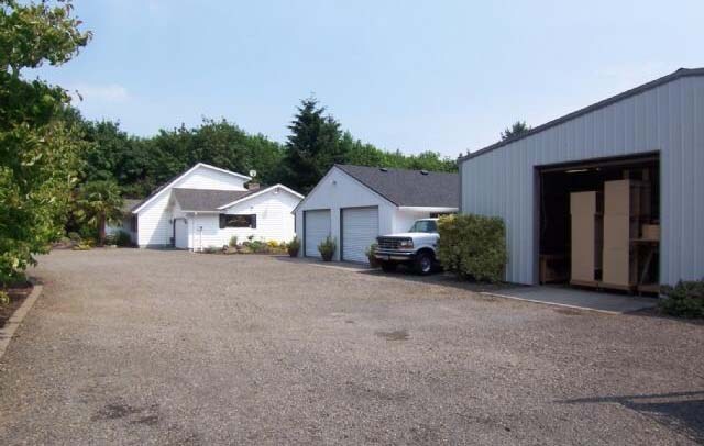

Property Detail
22256 Airport Rd Ne
510593
ACRES 69.55
Farms
MARION
EFU
Oregon
AE The base floodplain where base flood elevations are provided. AE Zones are now used on new format FIRMs instead of A1-A30 Zones.
69.55 AC
2024
Marion County
2025
Portland
010202
Salem, OR
3,022 SF
NEARBY LISTINGS FOR SALE OR LEASE
-
-
View all Aurora listings for sale on LoopNet.com
DEMOGRAPHICS near 22256 Airport Rd Ne
1 mile
3 mile
5 mile
2024 Total Population
1,004
4,803
47,919
2029 Population
1,009
4,804
48,281
Pop Growth 2024-2029
+ 0.50%
+ 0.02%
+ 0.76%
Average Age
43
43
42
2024 Total Households
373
1,764
18,197
HH Growth 2024-2029
+ 0.80%
+ 0.11%
+ 0.76%
Median Household Inc
$60,192
$64,104
$94,491
Avg Household Size
2.70
2.70
2.60
2024 Avg HH Vehicles
2.00
2.00
2.00
Median Home Value
$454,545
$465,384
$569,877
Median Year Built
1978
1981
1990
Nearby Places
Map Layers
Map Styles
 Street
 Aerial
Transit
 Traffic
 Biking
Places
Listings with unknown addresses are not visible on the map
- Restaurants
- Banks
- Shops
- Fitness
- Groceries
PUBLIC TRANSPORTATION
COMMUTER RAIL
Wilsonville (Westside Express Service - Tri-County Metropolitan Transportation District of Oregon Rail (TriMet Rail))
Drive
Walk
Distance
Wilsonville (Westside Express Service - Tri-County Metropolitan Transportation District of Oregon Rail (TriMet Rail))
13 min
5.9 mi
AIRPORT
Portland International
Drive
Walk
Distance
Portland International
50 min
33.5 mi
Freight Ports
Port of Portland
Drive
Walk
Distance
Port of Portland
37 min
24.7 mi
Nearby Properties
Address
Land Use
TOTAL SIZE
Lot Size
Zoning
Address
Land Use
TOTAL SIZE
Lot Size
Zoning
165,375 SF
27.47 AC
P-LU
Address
Land Use
TOTAL SIZE
Lot Size
Zoning
Address
Land Use
TOTAL SIZE
Lot Size
Zoning
19.24 AC
P
Address
Land Use
TOTAL SIZE
Lot Size
Zoning
Address
Land Use
TOTAL SIZE
Lot Size
Zoning
1 SF
7 AC
C2
Address
Land Use
TOTAL SIZE
Lot Size
Zoning
13.91 AC
M1
Address
Land Use
TOTAL SIZE
Lot Size
Zoning
4.53 AC
P
Address
Land Use
TOTAL SIZE
Lot Size
Zoning
Address
Land Use
TOTAL SIZE
Lot Size
Zoning
42,972 SF
0.99 AC
P
Address
Land Use
TOTAL SIZE
Lot Size
Zoning
24,734 SF
10.58 AC
ID
Address
Land Use
TOTAL SIZE
Lot Size
Zoning
Address
Land Use
TOTAL SIZE
Lot Size
Zoning
20 SF
0.73 AC
P
Address
Land Use
TOTAL SIZE
Lot Size
Zoning
24,905 SF
19.98 AC
ID
Address
Land Use
TOTAL SIZE
Lot Size
Zoning
6.66 AC
M1
Address
Land Use
TOTAL SIZE
Lot Size
Zoning
20 SF
0.48 AC
P
Address
Land Use
TOTAL SIZE
Lot Size
Zoning
1.39 AC
CM
Address
Land Use
TOTAL SIZE
Lot Size
Zoning
36,810 SF
0.78 AC
P
Address
Land Use
TOTAL SIZE
Lot Size
Zoning
42,400 SF
9.71 AC
ID
Address
Land Use
TOTAL SIZE
Lot Size
Zoning
30,612 SF
0.71 AC
P
Address
Land Use
TOTAL SIZE
Lot Size
Zoning
3.16 AC
M1
Address
Land Use
TOTAL SIZE
Lot Size
Zoning
171.47 AC
EFU
Address
Land Use
TOTAL SIZE
Lot Size
Zoning
6.82 AC
CM
Address
Land Use
TOTAL SIZE
Lot Size
Zoning
26,010 SF
0.60 AC
P
Address
Land Use
TOTAL SIZE
Lot Size
Zoning
41,050 SF
23.98 AC
EFU
Address
Land Use
TOTAL SIZE
Lot Size
Zoning
Address
Land Use
TOTAL SIZE
Lot Size
Zoning
0.67 AC
CM
Address
Land Use
TOTAL SIZE
Lot Size
Zoning
Address
Land Use
TOTAL SIZE
Lot Size
Zoning
Address
Land Use
TOTAL SIZE
Lot Size
Zoning
Address
Land Use
TOTAL SIZE
Lot Size
Zoning
1.10 AC
C2
The World's #1 Commercial Real Estate Marketplace
Connect with us
© 2026 CoStar Group
The information above has been obtained from sources believed reliable. While we do not doubt its accuracy we have not verified it and make no guarantee, warranty or representation about it. It is your responsibility to independently confirm its accuracy and completeness. Any projections, opinions, assumptions, or estimates used are for example only and do not represent the current or future performance of the property. The value of this transaction to you depends on tax and other factors which should be evaluated by your tax, financial, and legal advisors. You and your advisors should conduct a careful, independent investigation of the property to determine to your satisfaction the suitability of the property for your needs.