Property Record
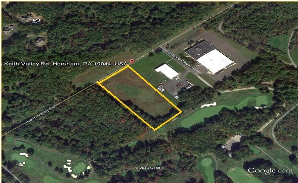
223 Keith Valley Rd, Horsham, PA 19044


NEARBY LISTINGS FOR SALE OR LEASE
Property Detail
223 Keith Valley Rd
Philadelphia-Camden-Wilmington, PA-NJ-DE-MD
Ametek/Drexelbrook
36-00-06154-002
307 X IRR 4.30 AC
Warehouse
Montgomery
AE
Pennsylvania
42091C0283G
1
2024
4.30 AC
2025
Horsham/Willow Grove
200506
Philadelphia
46,913 SF
DEMOGRAPHICS near 223 Keith Valley Rd
1 Mile
3 Mile
5 Mile
2024 Total Population
972
55,368
180,261
2029 Population
1,004
56,194
182,653
Pop Growth 2024-2029
+ 3.29%
+ 1.49%
+ 1.33%
Average Age
41
43
43
2024 Total Households
331
20,380
68,404
HH Growth 2024-2029
+ 3.02%
+ 1.47%
+ 1.39%
Median Household Inc
$179,444
$117,010
$108,831
Avg Household Size
2.80
2.60
2.50
2024 Avg HH Vehicles
2.00
2.00
2.00
Median Home Value
$656,976
$440,183
$404,580
Median Year Built
1985
1982
1977
Nearby Places
Map Layers
Map Styles
 Street
 Aerial
- Restaurants
- Banks
- Shops
- Fitness
- Groceries
PUBLIC TRANSPORTATION
COMMUTER RAIL
Hatboro (R2 - Southeastern Pennsylvania Transportation Authority Regional Rail (SEPTA Regional Rail))
DRIVE
WALK
Distance
Hatboro (R2 - Southeastern Pennsylvania Transportation Authority Regional Rail (SEPTA Regional Rail))
11 min
5.8 mi
Warminster (R2 - Southeastern Pennsylvania Transportation Authority Regional Rail (SEPTA Regional Rail))
DRIVE
WALK
Distance
Warminster (R2 - Southeastern Pennsylvania Transportation Authority Regional Rail (SEPTA Regional Rail))
12 min
5.9 mi
AIRPORT
Trenton Mercer
DRIVE
WALK
Distance
Trenton Mercer
45 min
25.5 mi
Philadelphia International
DRIVE
WALK
Distance
Philadelphia International
58 min
32.5 mi
Freight Ports
Port of Philadelphia
DRIVE
WALK
Distance
Port of Philadelphia
37 min
21.0 mi
SALE & LEASE HISTORY
LISTING DATE
SALE/LEASE

Sep 24, 2016
For Sale
Nearby Properties
Address
Land Use
TOTAL SIZE
Lot Size
Zoning
Address
Land Use
TOTAL SIZE
Lot Size
Zoning
1,006.32 AC
I1
Address
Land Use
TOTAL SIZE
Lot Size
Zoning
832,797 SF
171.68 AC
A
Address
Land Use
TOTAL SIZE
Lot Size
Zoning
614,768 SF
30.16 AC
R7
Address
Land Use
TOTAL SIZE
Lot Size
Zoning
368,495 SF
68.37 AC
PI
Address
Land Use
TOTAL SIZE
Lot Size
Zoning
368,492 SF
58.98 AC
I1
Address
Land Use
TOTAL SIZE
Lot Size
Zoning
418,962 SF
37.87 AC
O1
Address
Land Use
TOTAL SIZE
Lot Size
Zoning
110,113 SF
13.35 AC
SC1
Address
Land Use
TOTAL SIZE
Lot Size
Zoning
248,795 SF
16.64 AC
PI
Address
Land Use
TOTAL SIZE
Lot Size
Zoning
170,183 SF
46.63 AC
I1
Address
Land Use
TOTAL SIZE
Lot Size
Zoning
228,026 SF
24.47 AC
MF3
Address
Land Use
TOTAL SIZE
Lot Size
Zoning
140,582 SF
52.93 AC
R2
Address
Land Use
TOTAL SIZE
Lot Size
Zoning
94,059 SF
19.22 AC
R4
Address
Land Use
TOTAL SIZE
Lot Size
Zoning
93,657 SF
27.40 AC
A1
Address
Land Use
TOTAL SIZE
Lot Size
Zoning
88,000 SF
14.40 AC
PI
Address
Land Use
TOTAL SIZE
Lot Size
Zoning
89,667 SF
18.75 AC
I1
Address
Land Use
TOTAL SIZE
Lot Size
Zoning
108,242 SF
15.42 AC
PI
Address
Land Use
TOTAL SIZE
Lot Size
Zoning
213,350 SF
11.78 AC
R7
Address
Land Use
TOTAL SIZE
Lot Size
Zoning
160,798 SF
37.55 AC
R4
Address
Land Use
TOTAL SIZE
Lot Size
Zoning
141,532 SF
21.43 AC
R6
Address
Land Use
TOTAL SIZE
Lot Size
Zoning
148,942 SF
34.95 AC
R4
Address
Land Use
TOTAL SIZE
Lot Size
Zoning
61,032 SF
16.40 AC
A
Address
Land Use
TOTAL SIZE
Lot Size
Zoning
135,660 SF
25.99 AC
O1
Address
Land Use
TOTAL SIZE
Lot Size
Zoning
112,772 SF
10.39 AC
I2
Address
Land Use
TOTAL SIZE
Lot Size
Zoning
71,680 SF
8.12 AC
C1
Address
Land Use
TOTAL SIZE
Lot Size
Zoning
72,934 SF
8.51 AC
C2
Address
Land Use
TOTAL SIZE
Lot Size
Zoning
126,244 SF
11.13 AC
I2
Address
Land Use
TOTAL SIZE
Lot Size
Zoning
121,760 SF
13.11 AC
I2
Address
Land Use
TOTAL SIZE
Lot Size
Zoning
23,644 SF
94.71 AC
R2
Address
Land Use
TOTAL SIZE
Lot Size
Zoning
64,066 SF
5.05 AC
O1
Address
Land Use
TOTAL SIZE
Lot Size
Zoning
62,572 SF
6.52 AC
SC
The World's #1 Commercial Real Estate Marketplace
Connect with us
© 2025 CoStar Group
The information above has been obtained from sources believed reliable. While we do not doubt its accuracy we have not verified it and make no guarantee, warranty or representation about it. It is your responsibility to independently confirm its accuracy and completeness. Any projections, opinions, assumptions, or estimates used are for example only and do not represent the current or future performance of the property. The value of this transaction to you depends on tax and other factors which should be evaluated by your tax, financial, and legal advisors. You and your advisors should conduct a careful, independent investigation of the property to determine to your satisfaction the suitability of the property for your needs.