Property Record
223 Ranch Dr, High Point, NC 27263

NEARBY LISTINGS FOR SALE OR LEASE
Property Detail
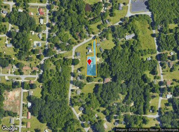
223 Ranch Dr
Greensboro-High Point, NC
C C Vuncannon
0158100
PT 7-8 PB 12-30 C C VUNCANNON PL:12-30
Industrialgeneral
Guilford
X
North Carolina
3710771900K
7-8
2024
0.44 AC
2025
High Point/SW Guilford Cty
031503
Greensboro/Winston-Salem
5,760 SF
DEMOGRAPHICS near 223 Ranch Dr
1 Mile
3 Mile
5 Mile
2024 Total Population
6,370
30,694
81,343
2029 Population
6,407
31,176
82,521
Pop Growth 2024-2029
+ 0.58%
+ 1.57%
+ 1.45%
Average Age
39
39
39
2024 Total Households
2,555
12,316
30,764
HH Growth 2024-2029
+ 0.70%
+ 1.58%
+ 1.56%
Median Household Inc
$49,648
$47,085
$46,437
Avg Household Size
2.50
2.40
2.40
2024 Avg HH Vehicles
2.00
2.00
2.00
Median Home Value
$115,410
$140,970
$143,068
Median Year Built
1970
1973
1972
Nearby Places
Map Layers
Map Styles
 Street
 Aerial
- Restaurants
- Banks
- Shops
- Fitness
- Groceries
PUBLIC TRANSPORTATION
COMMUTER RAIL
High Point Station (Piedmont - North Carolina by Train (NC Train))
DRIVE
WALK
Distance
High Point Station (Piedmont - North Carolina by Train (NC Train))
8 min
4.3 mi
AIRPORT
Piedmont Triad International
DRIVE
WALK
Distance
Piedmont Triad International
31 min
15.8 mi
Freight Ports
Port of Wilmington
DRIVE
WALK
Distance
Port of Wilmington
248 min
208.8 mi
Nearby Properties
Address
Land Use
TOTAL SIZE
Lot Size
Zoning
Address
Land Use
TOTAL SIZE
Lot Size
Zoning
355,633 SF
63.42 AC
HI
Address
Land Use
TOTAL SIZE
Lot Size
Zoning
204,276 SF
68.51 AC
M-2
Address
Land Use
TOTAL SIZE
Lot Size
Zoning
196,353 SF
13.76 AC
RC
Address
Land Use
TOTAL SIZE
Lot Size
Zoning
156,010 SF
36.21 AC
M-1
Address
Land Use
TOTAL SIZE
Lot Size
Zoning
127,800 SF
57.35 AC
M-1
Address
Land Use
TOTAL SIZE
Lot Size
Zoning
174,529 SF
2.87 AC
CB
Address
Land Use
TOTAL SIZE
Lot Size
Zoning
159,944 SF
13.95 AC
RS-40
Address
Land Use
TOTAL SIZE
Lot Size
Zoning
245,194 SF
23.44 AC
LI
Address
Land Use
TOTAL SIZE
Lot Size
Zoning
107,417 SF
6.46 AC
RM-26
Address
Land Use
TOTAL SIZE
Lot Size
Zoning
101,612 SF
15.82 AC
RM-16
Address
Land Use
TOTAL SIZE
Lot Size
Zoning
79,740 SF
24.38 AC
R-5
Address
Land Use
TOTAL SIZE
Lot Size
Zoning
127,040 SF
7.41 AC
RM-26
Address
Land Use
TOTAL SIZE
Lot Size
Zoning
299,394 SF
8.60 AC
M-2
Address
Land Use
TOTAL SIZE
Lot Size
Zoning
90,000 SF
15.36 AC
M-2
Address
Land Use
TOTAL SIZE
Lot Size
Zoning
89,183 SF
17.12 AC
GB
Address
Land Use
TOTAL SIZE
Lot Size
Zoning
170,516 SF
17.08 AC
RC
Address
Land Use
TOTAL SIZE
Lot Size
Zoning
163,309 SF
36.05 AC
R-5
Address
Land Use
TOTAL SIZE
Lot Size
Zoning
10,810 SF
158.27 AC
PNR
Address
Land Use
TOTAL SIZE
Lot Size
Zoning
7,680 SF
9.95 AC
GRD
Address
Land Use
TOTAL SIZE
Lot Size
Zoning
27,310 SF
20.06 AC
HI
Address
Land Use
TOTAL SIZE
Lot Size
Zoning
69,094 SF
5.47 AC
M-2
Address
Land Use
TOTAL SIZE
Lot Size
Zoning
109,950 SF
28.29 AC
M-1
Address
Land Use
TOTAL SIZE
Lot Size
Zoning
28.20 AC
RR
Address
Land Use
TOTAL SIZE
Lot Size
Zoning
493,334 SF
7.40 AC
LI
Address
Land Use
TOTAL SIZE
Lot Size
Zoning
186,419 SF
15.42 AC
GB
Address
Land Use
TOTAL SIZE
Lot Size
Zoning
98,287 SF
14.50 AC
RM-16
Address
Land Use
TOTAL SIZE
Lot Size
Zoning
52,061 SF
3.03 AC
LI
Address
Land Use
TOTAL SIZE
Lot Size
Zoning
7,168 SF
7.51 AC
GRD
Address
Land Use
TOTAL SIZE
Lot Size
Zoning
97,096 SF
2.47 AC
RM-26
Address
Land Use
TOTAL SIZE
Lot Size
Zoning
45,224 SF
8.03 AC
OI
The World's #1 Commercial Real Estate Marketplace
Connect with us
© 2026 CoStar Group
The information above has been obtained from sources believed reliable. While we do not doubt its accuracy we have not verified it and make no guarantee, warranty or representation about it. It is your responsibility to independently confirm its accuracy and completeness. Any projections, opinions, assumptions, or estimates used are for example only and do not represent the current or future performance of the property. The value of this transaction to you depends on tax and other factors which should be evaluated by your tax, financial, and legal advisors. You and your advisors should conduct a careful, independent investigation of the property to determine to your satisfaction the suitability of the property for your needs.