Property Record
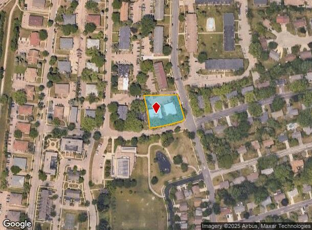
2230 Red Arrow Trl, Fitchburg, WI 53711
NEARBY LISTINGS FOR SALE OR LEASE
Property Detail
2230 Red Arrow Trl
Madison, WI
Hilltop
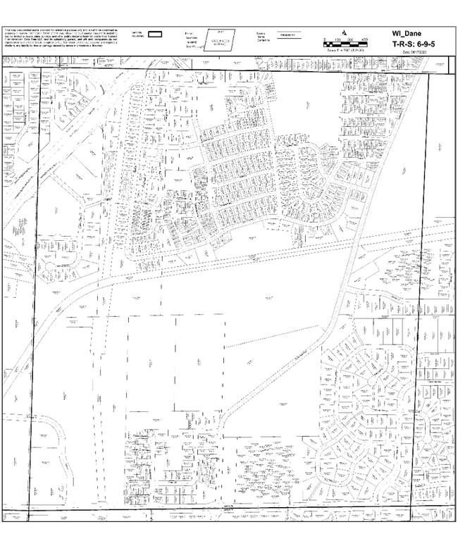
0609-052-0130-1
BELMAR PLAT HILLTOP ADDITION LOT 10 EXC BEG AT SW COR OF SD LOT 10 TH N10DEG182 4W 149.44 FT TH S15DEG5359E 59.07 FT TH S06DEG4022E 90.84 FT TO POB THIS EX C & ALSO INCL PRT LOT 2 CSM 695 CS3/228-11/2/71 F/K/A LOT 11 HILLTOP ADDN TO BEL MAR DESCR AS
Commercialnec
Dane
X
Wisconsin
55025C0415G
10
2024
0.74 AC
2024
Allied
000600
Milwaukee/Madison
DEMOGRAPHICS near 2230 Red Arrow Trl
1 Mile
3 Mile
5 Mile
2024 Total Population
12,176
85,292
211,250
2029 Population
12,541
88,247
218,435
Pop Growth 2024-2029
+ 3.00%
+ 3.46%
+ 3.40%
Average Age
36
39
36
2024 Total Households
4,968
36,792
92,181
HH Growth 2024-2029
+ 3.08%
+ 3.66%
+ 3.66%
Median Household Inc
$65,778
$80,358
$69,984
Avg Household Size
2.40
2.20
2.10
2024 Avg HH Vehicles
2.00
2.00
1.00
Median Home Value
$325,456
$344,857
$365,301
Median Year Built
1972
1979
1983
Nearby Places
Map Layers
Map Styles
 Street
 Aerial
- Restaurants
- Banks
- Shops
- Fitness
- Groceries
PUBLIC TRANSPORTATION
AIRPORT
Dane County Regional/Truax Field
DRIVE
WALK
Distance
Dane County Regional/Truax Field
23 min
10.4 mi
Freight Ports
Port Milwaukee
DRIVE
WALK
Distance
Port Milwaukee
104 min
87.1 mi
Nearby Properties
Address
Land Use
TOTAL SIZE
Lot Size
Zoning
Address
Land Use
TOTAL SIZE
Lot Size
Zoning
82,796 SF
9.26 AC
SE
Address
Land Use
TOTAL SIZE
Lot Size
Zoning
69,336 SF
26.90 AC
SE
Address
Land Use
TOTAL SIZE
Lot Size
Zoning
226,593 SF
28.49 AC
PD
Address
Land Use
TOTAL SIZE
Lot Size
Zoning
21.49 AC
Address
Land Use
TOTAL SIZE
Lot Size
Zoning
56,000 SF
23.87 AC
SE
Address
Land Use
TOTAL SIZE
Lot Size
Zoning
89.21 AC
Address
Land Use
TOTAL SIZE
Lot Size
Zoning
16.45 AC
Address
Land Use
TOTAL SIZE
Lot Size
Zoning
349,680 SF
6.28 AC
TR-U2
Address
Land Use
TOTAL SIZE
Lot Size
Zoning
420,780 SF
10.14 AC
PD
Address
Land Use
TOTAL SIZE
Lot Size
Zoning
18.97 AC
Address
Land Use
TOTAL SIZE
Lot Size
Zoning
1.44 AC
TE
Address
Land Use
TOTAL SIZE
Lot Size
Zoning
77,296 SF
4.84 AC
TR-U1
Address
Land Use
TOTAL SIZE
Lot Size
Zoning
11.20 AC
SE
Address
Land Use
TOTAL SIZE
Lot Size
Zoning
51,205 SF
9.32 AC
SE
Address
Land Use
TOTAL SIZE
Lot Size
Zoning
467,400 SF
6.17 AC
TR-U2
Address
Land Use
TOTAL SIZE
Lot Size
Zoning
6.30 AC
Address
Land Use
TOTAL SIZE
Lot Size
Zoning
17.80 AC
Address
Land Use
TOTAL SIZE
Lot Size
Zoning
14.47 AC
Address
Land Use
TOTAL SIZE
Lot Size
Zoning
24.62 AC
Address
Land Use
TOTAL SIZE
Lot Size
Zoning
3.21 AC
Address
Land Use
TOTAL SIZE
Lot Size
Zoning
404,794 SF
4.86 AC
CC-T
Address
Land Use
TOTAL SIZE
Lot Size
Zoning
6.39 AC
Address
Land Use
TOTAL SIZE
Lot Size
Zoning
13.98 AC
Address
Land Use
TOTAL SIZE
Lot Size
Zoning
237,225 SF
1.84 AC
PD
Address
Land Use
TOTAL SIZE
Lot Size
Zoning
Address
Land Use
TOTAL SIZE
Lot Size
Zoning
8.10 AC
Address
Land Use
TOTAL SIZE
Lot Size
Zoning
244,074 SF
7.96 AC
SR-V2
Address
Land Use
TOTAL SIZE
Lot Size
Zoning
Address
Land Use
TOTAL SIZE
Lot Size
Zoning
329,670 SF
11.12 AC
SR-V2
Address
Land Use
TOTAL SIZE
Lot Size
Zoning
13.87 AC
The World's #1 Commercial Real Estate Marketplace
Connect with us
© 2025 CoStar Group
The information above has been obtained from sources believed reliable. While we do not doubt its accuracy we have not verified it and make no guarantee, warranty or representation about it. It is your responsibility to independently confirm its accuracy and completeness. Any projections, opinions, assumptions, or estimates used are for example only and do not represent the current or future performance of the property. The value of this transaction to you depends on tax and other factors which should be evaluated by your tax, financial, and legal advisors. You and your advisors should conduct a careful, independent investigation of the property to determine to your satisfaction the suitability of the property for your needs.