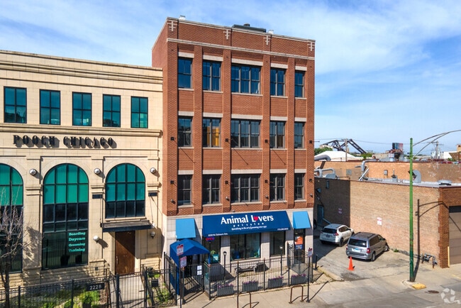
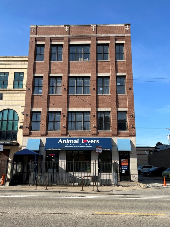
Property Record
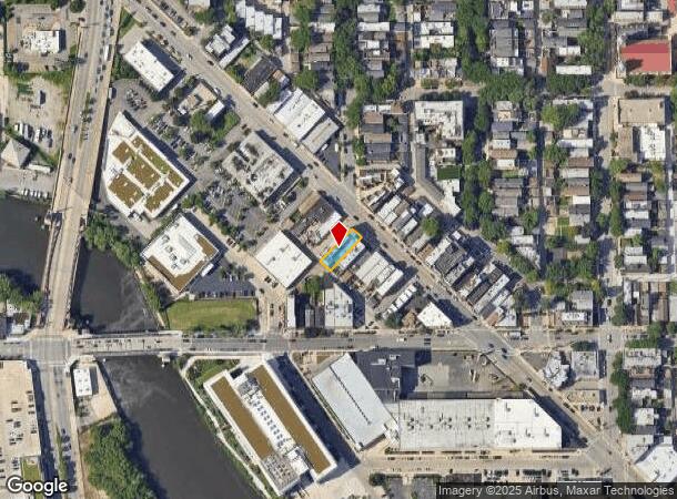
2232 N Clybourn Ave, Chicago, IL 60614
Current Lease Availabilities
NEARBY LISTINGS FOR SALE OR LEASE
Property Detail
2232 N Clybourn Ave
14-32-107-040-0000
Nickersons Addition To Chicago
Commercialbuilding
Cook
X
Illinois
17031C0416J
13,12
2023
0.96 AC
2024
North Branch/Goose Island
832500
Chicago
11,274 SF
Chicago-Naperville-Elgin, IL-IN-WI
DEMOGRAPHICS near 2232 N Clybourn Ave
1 Mile
3 Mile
5 Mile
2024 Total Population
56,477
545,367
1,093,643
2029 Population
54,971
529,400
1,053,675
Pop Growth 2024-2029
(2.67%)
(2.93%)
(3.65%)
Average Age
33
36
37
2024 Total Households
24,673
282,430
525,186
HH Growth 2024-2029
(2.98%)
(2.91%)
(3.47%)
Median Household Inc
$159,201
$106,567
$90,227
Avg Household Size
2.10
1.90
2.00
2024 Avg HH Vehicles
1.00
1.00
1.00
Median Home Value
$771,983
$535,051
$445,114
Median Year Built
1968
1965
1960
Nearby Places
- Restaurants
- Banks
- Shops
- Fitness
- Groceries
PUBLIC TRANSPORTATION
TRANSIT/SUBWAY
Armitage Station (Brown Line - Chicago Transit Authority "L" Trains (The "L"), Purple Line - Chicago Transit Authority "L" Trains (The "L"))
DRIVE
WALK
Distance
Armitage Station (Brown Line - Chicago Transit Authority "L" Trains (The "L"), Purple Line - Chicago Transit Authority "L" Trains (The "L"))
2 min
15 min
0.8 mi
Fullerton Station (Brown Line - Chicago Transit Authority "L" Trains (The "L"), Purple Line - Chicago Transit Authority "L" Trains (The "L"), Red Line - Chicago Transit Authority "L" Trains (The "L"))
DRIVE
WALK
Distance
Fullerton Station (Brown Line - Chicago Transit Authority "L" Trains (The "L"), Purple Line - Chicago Transit Authority "L" Trains (The "L"), Red Line - Chicago Transit Authority "L" Trains (The "L"))
2 min
17 min
0.9 mi
COMMUTER RAIL
Clybourn Station (Union Pacific North Line - Northeast Illinois Regional Commuter Railroad (Metra), Union Pacific Northwest Line - Northeast Illinois Regional Commuter Railroad (Metra))
DRIVE
WALK
Distance
Clybourn Station (Union Pacific North Line - Northeast Illinois Regional Commuter Railroad (Metra), Union Pacific Northwest Line - Northeast Illinois Regional Commuter Railroad (Metra))
1 min
11 min
0.5 mi
Western Avenue Station (Md-N/Md-W/Ncs) (Milwaukee District North Line - Northeast Illinois Regional Commuter Railroad (Metra), Milwaukee District West Line - Northeast Illinois Regional Commuter Railroad (Metra), North Central Service - Northeast Illinois Regional Commuter Railroad (Metra))
DRIVE
WALK
Distance
Western Avenue Station (Md-N/Md-W/Ncs) (Milwaukee District North Line - Northeast Illinois Regional Commuter Railroad (Metra), Milwaukee District West Line - Northeast Illinois Regional Commuter Railroad (Metra), North Central Service - Northeast Illinois Regional Commuter Railroad (Metra))
7 min
3.5 mi
AIRPORT
Chicago Midway International
DRIVE
WALK
Distance
Chicago Midway International
22 min
12.1 mi
Chicago O'Hare International
DRIVE
WALK
Distance
Chicago O'Hare International
22 min
14.2 mi
Freight Ports
Port Milwaukee
DRIVE
WALK
Distance
Port Milwaukee
100 min
82.5 mi
Nearby Properties
Address
Land Use
TOTAL SIZE
Lot Size
Zoning
Address
Land Use
TOTAL SIZE
Lot Size
Zoning
1,362,475 SF
1.97 AC
PD 1226
Address
Land Use
TOTAL SIZE
Lot Size
Zoning
1,396,750 SF
4.09 AC
PD 98
Address
Land Use
TOTAL SIZE
Lot Size
Zoning
0.82 AC
PD 1115
Address
Land Use
TOTAL SIZE
Lot Size
Zoning
0.88 AC
DC-16,PD 9
Address
Land Use
TOTAL SIZE
Lot Size
Zoning
4,296,046 SF
6.15 AC
DC-16
Address
Land Use
TOTAL SIZE
Lot Size
Zoning
3,914,400 SF
5.70 AC
DC-16
Address
Land Use
TOTAL SIZE
Lot Size
Zoning
831,084 SF
2.05 AC
PD 316
Address
Land Use
TOTAL SIZE
Lot Size
Zoning
1,051,000 SF
0.93 AC
PD 325
Address
Land Use
TOTAL SIZE
Lot Size
Zoning
1,502,279 SF
3.79 AC
PD 98
Address
Land Use
TOTAL SIZE
Lot Size
Zoning
1.09 AC
B1-3
Address
Land Use
TOTAL SIZE
Lot Size
Zoning
959,129 SF
1.32 AC
DC-16
Address
Land Use
TOTAL SIZE
Lot Size
Zoning
1.02 AC
PD 325
Address
Land Use
TOTAL SIZE
Lot Size
Zoning
0.35 AC
PD 325
Address
Land Use
TOTAL SIZE
Lot Size
Zoning
559,589 SF
1.72 AC
C3-5
Address
Land Use
TOTAL SIZE
Lot Size
Zoning
0.72 AC
PD 1403
Address
Land Use
TOTAL SIZE
Lot Size
Zoning
1,857,394 SF
3.13 AC
PD 447
Address
Land Use
TOTAL SIZE
Lot Size
Zoning
491,382 SF
2.05 AC
PD 316
Address
Land Use
TOTAL SIZE
Lot Size
Zoning
1,284,706 SF
4.40 AC
Address
Land Use
TOTAL SIZE
Lot Size
Zoning
835,475 SF
0.58 AC
PD 486
Address
Land Use
TOTAL SIZE
Lot Size
Zoning
1,101,926 SF
0.69 AC
DC-16
Address
Land Use
TOTAL SIZE
Lot Size
Zoning
948,900 SF
0.74 AC
DC-16
Address
Land Use
TOTAL SIZE
Lot Size
Zoning
403,219 SF
1.42 AC
DX-12,DX-1
Address
Land Use
TOTAL SIZE
Lot Size
Zoning
1,587,810 SF
0.33 AC
PD 996,DC-
Address
Land Use
TOTAL SIZE
Lot Size
Zoning
2.33 AC
PD 124
Address
Land Use
TOTAL SIZE
Lot Size
Zoning
1,232,426 SF
0.42 AC
PD 779
Address
Land Use
TOTAL SIZE
Lot Size
Zoning
781,284 SF
4.09 AC
PD 98
Address
Land Use
TOTAL SIZE
Lot Size
Zoning
717,243 SF
1.01 AC
PD 790
Address
Land Use
TOTAL SIZE
Lot Size
Zoning
433,026 SF
0.47 AC
DX-12
Address
Land Use
TOTAL SIZE
Lot Size
Zoning
229,725 SF
1.21 AC
DX-12,DX-1
Address
Land Use
TOTAL SIZE
Lot Size
Zoning
314,000 SF
PD 124
The World's #1 Commercial Real Estate Marketplace
Connect with us
© 2025 CoStar Group
The information above has been obtained from sources believed reliable. While we do not doubt its accuracy we have not verified it and make no guarantee, warranty or representation about it. It is your responsibility to independently confirm its accuracy and completeness. Any projections, opinions, assumptions, or estimates used are for example only and do not represent the current or future performance of the property. The value of this transaction to you depends on tax and other factors which should be evaluated by your tax, financial, and legal advisors. You and your advisors should conduct a careful, independent investigation of the property to determine to your satisfaction the suitability of the property for your needs.