Property Record
2232 Wiggins Rd, Fenton, MI 48430
NEARBY LISTINGS FOR SALE OR LEASE
-
-
View all Fenton listings for sale on LoopNet.com
Property Detail
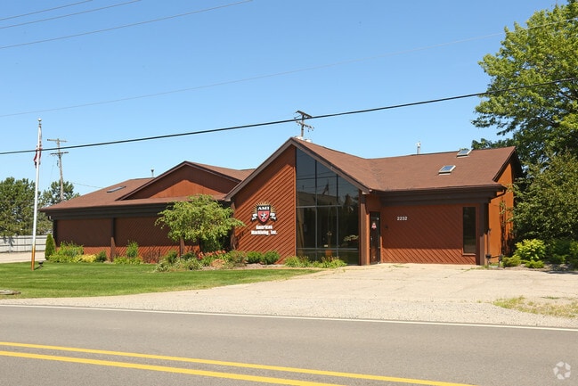
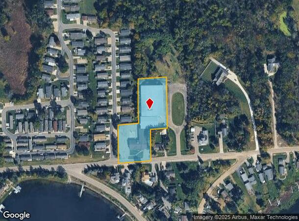
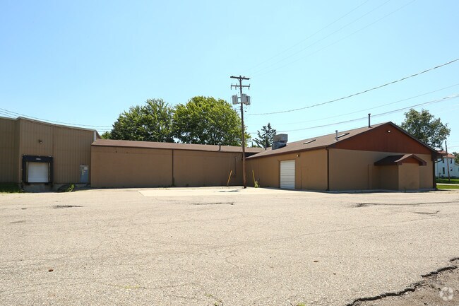
2232 Wiggins Rd
06-02-400-026
A PARCEL OF LAND BEG N 88 DEG 05 MIN E 320 FT FROM INTERSECTION OF C L OF WIGGINS RD & N & S 1/4 LINE OF SEC TH N 88 DEG 05
Industrialgeneral
Genesee
X
Michigan
26049C0427D
1.66 AC
2024
Flint
2025
Detroit
013302
Flint, MI
36,057 SF
DEMOGRAPHICS near 2232 Wiggins Rd
1 mile
3 mile
5 mile
2024 Total Population
1,970
11,788
40,482
2029 Population
1,916
11,538
39,580
Pop Growth 2024-2029
(2.74%)
(2.12%)
(2.23%)
Average Age
43
44
42
2024 Total Households
783
4,803
17,038
HH Growth 2024-2029
(2.68%)
(2.14%)
(2.28%)
Median Household Inc
$111,750
$100,095
$81,576
Avg Household Size
2.50
2.40
2.30
2024 Avg HH Vehicles
2.00
2.00
2.00
Median Home Value
$320,853
$301,759
$250,203
Median Year Built
1989
1990
1988
Nearby Places
Map Layers
Map Styles
 Street
 Aerial
Transit
 Traffic
 Biking
Places
Listings with unknown addresses are not visible on the map
- Restaurants
- Banks
- Shops
- Fitness
- Groceries
PUBLIC TRANSPORTATION
AIRPORT
Bishop International
Drive
Walk
Distance
Bishop International
24 min
10.6 mi
Nearby Properties
Address
Land Use
TOTAL SIZE
Lot Size
Zoning
Address
Land Use
TOTAL SIZE
Lot Size
Zoning
135,840 SF
PUD
Address
Land Use
TOTAL SIZE
Lot Size
Zoning
176,132 SF
27.71 AC
R-M
Address
Land Use
TOTAL SIZE
Lot Size
Zoning
752,146 SF
100 AC
RA
Address
Land Use
TOTAL SIZE
Lot Size
Zoning
14,472 SF
1.97 AC
R-3
Address
Land Use
TOTAL SIZE
Lot Size
Zoning
104,867 SF
PERSONA
Address
Land Use
TOTAL SIZE
Lot Size
Zoning
10,479 SF
1.19 AC
R-3
Address
Land Use
TOTAL SIZE
Lot Size
Zoning
9,399 SF
0.57 AC
R-3
Address
Land Use
TOTAL SIZE
Lot Size
Zoning
754 SF
15.74 AC
PUD
Address
Land Use
TOTAL SIZE
Lot Size
Zoning
5,933 SF
0.96 AC
R-3
Address
Land Use
TOTAL SIZE
Lot Size
Zoning
6,525 SF
0.70 AC
R-3
Address
Land Use
TOTAL SIZE
Lot Size
Zoning
6,088 SF
0.89 AC
R-3
Address
Land Use
TOTAL SIZE
Lot Size
Zoning
53,951 SF
8.08 AC
M-1
Address
Land Use
TOTAL SIZE
Lot Size
Zoning
6,342 SF
0.99 AC
R-4
Address
Land Use
TOTAL SIZE
Lot Size
Zoning
4,778 SF
0.45 AC
R-3
Address
Land Use
TOTAL SIZE
Lot Size
Zoning
3,391 SF
1.25 AC
R-5
Address
Land Use
TOTAL SIZE
Lot Size
Zoning
5,991 SF
1.73 AC
R-3
Address
Land Use
TOTAL SIZE
Lot Size
Zoning
3,954 SF
0.89 AC
R-3
Address
Land Use
TOTAL SIZE
Lot Size
Zoning
6,242 SF
0.42 AC
R-3
Address
Land Use
TOTAL SIZE
Lot Size
Zoning
6,990 SF
0.79 AC
R-3
Address
Land Use
TOTAL SIZE
Lot Size
Zoning
7,664 SF
0.32 AC
PUD
Address
Land Use
TOTAL SIZE
Lot Size
Zoning
6,826 SF
0.34 AC
R-3
Address
Land Use
TOTAL SIZE
Lot Size
Zoning
5,299 SF
0.52 AC
R-3
Address
Land Use
TOTAL SIZE
Lot Size
Zoning
2,912 SF
0.50 AC
R-3
Address
Land Use
TOTAL SIZE
Lot Size
Zoning
4,344 SF
0.42 AC
R-3
Address
Land Use
TOTAL SIZE
Lot Size
Zoning
4,870 SF
0.30 AC
R-3
Address
Land Use
TOTAL SIZE
Lot Size
Zoning
11,322 SF
0.58 AC
R-3
Address
Land Use
TOTAL SIZE
Lot Size
Zoning
4,491 SF
0.78 AC
R-3
Address
Land Use
TOTAL SIZE
Lot Size
Zoning
17.96 AC
PUD
Address
Land Use
TOTAL SIZE
Lot Size
Zoning
3,367 SF
0.38 AC
R-3
Address
Land Use
TOTAL SIZE
Lot Size
Zoning
6,702 SF
0.66 AC
R-5
The World's #1 Commercial Real Estate Marketplace
Connect with us
© 2026 CoStar Group
The information above has been obtained from sources believed reliable. While we do not doubt its accuracy we have not verified it and make no guarantee, warranty or representation about it. It is your responsibility to independently confirm its accuracy and completeness. Any projections, opinions, assumptions, or estimates used are for example only and do not represent the current or future performance of the property. The value of this transaction to you depends on tax and other factors which should be evaluated by your tax, financial, and legal advisors. You and your advisors should conduct a careful, independent investigation of the property to determine to your satisfaction the suitability of the property for your needs.