Property Record
2233 Sw 97Th St, Lawton, OK 73505

NEARBY LISTINGS FOR SALE OR LEASE
Property Detail
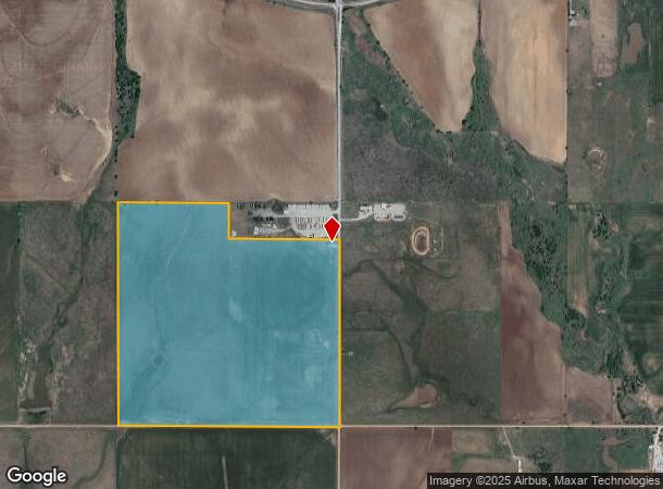
2233 Sw 97Th St
Lawton, OK
Farm 1N-13W
0036737
1-1N-13W SE/4 LESS: BEG AT NE/C SE/4; THN S ALG E BDRY OF SD SE/4 417.50'; THN W PAR'L TO N BDRY OF SD SE/4 1043.75'; THN N P
Agriculturalland
Comanche
X
Oklahoma
40031C0425E
147.35 AC
2024
Oklahoma West Area
2025
Other Market Areas
000504
DEMOGRAPHICS near 2233 Sw 97Th St
1 Mile
3 Mile
5 Mile
2024 Total Population
9
10,285
37,772
2029 Population
9
10,448
38,724
Pop Growth 2024-2029
0.00%
+ 1.58%
+ 2.52%
Average Age
45
39
38
2024 Total Households
3
3,992
15,150
HH Growth 2024-2029
0.00%
+ 1.60%
+ 2.55%
Median Household Inc
$175,000
$71,519
$53,100
Avg Household Size
2.00
2.50
2.40
2024 Avg HH Vehicles
3.00
2.00
2.00
Median Home Value
$299,999
$232,715
$171,622
Median Year Built
1999
1988
1980
Nearby Places
Map Layers
Map Styles
 Street
 Aerial
- Restaurants
- Banks
- Shops
- Fitness
- Groceries
PUBLIC TRANSPORTATION
AIRPORT
Lawton-Fort Sill Regional
DRIVE
WALK
Distance
Lawton-Fort Sill Regional
18 min
7.8 mi
Freight Ports
Tulsa Port Of Catoosa
DRIVE
WALK
Distance
Tulsa Port Of Catoosa
237 min
217.6 mi
SALE & LEASE HISTORY
LISTING DATE
SALE/LEASE

Sep 24, 2016
For Sale
Nearby Properties
Address
Land Use
TOTAL SIZE
Lot Size
Zoning
Address
Land Use
TOTAL SIZE
Lot Size
Zoning
44,900 SF
484.43 AC
Address
Land Use
TOTAL SIZE
Lot Size
Zoning
9,000 SF
25.35 AC
Address
Land Use
TOTAL SIZE
Lot Size
Zoning
30,000 SF
17.22 AC
Address
Land Use
TOTAL SIZE
Lot Size
Zoning
40,284 SF
7.19 AC
Address
Land Use
TOTAL SIZE
Lot Size
Zoning
8,800 SF
30.05 AC
Address
Land Use
TOTAL SIZE
Lot Size
Zoning
906 SF
5.51 AC
Address
Land Use
TOTAL SIZE
Lot Size
Zoning
39,546 SF
10.62 AC
Address
Land Use
TOTAL SIZE
Lot Size
Zoning
2,330 SF
19.42 AC
Address
Land Use
TOTAL SIZE
Lot Size
Zoning
131,736 SF
10.23 AC
Address
Land Use
TOTAL SIZE
Lot Size
Zoning
39,791 SF
20.50 AC
Address
Land Use
TOTAL SIZE
Lot Size
Zoning
83,945 SF
46.95 AC
Address
Land Use
TOTAL SIZE
Lot Size
Zoning
36,063 SF
6.35 AC
Address
Land Use
TOTAL SIZE
Lot Size
Zoning
65,320 SF
4.80 AC
Address
Land Use
TOTAL SIZE
Lot Size
Zoning
4,000 SF
3 AC
Address
Land Use
TOTAL SIZE
Lot Size
Zoning
28,310 SF
0.37 AC
Address
Land Use
TOTAL SIZE
Lot Size
Zoning
20,000 SF
6.42 AC
Address
Land Use
TOTAL SIZE
Lot Size
Zoning
5,320 SF
8.97 AC
Address
Land Use
TOTAL SIZE
Lot Size
Zoning
55,500 SF
9.99 AC
Address
Land Use
TOTAL SIZE
Lot Size
Zoning
12,496 SF
2.14 AC
Address
Land Use
TOTAL SIZE
Lot Size
Zoning
13,132 SF
Address
Land Use
TOTAL SIZE
Lot Size
Zoning
2,450 SF
0.95 AC
Address
Land Use
TOTAL SIZE
Lot Size
Zoning
10,530 SF
1.35 AC
Address
Land Use
TOTAL SIZE
Lot Size
Zoning
7,172 SF
1.37 AC
Address
Land Use
TOTAL SIZE
Lot Size
Zoning
17,350 SF
1.15 AC
Address
Land Use
TOTAL SIZE
Lot Size
Zoning
4,356 SF
1.24 AC
Address
Land Use
TOTAL SIZE
Lot Size
Zoning
31,442 SF
5.78 AC
Address
Land Use
TOTAL SIZE
Lot Size
Zoning
33,200 SF
2.54 AC
Address
Land Use
TOTAL SIZE
Lot Size
Zoning
8,935 SF
0.98 AC
Address
Land Use
TOTAL SIZE
Lot Size
Zoning
5,286 SF
1.34 AC
The World's #1 Commercial Real Estate Marketplace
Connect with us
© 2026 CoStar Group
The information above has been obtained from sources believed reliable. While we do not doubt its accuracy we have not verified it and make no guarantee, warranty or representation about it. It is your responsibility to independently confirm its accuracy and completeness. Any projections, opinions, assumptions, or estimates used are for example only and do not represent the current or future performance of the property. The value of this transaction to you depends on tax and other factors which should be evaluated by your tax, financial, and legal advisors. You and your advisors should conduct a careful, independent investigation of the property to determine to your satisfaction the suitability of the property for your needs.