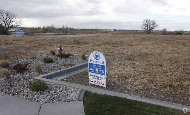
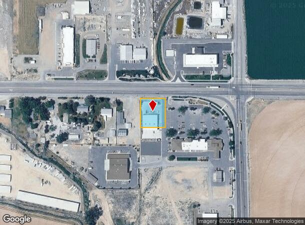
Property Record
22345 Highway 30, Kimberly, ID 83341
NEARBY LISTINGS FOR SALE OR LEASE
Property Detail
22345 Highway 30
Twin Falls, ID
Kimberly Redcap Subd
RPK91310010020A
KIMBERLY REDCAP SUBD LOT 2 BLOCK 1 (20-10-18 NE)
Storebuilding
Twin Falls
X
Idaho
16083C1425C
2
2025
0.55 AC
2025
Idaho South Area
001301
Other Market Areas
7,656 SF
DEMOGRAPHICS near 22345 Highway 30
1 Mile
3 Mile
5 Mile
2024 Total Population
2,624
9,447
33,934
2029 Population
2,888
10,419
37,338
Pop Growth 2024-2029
+ 10.06%
+ 10.29%
+ 10.03%
Average Age
35
36
38
2024 Total Households
837
3,064
12,179
HH Growth 2024-2029
+ 10.39%
+ 10.67%
+ 10.37%
Median Household Inc
$70,997
$75,528
$66,297
Avg Household Size
3.00
3.00
2.70
2024 Avg HH Vehicles
3.00
3.00
2.00
Median Home Value
$327,966
$336,627
$316,862
Median Year Built
2001
1996
1982
Nearby Places
Map Layers
Map Styles
 Street
 Aerial
- Restaurants
- Banks
- Shops
- Fitness
- Groceries
Nearby Properties
Address
Land Use
TOTAL SIZE
Lot Size
Zoning
Address
Land Use
TOTAL SIZE
Lot Size
Zoning
917,616 SF
143.88 AC
M-2
Address
Land Use
TOTAL SIZE
Lot Size
Zoning
259,424 SF
89.44 AC
M-2
Address
Land Use
TOTAL SIZE
Lot Size
Zoning
57,683 SF
36.64 AC
Address
Land Use
TOTAL SIZE
Lot Size
Zoning
29,988 SF
3.80 AC
Address
Land Use
TOTAL SIZE
Lot Size
Zoning
60,172 SF
20 AC
Address
Land Use
TOTAL SIZE
Lot Size
Zoning
10,536 SF
3.07 AC
C-1
Address
Land Use
TOTAL SIZE
Lot Size
Zoning
16,875 SF
80 AC
Address
Land Use
TOTAL SIZE
Lot Size
Zoning
12,402 SF
3.03 AC
Address
Land Use
TOTAL SIZE
Lot Size
Zoning
20,160 SF
7.52 AC
Address
Land Use
TOTAL SIZE
Lot Size
Zoning
20,110 SF
11.72 AC
C-1
Address
Land Use
TOTAL SIZE
Lot Size
Zoning
49,820 SF
10.96 AC
M-2
Address
Land Use
TOTAL SIZE
Lot Size
Zoning
8,727 SF
5.47 AC
Address
Land Use
TOTAL SIZE
Lot Size
Zoning
64.21 AC
Address
Land Use
TOTAL SIZE
Lot Size
Zoning
10,679 SF
2.23 AC
Address
Land Use
TOTAL SIZE
Lot Size
Zoning
28,025 SF
9.19 AC
M-2
Address
Land Use
TOTAL SIZE
Lot Size
Zoning
17,654 SF
1.96 AC
M-2
Address
Land Use
TOTAL SIZE
Lot Size
Zoning
12,680 SF
4.15 AC
C-1
Address
Land Use
TOTAL SIZE
Lot Size
Zoning
1,052 SF
40 AC
Address
Land Use
TOTAL SIZE
Lot Size
Zoning
20,972 SF
1.36 AC
M-2
Address
Land Use
TOTAL SIZE
Lot Size
Zoning
16,040 SF
2.70 AC
M-2
Address
Land Use
TOTAL SIZE
Lot Size
Zoning
12,720 SF
5.67 AC
Address
Land Use
TOTAL SIZE
Lot Size
Zoning
30,000 SF
17.48 AC
Address
Land Use
TOTAL SIZE
Lot Size
Zoning
4,047 SF
4.34 AC
C-1
Address
Land Use
TOTAL SIZE
Lot Size
Zoning
14,125 SF
2.33 AC
C-1
Address
Land Use
TOTAL SIZE
Lot Size
Zoning
70,778 SF
6.23 AC
Address
Land Use
TOTAL SIZE
Lot Size
Zoning
14,020 SF
2.31 AC
C-1
Address
Land Use
TOTAL SIZE
Lot Size
Zoning
79,004 SF
47.07 AC
Address
Land Use
TOTAL SIZE
Lot Size
Zoning
4,000 SF
4.60 AC
Address
Land Use
TOTAL SIZE
Lot Size
Zoning
30,100 SF
3.18 AC
Address
Land Use
TOTAL SIZE
Lot Size
Zoning
8,000 SF
1.64 AC
M-2
The World's #1 Commercial Real Estate Marketplace
Connect with us
© 2026 CoStar Group
The information above has been obtained from sources believed reliable. While we do not doubt its accuracy we have not verified it and make no guarantee, warranty or representation about it. It is your responsibility to independently confirm its accuracy and completeness. Any projections, opinions, assumptions, or estimates used are for example only and do not represent the current or future performance of the property. The value of this transaction to you depends on tax and other factors which should be evaluated by your tax, financial, and legal advisors. You and your advisors should conduct a careful, independent investigation of the property to determine to your satisfaction the suitability of the property for your needs.