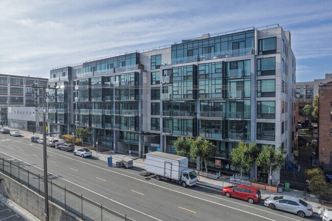
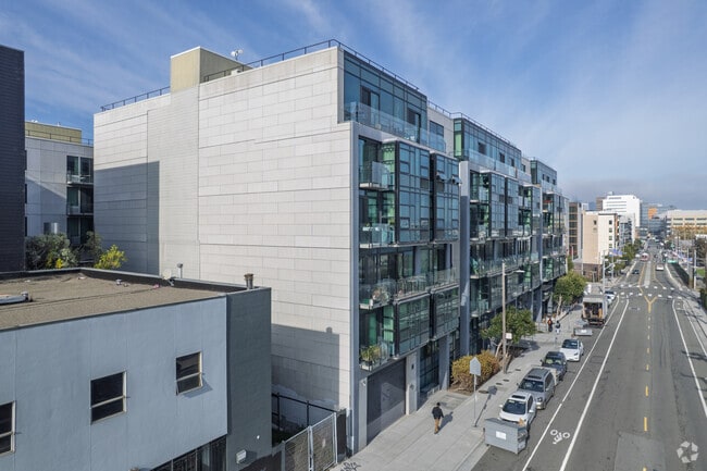
Property Record
2235 3Rd St, San Francisco, CA 94107
NEARBY LISTINGS FOR SALE OR LEASE
Property Detail
2235 3Rd St
San Francisco-Redwood City-South San Francisco, CA
MAP C2 11
4058-010
San Francisco
Apartment
California
2024
10
2025
1.15 AC
022600
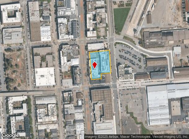
Dogpatch
157,256 SF
San Francisco
DEMOGRAPHICS near 2235 3Rd St
1 Mile
3 Mile
5 Mile
2024 Total Population
29,631
382,983
673,180
2029 Population
27,941
355,736
622,847
Pop Growth 2024-2029
(5.70%)
(7.11%)
(7.48%)
Average Age
37
42
42
2024 Total Households
12,722
175,532
291,588
HH Growth 2024-2029
(6.26%)
(7.54%)
(7.81%)
Median Household Inc
$185,126
$116,682
$127,959
Avg Household Size
2.10
2.00
2.20
2024 Avg HH Vehicles
1.00
1.00
1.00
Median Home Value
$1,092,057
$1,086,490
$1,094,771
Median Year Built
2003
1956
1949
Nearby Places
Map Layers
Map Styles
 Street
 Aerial
- Restaurants
- Banks
- Shops
- Fitness
- Groceries
PUBLIC TRANSPORTATION
TRANSIT/SUBWAY
20Th Street Station (T Third Street - San Francisco Municipal Railway (MUNI Metro), THIRD - San Francisco Municipal Railway (MUNI Metro))
DRIVE
WALK
Distance
20Th Street Station (T Third Street - San Francisco Municipal Railway (MUNI Metro), THIRD - San Francisco Municipal Railway (MUNI Metro))
1 min
0 min
0.0 mi
Mariposa Station (T Third Street - San Francisco Municipal Railway (MUNI Metro), THIRD - San Francisco Municipal Railway (MUNI Metro))
DRIVE
WALK
Distance
Mariposa Station (T Third Street - San Francisco Municipal Railway (MUNI Metro), THIRD - San Francisco Municipal Railway (MUNI Metro))
0 min
4 min
0.2 mi
Mariposa Station Outbound (T Third Street - San Francisco Municipal Railway (MUNI Metro))
DRIVE
WALK
Distance
Mariposa Station Outbound (T Third Street - San Francisco Municipal Railway (MUNI Metro))
0 min
5 min
0.3 mi
23Rd Street Station Outbound (T Third Street - San Francisco Municipal Railway (MUNI Metro), THIRD - San Francisco Municipal Railway (MUNI Metro))
DRIVE
WALK
Distance
23Rd Street Station Outbound (T Third Street - San Francisco Municipal Railway (MUNI Metro), THIRD - San Francisco Municipal Railway (MUNI Metro))
2 min
8 min
0.4 mi
Ucsf / Chase Center (16Th Street) (THIRD - San Francisco Municipal Transportation Agency)
DRIVE
WALK
Distance
Ucsf / Chase Center (16Th Street) (THIRD - San Francisco Municipal Transportation Agency)
2 min
9 min
0.5 mi
COMMUTER RAIL
22Nd Street Caltrain Station Southbound (Express - Caltrain (Caltrain), Limited - Caltrain (Caltrain), Local Weekday - Caltrain (Caltrain), Local Weekend - Caltrain (Caltrain))
DRIVE
WALK
Distance
22Nd Street Caltrain Station Southbound (Express - Caltrain (Caltrain), Limited - Caltrain (Caltrain), Local Weekday - Caltrain (Caltrain), Local Weekend - Caltrain (Caltrain))
2 min
9 min
0.5 mi
22Nd Street (Caltrain - Caltrain (Caltrain))
DRIVE
WALK
Distance
22Nd Street (Caltrain - Caltrain (Caltrain))
2 min
10 min
0.5 mi
AIRPORT
San Francisco International
DRIVE
WALK
Distance
San Francisco International
19 min
12.4 mi
Metro Oakland International
DRIVE
WALK
Distance
Metro Oakland International
31 min
20.1 mi
Freight Ports
Port of San Francisco
DRIVE
WALK
Distance
Port of San Francisco
7 min
2.7 mi
SALE & LEASE HISTORY
LISTING DATE
SALE/LEASE

May 04, 2021
For Lease
Jun 01, 2021
For Lease
Jan 08, 2019
For Lease
Nearby Properties
Address
Land Use
TOTAL SIZE
Lot Size
Zoning
Address
Land Use
TOTAL SIZE
Lot Size
Zoning
1,015,000 SF
2.43 AC
RC4
Address
Land Use
TOTAL SIZE
Lot Size
Zoning
764,661 SF
0.67 AC
C3OSD
Address
Land Use
TOTAL SIZE
Lot Size
Zoning
750,370 SF
3.25 AC
MBR3
Address
Land Use
TOTAL SIZE
Lot Size
Zoning
1,471,929 SF
1.93 AC
C3O
Address
Land Use
TOTAL SIZE
Lot Size
Zoning
1,300,000 SF
1.74 AC
C3O
Address
Land Use
TOTAL SIZE
Lot Size
Zoning
1,420,430 SF
1.16 AC
C3OSD
Address
Land Use
TOTAL SIZE
Lot Size
Zoning
1,534,312 SF
2.60 AC
C3O
Address
Land Use
TOTAL SIZE
Lot Size
Zoning
914,037 SF
1.36 AC
C3O
Address
Land Use
TOTAL SIZE
Lot Size
Zoning
248,303 SF
4.35 AC
Address
Land Use
TOTAL SIZE
Lot Size
Zoning
717,234 SF
3.47 AC
UMU
Address
Land Use
TOTAL SIZE
Lot Size
Zoning
605,459 SF
0.63 AC
C3O
Address
Land Use
TOTAL SIZE
Lot Size
Zoning
475,791 SF
0.55 AC
C3OSD
Address
Land Use
TOTAL SIZE
Lot Size
Zoning
690,442 SF
0.79 AC
C3O
Address
Land Use
TOTAL SIZE
Lot Size
Zoning
10.92 AC
Address
Land Use
TOTAL SIZE
Lot Size
Zoning
750,491 SF
0.51 AC
C3O
Address
Land Use
TOTAL SIZE
Lot Size
Zoning
432,000 SF
0.35 AC
C3OSD
Address
Land Use
TOTAL SIZE
Lot Size
Zoning
266,143 SF
4 AC
C-3-R
Address
Land Use
TOTAL SIZE
Lot Size
Zoning
885,581 SF
5.20 AC
M2
Address
Land Use
TOTAL SIZE
Lot Size
Zoning
512,395 SF
1.24 AC
C3O
Address
Land Use
TOTAL SIZE
Lot Size
Zoning
508,714 SF
1.29 AC
C3R
Address
Land Use
TOTAL SIZE
Lot Size
Zoning
1,084,662 SF
1.67 AC
C3O
Address
Land Use
TOTAL SIZE
Lot Size
Zoning
505,120 SF
0.41 AC
C3O
Address
Land Use
TOTAL SIZE
Lot Size
Zoning
694,334 SF
1.01 AC
C3O
Address
Land Use
TOTAL SIZE
Lot Size
Zoning
696,431 SF
0.97 AC
C3G
Address
Land Use
TOTAL SIZE
Lot Size
Zoning
139,070 SF
0.64 AC
C3O
Address
Land Use
TOTAL SIZE
Lot Size
Zoning
1.52 AC
C3G
Address
Land Use
TOTAL SIZE
Lot Size
Zoning
1,424,230 SF
2.60 AC
C3G
Address
Land Use
TOTAL SIZE
Lot Size
Zoning
614,740 SF
1.74 AC
C3OSD
Address
Land Use
TOTAL SIZE
Lot Size
Zoning
615,957 SF
0.63 AC
C3O
Address
Land Use
TOTAL SIZE
Lot Size
Zoning
492,980 SF
0.43 AC
C3O
The World's #1 Commercial Real Estate Marketplace
Connect with us
© 2026 CoStar Group
The information above has been obtained from sources believed reliable. While we do not doubt its accuracy we have not verified it and make no guarantee, warranty or representation about it. It is your responsibility to independently confirm its accuracy and completeness. Any projections, opinions, assumptions, or estimates used are for example only and do not represent the current or future performance of the property. The value of this transaction to you depends on tax and other factors which should be evaluated by your tax, financial, and legal advisors. You and your advisors should conduct a careful, independent investigation of the property to determine to your satisfaction the suitability of the property for your needs.