Property Record
2235 E 61St St, Tulsa, OK 74136

NEARBY LISTINGS FOR SALE OR LEASE
Property Detail
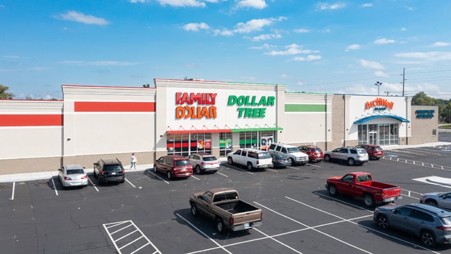
2235 E 61St St
Tulsa, OK
Southern Village Center
39875-93-31-13480
S292 LT 1 & E25 N216 S292 LT 2 BK 1
Departmentstore
Tulsa
X
Oklahoma
40143C0354M
1
2025
2.10 AC
2025
South Central Tulsa
006803
Tulsa
28,975 SF
DEMOGRAPHICS near 2235 E 61St St
1 Mile
3 Mile
5 Mile
2024 Total Population
12,892
82,455
202,157
2029 Population
13,468
85,494
209,057
Pop Growth 2024-2029
+ 4.47%
+ 3.69%
+ 3.41%
Average Age
41
40
40
2024 Total Households
6,211
38,380
91,891
HH Growth 2024-2029
+ 4.48%
+ 3.72%
+ 3.48%
Median Household Inc
$45,220
$53,749
$58,981
Avg Household Size
2.00
2.00
2.10
2024 Avg HH Vehicles
1.00
2.00
2.00
Median Home Value
$182,570
$253,824
$225,098
Median Year Built
1971
1973
1973
Nearby Places
Map Layers
Map Styles
 Street
 Aerial
- Restaurants
- Banks
- Shops
- Fitness
- Groceries
PUBLIC TRANSPORTATION
AIRPORT
Tulsa International
DRIVE
WALK
Distance
Tulsa International
25 min
12.9 mi
Freight Ports
DRIVE
WALK
Distance
28 min
20.0 mi
SALE & LEASE HISTORY
LISTING DATE
SALE/LEASE

Sep 26, 2016
For Lease
Oct 13, 2025
For Sale
Oct 08, 2020
For Sale
May 24, 2023
For Sale
Mar 30, 2021
For Lease
Jun 04, 2024
For Sale
Apr 06, 2017
For Lease
Nearby Properties
Address
Land Use
TOTAL SIZE
Lot Size
Zoning
Address
Land Use
TOTAL SIZE
Lot Size
Zoning
2,622,731 SF
26.90 AC
OH
Address
Land Use
TOTAL SIZE
Lot Size
Zoning
1,584,609 SF
84.41 AC
AG
Address
Land Use
TOTAL SIZE
Lot Size
Zoning
717,386 SF
49.74 AC
OL
Address
Land Use
TOTAL SIZE
Lot Size
Zoning
790,247 SF
149.86 AC
RS3
Address
Land Use
TOTAL SIZE
Lot Size
Zoning
358,576 SF
38.21 AC
RM1
Address
Land Use
TOTAL SIZE
Lot Size
Zoning
236,738 SF
11.56 AC
PUD
Address
Land Use
TOTAL SIZE
Lot Size
Zoning
139,648 SF
20.75 AC
RS3
Address
Land Use
TOTAL SIZE
Lot Size
Zoning
61,153 SF
7.16 AC
CH
Address
Land Use
TOTAL SIZE
Lot Size
Zoning
310,629 SF
19.19 AC
OM
Address
Land Use
TOTAL SIZE
Lot Size
Zoning
290,963 SF
10.77 AC
RM1
Address
Land Use
TOTAL SIZE
Lot Size
Zoning
325 SF
44.06 AC
RM2
Address
Land Use
TOTAL SIZE
Lot Size
Zoning
72,042 SF
5.10 AC
RS3
Address
Land Use
TOTAL SIZE
Lot Size
Zoning
266,675 SF
12.31 AC
RM1
Address
Land Use
TOTAL SIZE
Lot Size
Zoning
147,881 SF
35.20 AC
RS2
Address
Land Use
TOTAL SIZE
Lot Size
Zoning
98,590 SF
6.41 AC
OM
Address
Land Use
TOTAL SIZE
Lot Size
Zoning
107,538 SF
19.74 AC
OM
Address
Land Use
TOTAL SIZE
Lot Size
Zoning
62,000 SF
7.20 AC
OM
Address
Land Use
TOTAL SIZE
Lot Size
Zoning
15.98 AC
OMH
Address
Land Use
TOTAL SIZE
Lot Size
Zoning
56,611 SF
26.92 AC
RS2
Address
Land Use
TOTAL SIZE
Lot Size
Zoning
56,984 SF
5.54 AC
RS3
Address
Land Use
TOTAL SIZE
Lot Size
Zoning
132,105 SF
9.32 AC
RS3
Address
Land Use
TOTAL SIZE
Lot Size
Zoning
58,864 SF
5.18 AC
RS3
Address
Land Use
TOTAL SIZE
Lot Size
Zoning
62,792 SF
5.18 AC
RM1
Address
Land Use
TOTAL SIZE
Lot Size
Zoning
53,220 SF
4.93 AC
CH
Address
Land Use
TOTAL SIZE
Lot Size
Zoning
74,600 SF
3.65 AC
RM2
Address
Land Use
TOTAL SIZE
Lot Size
Zoning
1,011,877 SF
5.55 AC
CH
Address
Land Use
TOTAL SIZE
Lot Size
Zoning
330,521 SF
22.04 AC
PUD
Address
Land Use
TOTAL SIZE
Lot Size
Zoning
24,134 SF
7.47 AC
OM
Address
Land Use
TOTAL SIZE
Lot Size
Zoning
84,791 SF
8.04 AC
RS3
Address
Land Use
TOTAL SIZE
Lot Size
Zoning
22,938 SF
2.95 AC
OM
The World's #1 Commercial Real Estate Marketplace
Connect with us
© 2026 CoStar Group
The information above has been obtained from sources believed reliable. While we do not doubt its accuracy we have not verified it and make no guarantee, warranty or representation about it. It is your responsibility to independently confirm its accuracy and completeness. Any projections, opinions, assumptions, or estimates used are for example only and do not represent the current or future performance of the property. The value of this transaction to you depends on tax and other factors which should be evaluated by your tax, financial, and legal advisors. You and your advisors should conduct a careful, independent investigation of the property to determine to your satisfaction the suitability of the property for your needs.