Property Record
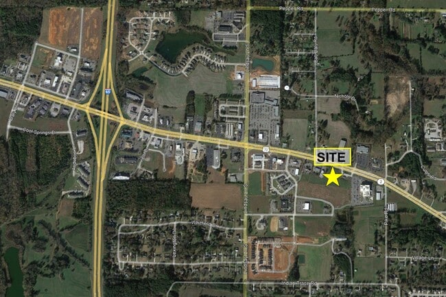
Highway 72, Athens, AL 35611


NEARBY LISTINGS FOR SALE OR LEASE
Property Detail
Highway 72
1006140000054006
BEG SW COR OF SEC 14 3 4 N 2383.84 E 349 POB ELY 553.5 S 400.73 ELY 200 POB N 207.89 SE 250 N 250 SE 200 1553.51 POB
Commercialacreage
Limestone
X
Alabama
01083C0193F
5.20 AC
2025
Athens
2025
Huntsville
020402
Huntsville, AL
DEMOGRAPHICS near Highway 72
1 Mile
3 Mile
5 Mile
2024 Total Population
2,799
15,720
41,555
2029 Population
3,298
18,574
49,118
Pop Growth 2024-2029
+ 17.83%
+ 18.16%
+ 18.20%
Average Age
44
42
42
2024 Total Households
1,144
6,435
16,674
HH Growth 2024-2029
+ 18.18%
+ 18.63%
+ 18.66%
Median Household Inc
$104,121
$79,354
$64,040
Avg Household Size
2.40
2.40
2.40
2024 Avg HH Vehicles
3.00
2.00
2.00
Median Home Value
$303,597
$269,641
$240,190
Median Year Built
1995
1991
1989
Nearby Places
Map Layers
Map Styles
 Street
 Aerial
- Restaurants
- Banks
- Shops
- Fitness
- Groceries
PUBLIC TRANSPORTATION
AIRPORT
Huntsville International-Carl T Jones Field
DRIVE
WALK
Distance
Huntsville International-Carl T Jones Field
29 min
18.1 mi
Freight Ports
Port of Mobile
DRIVE
WALK
Distance
Port of Mobile
379 min
347.7 mi
SALE & LEASE HISTORY
LISTING DATE
SALE/LEASE

Jul 07, 2022
For Sale
Nearby Properties
Address
Land Use
TOTAL SIZE
Lot Size
Zoning
Address
Land Use
TOTAL SIZE
Lot Size
Zoning
45,536 SF
13.96 AC
Address
Land Use
TOTAL SIZE
Lot Size
Zoning
4,800 SF
32 AC
Address
Land Use
TOTAL SIZE
Lot Size
Zoning
6,703 SF
54.94 AC
Address
Land Use
TOTAL SIZE
Lot Size
Zoning
Address
Land Use
TOTAL SIZE
Lot Size
Zoning
194,291 SF
21.53 AC
Address
Land Use
TOTAL SIZE
Lot Size
Zoning
7,668 SF
15.33 AC
Address
Land Use
TOTAL SIZE
Lot Size
Zoning
9.37 AC
Address
Land Use
TOTAL SIZE
Lot Size
Zoning
1,698 SF
18.22 AC
Address
Land Use
TOTAL SIZE
Lot Size
Zoning
11,620 SF
7.40 AC
Address
Land Use
TOTAL SIZE
Lot Size
Zoning
134,312 SF
17.38 AC
Address
Land Use
TOTAL SIZE
Lot Size
Zoning
6,310 SF
13.68 AC
Address
Land Use
TOTAL SIZE
Lot Size
Zoning
36,460 SF
6.65 AC
Address
Land Use
TOTAL SIZE
Lot Size
Zoning
69,930 SF
2.80 AC
Address
Land Use
TOTAL SIZE
Lot Size
Zoning
11 AC
Address
Land Use
TOTAL SIZE
Lot Size
Zoning
2,119 SF
17.54 AC
Address
Land Use
TOTAL SIZE
Lot Size
Zoning
3,544 SF
5.43 AC
Address
Land Use
TOTAL SIZE
Lot Size
Zoning
60,612 SF
3.74 AC
Address
Land Use
TOTAL SIZE
Lot Size
Zoning
7.60 AC
Address
Land Use
TOTAL SIZE
Lot Size
Zoning
42,868 SF
11.54 AC
Address
Land Use
TOTAL SIZE
Lot Size
Zoning
70,749 SF
8.01 AC
Address
Land Use
TOTAL SIZE
Lot Size
Zoning
241,870 SF
7.50 AC
Address
Land Use
TOTAL SIZE
Lot Size
Zoning
45,156 SF
2.28 AC
Address
Land Use
TOTAL SIZE
Lot Size
Zoning
8,943 SF
48 AC
Address
Land Use
TOTAL SIZE
Lot Size
Zoning
36,990 SF
7.72 AC
Address
Land Use
TOTAL SIZE
Lot Size
Zoning
17 AC
Address
Land Use
TOTAL SIZE
Lot Size
Zoning
11,928 SF
1.88 AC
Address
Land Use
TOTAL SIZE
Lot Size
Zoning
42,975 SF
2.18 AC
Address
Land Use
TOTAL SIZE
Lot Size
Zoning
Address
Land Use
TOTAL SIZE
Lot Size
Zoning
5,000 SF
10.30 AC
Address
Land Use
TOTAL SIZE
Lot Size
Zoning
4.33 AC
The World's #1 Commercial Real Estate Marketplace
Connect with us
© 2026 CoStar Group
The information above has been obtained from sources believed reliable. While we do not doubt its accuracy we have not verified it and make no guarantee, warranty or representation about it. It is your responsibility to independently confirm its accuracy and completeness. Any projections, opinions, assumptions, or estimates used are for example only and do not represent the current or future performance of the property. The value of this transaction to you depends on tax and other factors which should be evaluated by your tax, financial, and legal advisors. You and your advisors should conduct a careful, independent investigation of the property to determine to your satisfaction the suitability of the property for your needs.