Property Record
2237 Mcelmurray Rd, Hephzibah, GA 30815


NEARBY LISTINGS FOR SALE OR LEASE
-
-
View all Hephzibah listings for sale on LoopNet.com
Property Detail
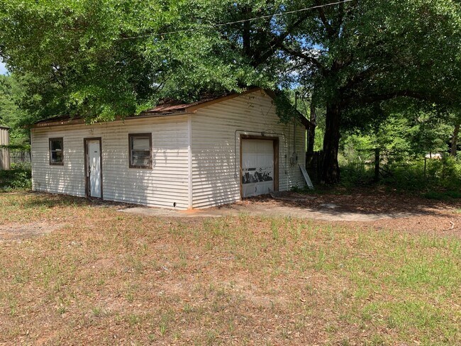
2237 Mcelmurray Rd
2110016050
2237 MCELMURRAY RD
Commercialacreage
Richmond
X
Georgia
13245C0210G
1.35 AC
2025
South Richmond County
2025
Augusta/Richmond County
010907
Augusta-Richmond County, GA-SC
720 SF
DEMOGRAPHICS near 2237 Mcelmurray Rd
1 mile
3 mile
5 mile
2024 Total Population
871
14,830
49,188
2029 Population
876
14,956
48,792
Pop Growth 2024-2029
+ 0.57%
+ 0.85%
(0.81%)
Average Age
38
39
39
2024 Total Households
315
5,555
18,281
HH Growth 2024-2029
+ 0.95%
+ 0.97%
(0.69%)
Median Household Inc
$60,147
$55,370
$57,352
Avg Household Size
2.80
2.60
2.60
2024 Avg HH Vehicles
2.00
2.00
2.00
Median Home Value
$146,153
$148,006
$146,691
Median Year Built
1997
1991
1989
Nearby Places
Map Layers
Map Styles
 Street
 Aerial
Transit
 Traffic
 Biking
Places
Listings with unknown addresses are not visible on the map
- Restaurants
- Banks
- Shops
- Fitness
- Groceries
PUBLIC TRANSPORTATION
AIRPORT
Augusta Regional at Bush Field
Drive
Walk
Distance
Augusta Regional at Bush Field
19 min
9.5 mi
SALE & LEASE HISTORY
LISTING DATE
SALE/LEASE

Sep 24, 2016
For Sale
Oct 06, 2017
For Sale
Jun 17, 2021
For Sale
Apr 03, 2017
For Sale
Nearby Properties
Address
Land Use
TOTAL SIZE
Lot Size
Zoning
Address
Land Use
TOTAL SIZE
Lot Size
Zoning
59,310 SF
43.16 AC
A
Address
Land Use
TOTAL SIZE
Lot Size
Zoning
252,567 SF
27.65 AC
B-2
Address
Land Use
TOTAL SIZE
Lot Size
Zoning
109,424 SF
24.28 AC
R-1
Address
Land Use
TOTAL SIZE
Lot Size
Zoning
1,080 SF
18.87 AC
R-3B
Address
Land Use
TOTAL SIZE
Lot Size
Zoning
148,108 SF
27.95 AC
CITY
Address
Land Use
TOTAL SIZE
Lot Size
Zoning
17,192 SF
12.84 AC
A_R-1 SPEX
Address
Land Use
TOTAL SIZE
Lot Size
Zoning
80,038 SF
19.49 AC
R-1A
Address
Land Use
TOTAL SIZE
Lot Size
Zoning
17,202 SF
28.86 AC
B-1
Address
Land Use
TOTAL SIZE
Lot Size
Zoning
74,554 SF
112.94 AC
CITY
Address
Land Use
TOTAL SIZE
Lot Size
Zoning
100,202 SF
27.83 AC
CITY
Address
Land Use
TOTAL SIZE
Lot Size
Zoning
7,800 SF
4.68 AC
B-2
Address
Land Use
TOTAL SIZE
Lot Size
Zoning
961 SF
5.15 AC
B-2
Address
Land Use
TOTAL SIZE
Lot Size
Zoning
33,488 SF
7.06 AC
CITY
Address
Land Use
TOTAL SIZE
Lot Size
Zoning
75,113 SF
10.53 AC
CITY
Address
Land Use
TOTAL SIZE
Lot Size
Zoning
5,238 SF
1.89 AC
LI
Address
Land Use
TOTAL SIZE
Lot Size
Zoning
3.01 AC
B1
Address
Land Use
TOTAL SIZE
Lot Size
Zoning
4,750 SF
5.74 AC
R-MH
Address
Land Use
TOTAL SIZE
Lot Size
Zoning
6,400 SF
5.18 AC
CITY
Address
Land Use
TOTAL SIZE
Lot Size
Zoning
10,297 SF
4.84 AC
R-MH_B-2
Address
Land Use
TOTAL SIZE
Lot Size
Zoning
5,400 SF
1.14 AC
B-2
Address
Land Use
TOTAL SIZE
Lot Size
Zoning
51,304 SF
7.40 AC
CITY
Address
Land Use
TOTAL SIZE
Lot Size
Zoning
3,850 SF
0.88 AC
CITY
Address
Land Use
TOTAL SIZE
Lot Size
Zoning
12,986 SF
8.28 AC
CITY
Address
Land Use
TOTAL SIZE
Lot Size
Zoning
11,631 SF
1.82 AC
CITY
Address
Land Use
TOTAL SIZE
Lot Size
Zoning
9,060 SF
7.25 AC
A
Address
Land Use
TOTAL SIZE
Lot Size
Zoning
3,878 SF
1.78 AC
CITY
Address
Land Use
TOTAL SIZE
Lot Size
Zoning
17,179 SF
4.31 AC
CITY
Address
Land Use
TOTAL SIZE
Lot Size
Zoning
1,936 SF
10.73 AC
R-1
Address
Land Use
TOTAL SIZE
Lot Size
Zoning
6,800 SF
23.74 AC
R-1 SPEX
Address
Land Use
TOTAL SIZE
Lot Size
Zoning
4,305 SF
138.20 AC
A,B
The World's #1 Commercial Real Estate Marketplace
Connect with us
© 2026 CoStar Group
The information above has been obtained from sources believed reliable. While we do not doubt its accuracy we have not verified it and make no guarantee, warranty or representation about it. It is your responsibility to independently confirm its accuracy and completeness. Any projections, opinions, assumptions, or estimates used are for example only and do not represent the current or future performance of the property. The value of this transaction to you depends on tax and other factors which should be evaluated by your tax, financial, and legal advisors. You and your advisors should conduct a careful, independent investigation of the property to determine to your satisfaction the suitability of the property for your needs.