Property Record
2238 15Th St, Boulder, CO 80302
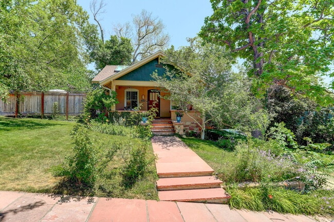
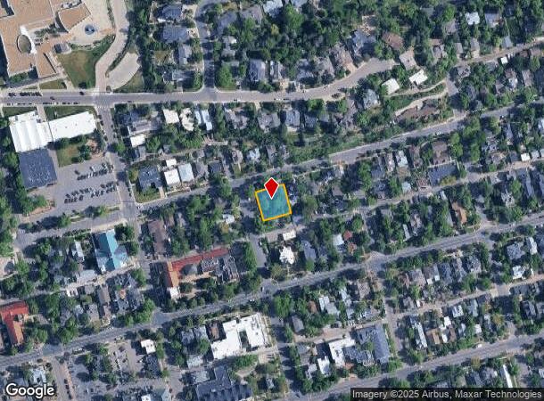
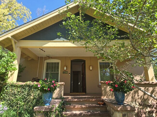
Property Detail
2238 15Th St
Boulder, CO
Boulder O T East & West & North - Bo
1463303-08-006
N 2/3 OF LOTS 5 & 6 & 10 FT STRIP ADJ TO 5 & 6 ON N SIDE FMLY STREET BLK 146 BOULDER O T 2 IMPS
Multifamilydwelling
Boulder
X
Colorado
08013C0394K
5
2024
0.23 AC
2025
Whittier-Boulder
012204
Denver
3,166 SF
NEARBY LISTINGS FOR SALE OR LEASE
DEMOGRAPHICS near 2238 15Th St
1 mile
3 mile
5 mile
2024 Total Population
24,538
94,340
116,294
2029 Population
24,616
94,353
115,906
Pop Growth 2024-2029
+ 0.32%
+ 0.01%
(0.33%)
Average Age
36
36
37
2024 Total Households
10,752
37,939
47,577
HH Growth 2024-2029
+ 0.54%
+ 0.28%
(0.20%)
Median Household Inc
$61,372
$68,335
$76,271
Avg Household Size
2.00
2.10
2.10
2024 Avg HH Vehicles
2.00
2.00
2.00
Median Home Value
$1,068,444
$933,669
$900,211
Median Year Built
1972
1978
1978
Nearby Places
Map Layers
Map Styles
 Street
 Aerial
Transit
 Traffic
 Biking
Places
Listings with unknown addresses are not visible on the map
- Restaurants
- Banks
- Shops
- Fitness
- Groceries
SALE & LEASE HISTORY
LISTING DATE
SALE/LEASE

Oct 16, 2024
For Sale
Jan 06, 2025
For Sale
Nearby Properties
Address
Land Use
TOTAL SIZE
Lot Size
Zoning
Address
Land Use
TOTAL SIZE
Lot Size
Zoning
1,285,025 SF
17.46 AC
Address
Land Use
TOTAL SIZE
Lot Size
Zoning
30.08 AC
Address
Land Use
TOTAL SIZE
Lot Size
Zoning
14.66 AC
Address
Land Use
TOTAL SIZE
Lot Size
Zoning
171.91 AC
Address
Land Use
TOTAL SIZE
Lot Size
Zoning
1,892,750 SF
200 AC
Address
Land Use
TOTAL SIZE
Lot Size
Zoning
941,000 SF
44 SF
Address
Land Use
TOTAL SIZE
Lot Size
Zoning
155,000 SF
205.33 AC
Address
Land Use
TOTAL SIZE
Lot Size
Zoning
329,080 SF
16.41 AC
Address
Land Use
TOTAL SIZE
Lot Size
Zoning
244,999 SF
2.24 AC
Address
Land Use
TOTAL SIZE
Lot Size
Zoning
599,605 SF
4.46 AC
Address
Land Use
TOTAL SIZE
Lot Size
Zoning
842,665 SF
59.42 AC
Address
Land Use
TOTAL SIZE
Lot Size
Zoning
196,542 SF
1.41 AC
Address
Land Use
TOTAL SIZE
Lot Size
Zoning
191,430 SF
5.92 AC
Address
Land Use
TOTAL SIZE
Lot Size
Zoning
204,396 SF
1.41 AC
Address
Land Use
TOTAL SIZE
Lot Size
Zoning
385,761 SF
19.07 AC
Address
Land Use
TOTAL SIZE
Lot Size
Zoning
161,616 SF
8 AC
Address
Land Use
TOTAL SIZE
Lot Size
Zoning
294,015 SF
2.05 AC
Address
Land Use
TOTAL SIZE
Lot Size
Zoning
518,974 SF
65.71 AC
Address
Land Use
TOTAL SIZE
Lot Size
Zoning
234,968 SF
0.96 AC
Address
Land Use
TOTAL SIZE
Lot Size
Zoning
25.41 AC
GI
Address
Land Use
TOTAL SIZE
Lot Size
Zoning
48.98 AC
A
Address
Land Use
TOTAL SIZE
Lot Size
Zoning
117,540 SF
Address
Land Use
TOTAL SIZE
Lot Size
Zoning
161,761 SF
4.79 AC
Address
Land Use
TOTAL SIZE
Lot Size
Zoning
276,166 SF
2.98 AC
Address
Land Use
TOTAL SIZE
Lot Size
Zoning
173,205 SF
3.35 AC
Address
Land Use
TOTAL SIZE
Lot Size
Zoning
161,711 SF
20.40 AC
MH
Address
Land Use
TOTAL SIZE
Lot Size
Zoning
159,270 SF
9.52 AC
Address
Land Use
TOTAL SIZE
Lot Size
Zoning
75,623 SF
2.06 AC
Address
Land Use
TOTAL SIZE
Lot Size
Zoning
234,050 SF
30.93 AC
Address
Land Use
TOTAL SIZE
Lot Size
Zoning
26.21 AC
The World's #1 Commercial Real Estate Marketplace
Connect with us
© 2026 CoStar Group
The information above has been obtained from sources believed reliable. While we do not doubt its accuracy we have not verified it and make no guarantee, warranty or representation about it. It is your responsibility to independently confirm its accuracy and completeness. Any projections, opinions, assumptions, or estimates used are for example only and do not represent the current or future performance of the property. The value of this transaction to you depends on tax and other factors which should be evaluated by your tax, financial, and legal advisors. You and your advisors should conduct a careful, independent investigation of the property to determine to your satisfaction the suitability of the property for your needs.