Property Record
22385 Pontiac Trl, South Lyon, MI 48178

NEARBY LISTINGS FOR SALE OR LEASE
Property Detail
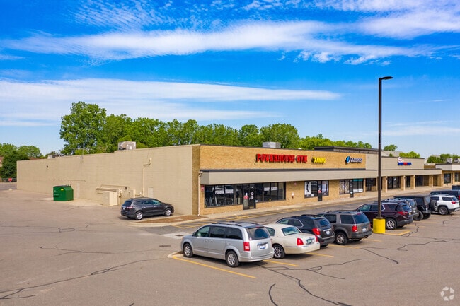
22385 Pontiac Trl
21-31-200-019
T1N, R7E, SEC 31 PART OF N 1/2 OF NE 1/4 BEG AT PT DIST S 00-29-29 E 60 FT FR NE SEC COR, TH N 89-53-45 W 581.56 FT, TH S
Supermarket
Oakland
X
Michigan
26093C0484D
4.61 AC
2024
Central I-96 Corridor
2025
Detroit
139202
Detroit-Warren-Dearborn, MI
53,610 SF
DEMOGRAPHICS near 22385 Pontiac Trl
1 Mile
3 Mile
5 Mile
2024 Total Population
5,412
29,916
52,417
2029 Population
5,386
30,042
52,632
Pop Growth 2024-2029
(0.48%)
+ 0.42%
+ 0.41%
Average Age
39
41
41
2024 Total Households
2,105
11,455
19,661
HH Growth 2024-2029
(0.43%)
+ 0.40%
+ 0.39%
Median Household Inc
$87,698
$100,962
$106,692
Avg Household Size
2.50
2.60
2.60
2024 Avg HH Vehicles
2.00
2.00
2.00
Median Home Value
$301,566
$330,687
$359,790
Median Year Built
1990
1994
1994
Nearby Places
Map Layers
Map Styles
 Street
 Aerial
- Restaurants
- Banks
- Shops
- Fitness
- Groceries
PUBLIC TRANSPORTATION
AIRPORT
Detroit Metro Wayne County
DRIVE
WALK
Distance
Detroit Metro Wayne County
45 min
34.1 mi
Freight Ports
Port of Toledo
DRIVE
WALK
Distance
Port of Toledo
92 min
70.7 mi
Nearby Properties
Address
Land Use
TOTAL SIZE
Lot Size
Zoning
Address
Land Use
TOTAL SIZE
Lot Size
Zoning
9,208 SF
230 AC
RE
Address
Land Use
TOTAL SIZE
Lot Size
Zoning
160,702 SF
16.50 AC
Address
Land Use
TOTAL SIZE
Lot Size
Zoning
4,228 SF
105.74 AC
DI
Address
Land Use
TOTAL SIZE
Lot Size
Zoning
137,373 SF
16.51 AC
AI
Address
Land Use
TOTAL SIZE
Lot Size
Zoning
4,885 SF
67.51 AC
Address
Land Use
TOTAL SIZE
Lot Size
Zoning
55,744 SF
4.40 AC
Address
Land Use
TOTAL SIZE
Lot Size
Zoning
107,743 SF
8.06 AC
AI
Address
Land Use
TOTAL SIZE
Lot Size
Zoning
61,746 SF
20.61 AC
Address
Land Use
TOTAL SIZE
Lot Size
Zoning
1,472 SF
35.14 AC
MM
Address
Land Use
TOTAL SIZE
Lot Size
Zoning
68,420 SF
6.38 AC
Address
Land Use
TOTAL SIZE
Lot Size
Zoning
64,555 SF
9.60 AC
II
Address
Land Use
TOTAL SIZE
Lot Size
Zoning
45,228 SF
5.35 AC
BI
Address
Land Use
TOTAL SIZE
Lot Size
Zoning
56,780 SF
5.13 AC
BI
Address
Land Use
TOTAL SIZE
Lot Size
Zoning
9,914 SF
0.99 AC
LI
Address
Land Use
TOTAL SIZE
Lot Size
Zoning
60,680 SF
6.35 AC
AI
Address
Land Use
TOTAL SIZE
Lot Size
Zoning
64.30 AC
AR AGR
Address
Land Use
TOTAL SIZE
Lot Size
Zoning
60,137 SF
7.96 AC
BI
Address
Land Use
TOTAL SIZE
Lot Size
Zoning
12,904 SF
1.67 AC
Address
Land Use
TOTAL SIZE
Lot Size
Zoning
44,578 SF
10 AC
II
Address
Land Use
TOTAL SIZE
Lot Size
Zoning
23,048 SF
4.72 AC
GB
Address
Land Use
TOTAL SIZE
Lot Size
Zoning
117,492 SF
Address
Land Use
TOTAL SIZE
Lot Size
Zoning
117,492 SF
31 AC
Address
Land Use
TOTAL SIZE
Lot Size
Zoning
782 SF
29.85 AC
Address
Land Use
TOTAL SIZE
Lot Size
Zoning
14,735 SF
3.40 AC
BI
Address
Land Use
TOTAL SIZE
Lot Size
Zoning
24,242 SF
3.94 AC
BI
The World's #1 Commercial Real Estate Marketplace
Connect with us
© 2026 CoStar Group
The information above has been obtained from sources believed reliable. While we do not doubt its accuracy we have not verified it and make no guarantee, warranty or representation about it. It is your responsibility to independently confirm its accuracy and completeness. Any projections, opinions, assumptions, or estimates used are for example only and do not represent the current or future performance of the property. The value of this transaction to you depends on tax and other factors which should be evaluated by your tax, financial, and legal advisors. You and your advisors should conduct a careful, independent investigation of the property to determine to your satisfaction the suitability of the property for your needs.