Property Record
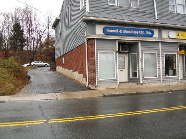
224 Main St, Watertown, CT 06779

Property Detail
224 Main St
WATE-000133A-000182-000035
Naugatuck Vly
Commercialofficeresidentialmixeduse
Connecticut
BC
35
2025
0.78 AC
2025
SE Litchfield County
253500
Hartford
7,611 SF
Torrington, CT
NEARBY LISTINGS FOR SALE OR LEASE
DEMOGRAPHICS near 224 Main St
1 mile
3 mile
5 mile
2025 Total Population
12,401
57,778
132,461
2030 Population
12,699
59,181
135,705
Pop Growth 2025-2030
+ 2.40%
+ 2.43%
+ 2.45%
Average Age
41
40
40
2025 Total Households
4,893
22,254
51,657
HH Growth 2025-2030
+ 2.37%
+ 2.47%
+ 2.51%
Median Household Inc
$78,991
$67,688
$61,826
Avg Household Size
2.50
2.50
2.50
2025 Avg HH Vehicles
2.00
2.00
2.00
Median Home Value
$242,307
$260,319
$255,903
Median Year Built
1965
1961
1959
Nearby Places
Map Layers
Map Styles
 Street
 Aerial
Layers
 Traffic
 Biking
Places
Listings with unknown addresses are not visible on the map
- Restaurants
- Banks
- Shops
- Fitness
- Groceries
PUBLIC TRANSPORTATION
COMMUTER RAIL
Waterbury Station (New Haven Line - Metro-North Commuter Railroad Company (Metro-North))
Drive
Walk
Distance
Waterbury Station (New Haven Line - Metro-North Commuter Railroad Company (Metro-North))
8 min
3.9 mi
Naugatuck Station (New Haven Line - Metro-North Commuter Railroad Company (Metro-North))
Drive
Walk
Distance
Naugatuck Station (New Haven Line - Metro-North Commuter Railroad Company (Metro-North))
12 min
8.3 mi
AIRPORT
Tweed/New Haven
Drive
Walk
Distance
Tweed/New Haven
49 min
31.0 mi
Bradley International
Drive
Walk
Distance
Bradley International
75 min
44.8 mi
Freight Ports
Port of New Haven
Drive
Walk
Distance
Port of New Haven
43 min
28.2 mi
Nearby Properties
Address
Land Use
TOTAL SIZE
Lot Size
Zoning
Address
Land Use
TOTAL SIZE
Lot Size
Zoning
276,286 SF
19.50 AC
IG80
Address
Land Use
TOTAL SIZE
Lot Size
Zoning
196,057 SF
17 AC
RS
Address
Land Use
TOTAL SIZE
Lot Size
Zoning
16.10 AC
CO
Address
Land Use
TOTAL SIZE
Lot Size
Zoning
75 AC
R20
Address
Land Use
TOTAL SIZE
Lot Size
Zoning
155,861 SF
13.70 AC
R125
Address
Land Use
TOTAL SIZE
Lot Size
Zoning
201,817 SF
34.84 AC
R125
Address
Land Use
TOTAL SIZE
Lot Size
Zoning
140,700 SF
25.55 AC
R30
Address
Land Use
TOTAL SIZE
Lot Size
Zoning
129,672 SF
8 AC
IG
Address
Land Use
TOTAL SIZE
Lot Size
Zoning
76,264 SF
15.03 AC
RS
Address
Land Use
TOTAL SIZE
Lot Size
Zoning
39 AC
RM
Address
Land Use
TOTAL SIZE
Lot Size
Zoning
24.49 AC
CA
Address
Land Use
TOTAL SIZE
Lot Size
Zoning
30.46 AC
RM
Address
Land Use
TOTAL SIZE
Lot Size
Zoning
72,336 SF
15.39 AC
R30
Address
Land Use
TOTAL SIZE
Lot Size
Zoning
5 AC
RO
Address
Land Use
TOTAL SIZE
Lot Size
Zoning
24.60 AC
RM
Address
Land Use
TOTAL SIZE
Lot Size
Zoning
125,520 SF
9 AC
CA
Address
Land Use
TOTAL SIZE
Lot Size
Zoning
54,820 SF
1.03 AC
CA
Address
Land Use
TOTAL SIZE
Lot Size
Zoning
209.81 AC
R125
Address
Land Use
TOTAL SIZE
Lot Size
Zoning
1.24 AC
RM
Address
Land Use
TOTAL SIZE
Lot Size
Zoning
326,357 SF
53.34 AC
IR200
Address
Land Use
TOTAL SIZE
Lot Size
Zoning
117,743 SF
2.95 AC
CA
Address
Land Use
TOTAL SIZE
Lot Size
Zoning
84,480 SF
11.06 AC
BSC
Address
Land Use
TOTAL SIZE
Lot Size
Zoning
180,169 SF
3.64 AC
RM
Address
Land Use
TOTAL SIZE
Lot Size
Zoning
53,668 SF
5.14 AC
CO
Address
Land Use
TOTAL SIZE
Lot Size
Zoning
78,530 SF
20.98 AC
BSC
Address
Land Use
TOTAL SIZE
Lot Size
Zoning
12.45 AC
RM
Address
Land Use
TOTAL SIZE
Lot Size
Zoning
60,703 SF
6.60 AC
R125
Address
Land Use
TOTAL SIZE
Lot Size
Zoning
47.80 AC
RS
Address
Land Use
TOTAL SIZE
Lot Size
Zoning
13.12 AC
CA40
Address
Land Use
TOTAL SIZE
Lot Size
Zoning
13.52 AC
RM
The World's #1 Commercial Real Estate Marketplace
Connect with us
© 2026 CoStar Group
The information above has been obtained from sources believed reliable. While we do not doubt its accuracy we have not verified it and make no guarantee, warranty or representation about it. It is your responsibility to independently confirm its accuracy and completeness. Any projections, opinions, assumptions, or estimates used are for example only and do not represent the current or future performance of the property. The value of this transaction to you depends on tax and other factors which should be evaluated by your tax, financial, and legal advisors. You and your advisors should conduct a careful, independent investigation of the property to determine to your satisfaction the suitability of the property for your needs.