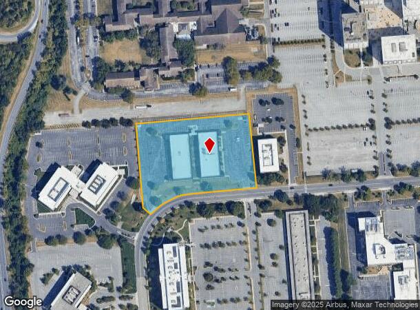
Property Record
222 Schilling Cir, Hunt Valley, MD 21031


NEARBY LISTINGS FOR SALE OR LEASE
Property Detail
222 Schilling Cir
Baltimore-Columbia-Towson, MD
Hunt Va Bus Community
08-1900001888
3.896 AC HUNT VA BUS COMMUNITY
Officebuilding
Baltimore
X
Maryland
2400100235G
76
2024
3.89 AC
2025
Route 83 Corridor North
408400
Baltimore
56,100 SF
DEMOGRAPHICS near 222 Schilling Cir
1 Mile
3 Mile
5 Mile
2024 Total Population
1,670
27,554
68,968
2029 Population
1,683
27,227
68,101
Pop Growth 2024-2029
+ 0.78%
(1.19%)
(1.26%)
Average Age
48
44
43
2024 Total Households
844
12,048
27,954
HH Growth 2024-2029
+ 1.07%
(1.27%)
(1.30%)
Median Household Inc
$85,984
$96,038
$107,359
Avg Household Size
1.80
2.20
2.40
2024 Avg HH Vehicles
2.00
2.00
2.00
Median Home Value
$340,500
$396,040
$456,863
Median Year Built
2007
1985
1980
Nearby Places
- Restaurants
- Banks
- Shops
- Fitness
- Groceries
PUBLIC TRANSPORTATION
TRANSIT/SUBWAY
Pepper Road (Hunt Valley & BWI Marshall - Maryland Transit Administration Light Rail (Baltimore Light Rail))
DRIVE
WALK
Distance
Pepper Road (Hunt Valley & BWI Marshall - Maryland Transit Administration Light Rail (Baltimore Light Rail))
3 min
8 min
0.4 mi
Mccormick Road (Hunt Valley & BWI Marshall - Maryland Transit Administration Light Rail (Baltimore Light Rail))
DRIVE
WALK
Distance
Mccormick Road (Hunt Valley & BWI Marshall - Maryland Transit Administration Light Rail (Baltimore Light Rail))
2 min
8 min
0.4 mi
Hunt Valley (Hunt Valley & BWI Marshall - Maryland Transit Administration Light Rail (Baltimore Light Rail))
DRIVE
WALK
Distance
Hunt Valley (Hunt Valley & BWI Marshall - Maryland Transit Administration Light Rail (Baltimore Light Rail))
3 min
15 min
0.8 mi
Gilroy Road (Hunt Valley & BWI Marshall - Maryland Transit Administration Light Rail (Baltimore Light Rail))
DRIVE
WALK
Distance
Gilroy Road (Hunt Valley & BWI Marshall - Maryland Transit Administration Light Rail (Baltimore Light Rail))
3 min
17 min
0.9 mi
AIRPORT
Baltimore/Washington International Thurgood Marshall
DRIVE
WALK
Distance
Baltimore/Washington International Thurgood Marshall
44 min
29.3 mi
Freight Ports
Port of Baltimore
DRIVE
WALK
Distance
Port of Baltimore
31 min
18.8 mi
SALE & LEASE HISTORY
LISTING DATE
SALE/LEASE

Oct 19, 2021
For Lease
Mar 22, 2021
For Lease
Jun 28, 2017
For Lease
Jul 10, 2017
For Lease
Feb 05, 2019
For Lease
Aug 10, 2017
For Lease
Nearby Properties
Address
Land Use
TOTAL SIZE
Lot Size
Zoning
Address
Land Use
TOTAL SIZE
Lot Size
Zoning
513,056 SF
55.49 AC
BM
Address
Land Use
TOTAL SIZE
Lot Size
Zoning
343,606 SF
19.65 AC
Address
Land Use
TOTAL SIZE
Lot Size
Zoning
595,100 SF
5.73 AC
Address
Land Use
TOTAL SIZE
Lot Size
Zoning
38.89 AC
DR16
Address
Land Use
TOTAL SIZE
Lot Size
Zoning
512,317 SF
2.76 AC
BM
Address
Land Use
TOTAL SIZE
Lot Size
Zoning
13,468 SF
32.08 AC
DR16
Address
Land Use
TOTAL SIZE
Lot Size
Zoning
28.74 AC
DR16
Address
Land Use
TOTAL SIZE
Lot Size
Zoning
489,483 SF
84.32 AC
RC4
Address
Land Use
TOTAL SIZE
Lot Size
Zoning
237,800 SF
1.28 AC
BM
Address
Land Use
TOTAL SIZE
Lot Size
Zoning
26.73 AC
DR16
Address
Land Use
TOTAL SIZE
Lot Size
Zoning
250,462 SF
185.60 AC
Address
Land Use
TOTAL SIZE
Lot Size
Zoning
330,802 SF
14.81 AC
ML-IM
Address
Land Use
TOTAL SIZE
Lot Size
Zoning
218,049 SF
22.47 AC
Address
Land Use
TOTAL SIZE
Lot Size
Zoning
176,584 SF
31 AC
Address
Land Use
TOTAL SIZE
Lot Size
Zoning
Address
Land Use
TOTAL SIZE
Lot Size
Zoning
138,000 SF
3.09 AC
Address
Land Use
TOTAL SIZE
Lot Size
Zoning
418,286 SF
22.60 AC
ML
Address
Land Use
TOTAL SIZE
Lot Size
Zoning
172,782 SF
5.35 AC
ML-IM
Address
Land Use
TOTAL SIZE
Lot Size
Zoning
14.49 AC
DR16
Address
Land Use
TOTAL SIZE
Lot Size
Zoning
18.07 AC
DR3.5
Address
Land Use
TOTAL SIZE
Lot Size
Zoning
326,069 SF
9.28 AC
ML-IM
Address
Land Use
TOTAL SIZE
Lot Size
Zoning
204,329 SF
25.45 AC
ML
Address
Land Use
TOTAL SIZE
Lot Size
Zoning
143,260 SF
7.31 AC
ML
Address
Land Use
TOTAL SIZE
Lot Size
Zoning
4,000 SF
23.97 AC
DR3.5
Address
Land Use
TOTAL SIZE
Lot Size
Zoning
90,173 SF
10.06 AC
Address
Land Use
TOTAL SIZE
Lot Size
Zoning
374,156 SF
16.09 AC
MLIM
Address
Land Use
TOTAL SIZE
Lot Size
Zoning
424,897 SF
38.53 AC
ML
Address
Land Use
TOTAL SIZE
Lot Size
Zoning
130,720 SF
10.48 AC
ML
Address
Land Use
TOTAL SIZE
Lot Size
Zoning
867,806 SF
48.59 AC
MLIM
Address
Land Use
TOTAL SIZE
Lot Size
Zoning
222,264 SF
5.70 AC
OT
The World's #1 Commercial Real Estate Marketplace
Connect with us
© 2025 CoStar Group
The information above has been obtained from sources believed reliable. While we do not doubt its accuracy we have not verified it and make no guarantee, warranty or representation about it. It is your responsibility to independently confirm its accuracy and completeness. Any projections, opinions, assumptions, or estimates used are for example only and do not represent the current or future performance of the property. The value of this transaction to you depends on tax and other factors which should be evaluated by your tax, financial, and legal advisors. You and your advisors should conduct a careful, independent investigation of the property to determine to your satisfaction the suitability of the property for your needs.