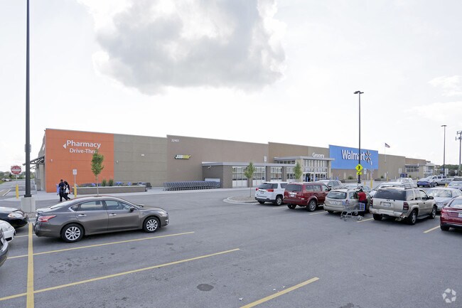
Property Record
22401 Central Ave, Richton Park, IL 60471


NEARBY LISTINGS FOR SALE OR LEASE
Property Detail
22401 Central Ave
Commercialbuilding
Cook
AE
Illinois
17197C0335G
22.05 AC
2023
Joliet/Central Will
2024
Chicago
830008
Chicago-Naperville-Elgin, IL-IN-WI
192,369 SF
31-33-100-008-0000
DEMOGRAPHICS near 22401 Central Ave
1 Mile
3 Mile
5 Mile
2024 Total Population
3,824
38,215
108,050
2029 Population
3,707
37,456
106,656
Pop Growth 2024-2029
(3.06%)
(1.99%)
(1.29%)
Average Age
41
41
41
2024 Total Households
1,346
14,331
40,089
HH Growth 2024-2029
(3.34%)
(2.32%)
(1.61%)
Median Household Inc
$99,076
$72,648
$75,669
Avg Household Size
2.80
2.60
2.60
2024 Avg HH Vehicles
2.00
2.00
2.00
Median Home Value
$189,084
$182,198
$195,625
Median Year Built
1977
1980
1978
Nearby Places
Map Layers
Map Styles
 Street
 Aerial
- Restaurants
- Banks
- Shops
- Fitness
- Groceries
PUBLIC TRANSPORTATION
COMMUTER RAIL
Richton Park Station (Metra Electric Line - Northeast Illinois Regional Commuter Railroad (Metra))
DRIVE
WALK
Distance
Richton Park Station (Metra Electric Line - Northeast Illinois Regional Commuter Railroad (Metra))
7 min
2.7 mi
University Park Station (Metra Electric Line - Northeast Illinois Regional Commuter Railroad (Metra))
DRIVE
WALK
Distance
University Park Station (Metra Electric Line - Northeast Illinois Regional Commuter Railroad (Metra))
8 min
4.0 mi
AIRPORT
Chicago Midway International
DRIVE
WALK
Distance
Chicago Midway International
38 min
23.1 mi
Freight Ports
Port Milwaukee
DRIVE
WALK
Distance
Port Milwaukee
145 min
116.8 mi
Nearby Properties
Address
Land Use
TOTAL SIZE
Lot Size
Zoning
Address
Land Use
TOTAL SIZE
Lot Size
Zoning
65.63 AC
Address
Land Use
TOTAL SIZE
Lot Size
Zoning
913,500 SF
54.87 AC
Address
Land Use
TOTAL SIZE
Lot Size
Zoning
757,504 SF
46.30 AC
Address
Land Use
TOTAL SIZE
Lot Size
Zoning
575,024 SF
39.03 AC
Address
Land Use
TOTAL SIZE
Lot Size
Zoning
497,420 SF
35 AC
Address
Land Use
TOTAL SIZE
Lot Size
Zoning
699,960 SF
31.34 AC
Address
Land Use
TOTAL SIZE
Lot Size
Zoning
650,160 SF
35.39 AC
Address
Land Use
TOTAL SIZE
Lot Size
Zoning
60.19 AC
Address
Land Use
TOTAL SIZE
Lot Size
Zoning
37.62 AC
Address
Land Use
TOTAL SIZE
Lot Size
Zoning
455,870 SF
23.32 AC
Address
Land Use
TOTAL SIZE
Lot Size
Zoning
458,858 SF
36.97 AC
Address
Land Use
TOTAL SIZE
Lot Size
Zoning
14,000 SF
12.99 AC
Address
Land Use
TOTAL SIZE
Lot Size
Zoning
Address
Land Use
TOTAL SIZE
Lot Size
Zoning
Address
Land Use
TOTAL SIZE
Lot Size
Zoning
Address
Land Use
TOTAL SIZE
Lot Size
Zoning
12.36 AC
Address
Land Use
TOTAL SIZE
Lot Size
Zoning
Address
Land Use
TOTAL SIZE
Lot Size
Zoning
70.02 AC
Address
Land Use
TOTAL SIZE
Lot Size
Zoning
300,399 SF
26.50 AC
Address
Land Use
TOTAL SIZE
Lot Size
Zoning
11.84 AC
Address
Land Use
TOTAL SIZE
Lot Size
Zoning
150,289 SF
16.40 AC
Address
Land Use
TOTAL SIZE
Lot Size
Zoning
224,611 SF
0.90 AC
Address
Land Use
TOTAL SIZE
Lot Size
Zoning
322,629 SF
53.73 AC
Address
Land Use
TOTAL SIZE
Lot Size
Zoning
8,920 SF
38.44 AC
Address
Land Use
TOTAL SIZE
Lot Size
Zoning
4,168 SF
145.94 AC
Address
Land Use
TOTAL SIZE
Lot Size
Zoning
2.04 AC
Address
Land Use
TOTAL SIZE
Lot Size
Zoning
5,000 SF
22.39 AC
Address
Land Use
TOTAL SIZE
Lot Size
Zoning
250,656 SF
Address
Land Use
TOTAL SIZE
Lot Size
Zoning
266,177 SF
25 AC
The World's #1 Commercial Real Estate Marketplace
Connect with us
© 2025 CoStar Group
The information above has been obtained from sources believed reliable. While we do not doubt its accuracy we have not verified it and make no guarantee, warranty or representation about it. It is your responsibility to independently confirm its accuracy and completeness. Any projections, opinions, assumptions, or estimates used are for example only and do not represent the current or future performance of the property. The value of this transaction to you depends on tax and other factors which should be evaluated by your tax, financial, and legal advisors. You and your advisors should conduct a careful, independent investigation of the property to determine to your satisfaction the suitability of the property for your needs.