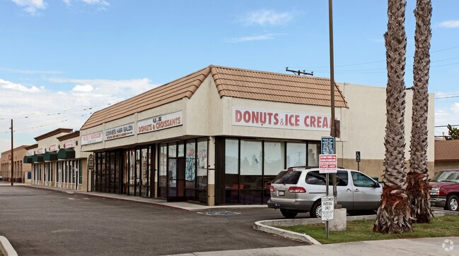
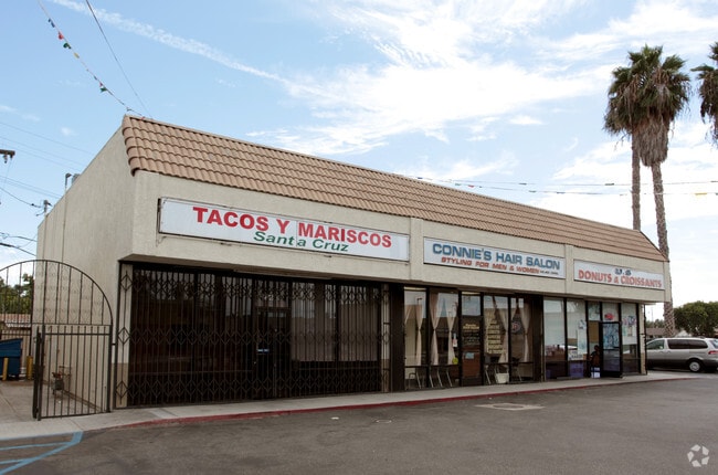
Property Record
22410 Norwalk Blvd, Hawaiian Gardens, CA 90716

NEARBY LISTINGS FOR SALE OR LEASE
Property Detail
22410 Norwalk Blvd
Los Angeles-Long Beach-Glendale, CA
Parcel Maps 21098
7076-034-023
P M 244-81-82 LOT 1
Storemultistory
Los Angeles
X
California
06059C0104J
1
2024
0.23 AC
2025
Long Beach: Suburban
555212
Los Angeles
2,970 SF
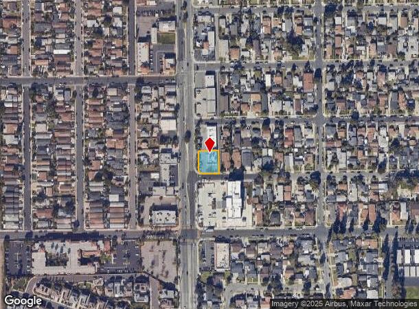
DEMOGRAPHICS near 22410 Norwalk Blvd
1 Mile
3 Mile
5 Mile
2024 Total Population
29,169
192,906
512,923
2029 Population
28,354
187,766
500,142
Pop Growth 2024-2029
(2.79%)
(2.66%)
(2.49%)
Average Age
39
41
41
2024 Total Households
8,770
62,643
168,624
HH Growth 2024-2029
(2.88%)
(2.85%)
(2.67%)
Median Household Inc
$93,720
$108,327
$96,985
Avg Household Size
3.20
3.00
2.90
2024 Avg HH Vehicles
2.00
2.00
2.00
Median Home Value
$702,822
$777,278
$742,822
Median Year Built
1967
1964
1964
Nearby Places
Map Layers
Map Styles
 Street
 Aerial
- Restaurants
- Banks
- Shops
- Fitness
- Groceries
PUBLIC TRANSPORTATION
COMMUTER RAIL
Buena Park (91 Line - Southern California Regional Rail Authority (Metrolink), Orange County Line - Southern California Regional Rail Authority (Metrolink))
DRIVE
WALK
Distance
Buena Park (91 Line - Southern California Regional Rail Authority (Metrolink), Orange County Line - Southern California Regional Rail Authority (Metrolink))
15 min
7.1 mi
Norwalk/Santa Fe Springs (91 Line - Southern California Regional Rail Authority (Metrolink), Orange County Line - Southern California Regional Rail Authority (Metrolink))
DRIVE
WALK
Distance
Norwalk/Santa Fe Springs (91 Line - Southern California Regional Rail Authority (Metrolink), Orange County Line - Southern California Regional Rail Authority (Metrolink))
18 min
10.0 mi
AIRPORT
Long Beach (Daugherty Field)
DRIVE
WALK
Distance
Long Beach (Daugherty Field)
16 min
9.6 mi
John Wayne/Orange County
DRIVE
WALK
Distance
John Wayne/Orange County
25 min
19.7 mi
Los Angeles International
DRIVE
WALK
Distance
Los Angeles International
31 min
26.2 mi
Freight Ports
Port of Long Beach
DRIVE
WALK
Distance
Port of Long Beach
1 min
7.7 mi
SALE & LEASE HISTORY
LISTING DATE
SALE/LEASE

Sep 25, 2016
For Lease
Nearby Properties
Address
Land Use
TOTAL SIZE
Lot Size
Zoning
Address
Land Use
TOTAL SIZE
Lot Size
Zoning
324,400 SF
55.03 AC
CECR
Address
Land Use
TOTAL SIZE
Lot Size
Zoning
927.44 AC
Address
Land Use
TOTAL SIZE
Lot Size
Zoning
235,971 SF
10.58 AC
HGC4*
Address
Land Use
TOTAL SIZE
Lot Size
Zoning
210,000 SF
9.18 AC
PC3
Address
Land Use
TOTAL SIZE
Lot Size
Zoning
203,371 SF
0.14 AC
HGC4*
Address
Land Use
TOTAL SIZE
Lot Size
Zoning
247,536 SF
5.79 AC
CECR
Address
Land Use
TOTAL SIZE
Lot Size
Zoning
Address
Land Use
TOTAL SIZE
Lot Size
Zoning
11.86 AC
Address
Land Use
TOTAL SIZE
Lot Size
Zoning
312,469 SF
6.85 AC
LBCCA
Address
Land Use
TOTAL SIZE
Lot Size
Zoning
8.09 AC
Address
Land Use
TOTAL SIZE
Lot Size
Zoning
120,094 SF
5.93 AC
Address
Land Use
TOTAL SIZE
Lot Size
Zoning
Address
Land Use
TOTAL SIZE
Lot Size
Zoning
11.49 AC
Address
Land Use
TOTAL SIZE
Lot Size
Zoning
105,069 SF
5.19 AC
Address
Land Use
TOTAL SIZE
Lot Size
Zoning
2,663 SF
1.43 AC
Address
Land Use
TOTAL SIZE
Lot Size
Zoning
80,339 SF
5.88 AC
ATCPD*
Address
Land Use
TOTAL SIZE
Lot Size
Zoning
83,600 SF
5.09 AC
R3
Address
Land Use
TOTAL SIZE
Lot Size
Zoning
165,343 SF
3.93 AC
Address
Land Use
TOTAL SIZE
Lot Size
Zoning
163,295 SF
6.17 AC
R3
Address
Land Use
TOTAL SIZE
Lot Size
Zoning
Address
Land Use
TOTAL SIZE
Lot Size
Zoning
175,482 SF
3.13 AC
HGC4*
Address
Land Use
TOTAL SIZE
Lot Size
Zoning
Address
Land Use
TOTAL SIZE
Lot Size
Zoning
3.84 AC
Address
Land Use
TOTAL SIZE
Lot Size
Zoning
7,200 SF
3.73 AC
Address
Land Use
TOTAL SIZE
Lot Size
Zoning
340,346 SF
5.74 AC
CECR
Address
Land Use
TOTAL SIZE
Lot Size
Zoning
Address
Land Use
TOTAL SIZE
Lot Size
Zoning
14.89 AC
Address
Land Use
TOTAL SIZE
Lot Size
Zoning
7,500 SF
30.41 AC
Address
Land Use
TOTAL SIZE
Lot Size
Zoning
6.70 AC
Address
Land Use
TOTAL SIZE
Lot Size
Zoning
38,433 SF
7.01 AC
LBCR
The World's #1 Commercial Real Estate Marketplace
Connect with us
© 2025 CoStar Group
The information above has been obtained from sources believed reliable. While we do not doubt its accuracy we have not verified it and make no guarantee, warranty or representation about it. It is your responsibility to independently confirm its accuracy and completeness. Any projections, opinions, assumptions, or estimates used are for example only and do not represent the current or future performance of the property. The value of this transaction to you depends on tax and other factors which should be evaluated by your tax, financial, and legal advisors. You and your advisors should conduct a careful, independent investigation of the property to determine to your satisfaction the suitability of the property for your needs.