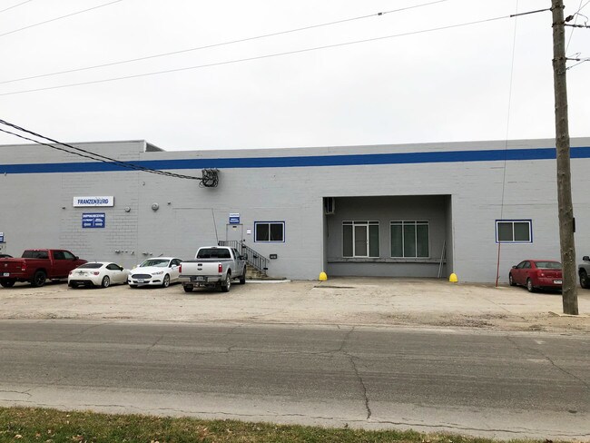
Property Record
2245 Dean Ave, Des Moines, IA 50317


NEARBY LISTINGS FOR SALE OR LEASE
Property Detail
2245 Dean Ave
Des Moines-West Des Moines, IA
Sec 01-78-24
050-04433001000
LOT 36 & 23F W OF & ADJ BAILEYS ADDITION; AND E 400 F LT 2 OP S 1/2 SEC 1-78-24
Warehouse
Polk
X
Iowa
19153C0355F
36,2
2024
1.85 AC
2025
Northeast
002100
Des Moines
63,926 SF
DEMOGRAPHICS near 2245 Dean Ave
1 Mile
3 Mile
5 Mile
2024 Total Population
8,279
75,451
181,208
2029 Population
8,601
78,694
188,875
Pop Growth 2024-2029
+ 3.89%
+ 4.30%
+ 4.23%
Average Age
37
37
37
2024 Total Households
3,007
30,986
73,807
HH Growth 2024-2029
+ 4.02%
+ 4.72%
+ 4.50%
Median Household Inc
$43,358
$54,122
$56,861
Avg Household Size
2.60
2.30
2.30
2024 Avg HH Vehicles
2.00
2.00
2.00
Median Home Value
$86,128
$138,802
$158,183
Median Year Built
1947
1964
1965
Nearby Places
Map Layers
Map Styles
 Street
 Aerial
- Restaurants
- Banks
- Shops
- Fitness
- Groceries
PUBLIC TRANSPORTATION
AIRPORT
Des Moines International
DRIVE
WALK
Distance
Des Moines International
15 min
7.8 mi
SALE & LEASE HISTORY
LISTING DATE
SALE/LEASE

Sep 25, 2016
For Lease
Sep 23, 2016
For Sale
Nov 20, 2018
For Sale
Jan 07, 2018
For Sale
Nearby Properties
Address
Land Use
TOTAL SIZE
Lot Size
Zoning
Address
Land Use
TOTAL SIZE
Lot Size
Zoning
936,742 SF
6.85 AC
C-0
Address
Land Use
TOTAL SIZE
Lot Size
Zoning
2,157,357 SF
23.95 AC
PUD
Address
Land Use
TOTAL SIZE
Lot Size
Zoning
428,582 SF
6.87 AC
C-0
Address
Land Use
TOTAL SIZE
Lot Size
Zoning
481,030 SF
31.92 AC
PUD
Address
Land Use
TOTAL SIZE
Lot Size
Zoning
972,206 SF
1.23 AC
C-3
Address
Land Use
TOTAL SIZE
Lot Size
Zoning
484,524 SF
2.03 AC
C-3
Address
Land Use
TOTAL SIZE
Lot Size
Zoning
798,696 SF
4.04 AC
C-3
Address
Land Use
TOTAL SIZE
Lot Size
Zoning
529,814 SF
3.11 AC
C-3
Address
Land Use
TOTAL SIZE
Lot Size
Zoning
311,655 SF
2.38 AC
C3
Address
Land Use
TOTAL SIZE
Lot Size
Zoning
177,094 SF
24.60 AC
Address
Land Use
TOTAL SIZE
Lot Size
Zoning
300,115 SF
2.48 AC
Address
Land Use
TOTAL SIZE
Lot Size
Zoning
208,955 SF
1.84 AC
Address
Land Use
TOTAL SIZE
Lot Size
Zoning
335,556 SF
0.86 AC
C-3
Address
Land Use
TOTAL SIZE
Lot Size
Zoning
461,246 SF
2.11 AC
C-3
Address
Land Use
TOTAL SIZE
Lot Size
Zoning
262,833 SF
0.97 AC
C-3
Address
Land Use
TOTAL SIZE
Lot Size
Zoning
402,849 SF
0.83 AC
C-3
Address
Land Use
TOTAL SIZE
Lot Size
Zoning
432,630 SF
0.82 AC
C-3
Address
Land Use
TOTAL SIZE
Lot Size
Zoning
475,929 SF
49.86 AC
M2
Address
Land Use
TOTAL SIZE
Lot Size
Zoning
342,000 SF
22.18 AC
Address
Land Use
TOTAL SIZE
Lot Size
Zoning
178,611 SF
3.02 AC
Address
Land Use
TOTAL SIZE
Lot Size
Zoning
257,407 SF
1.43 AC
Address
Land Use
TOTAL SIZE
Lot Size
Zoning
127,000 SF
1.92 AC
Address
Land Use
TOTAL SIZE
Lot Size
Zoning
427,768 SF
0.87 AC
C-3
Address
Land Use
TOTAL SIZE
Lot Size
Zoning
249,188 SF
0.39 AC
Address
Land Use
TOTAL SIZE
Lot Size
Zoning
555,952 SF
2 AC
C-3
Address
Land Use
TOTAL SIZE
Lot Size
Zoning
117,000 SF
4.02 AC
PUD
Address
Land Use
TOTAL SIZE
Lot Size
Zoning
184,659 SF
4.10 AC
Address
Land Use
TOTAL SIZE
Lot Size
Zoning
123,535 SF
0.63 AC
Address
Land Use
TOTAL SIZE
Lot Size
Zoning
162,217 SF
6.32 AC
The World's #1 Commercial Real Estate Marketplace
Connect with us
© 2026 CoStar Group
The information above has been obtained from sources believed reliable. While we do not doubt its accuracy we have not verified it and make no guarantee, warranty or representation about it. It is your responsibility to independently confirm its accuracy and completeness. Any projections, opinions, assumptions, or estimates used are for example only and do not represent the current or future performance of the property. The value of this transaction to you depends on tax and other factors which should be evaluated by your tax, financial, and legal advisors. You and your advisors should conduct a careful, independent investigation of the property to determine to your satisfaction the suitability of the property for your needs.