Property Record
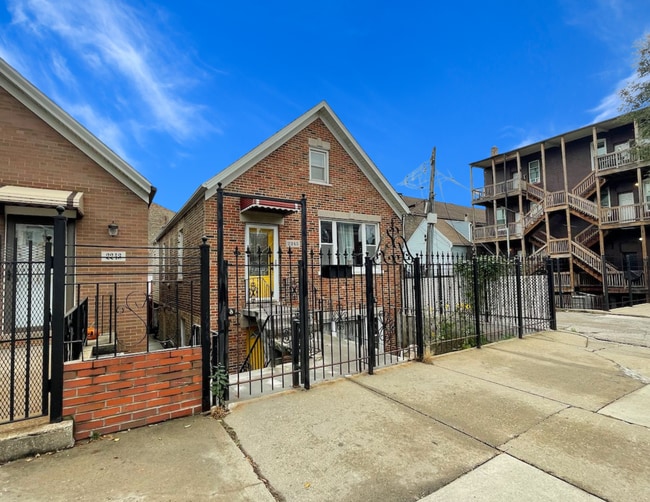
2245 W 23Rd St, Chicago, IL 60608


NEARBY LISTINGS FOR SALE OR LEASE
Property Detail
2245 W 23Rd St
Chicago-Naperville-Elgin, IL-IN
Laughtons Sub
17-30-109-012-0000
(SUBDIVISION) OF NH OF BLK4 IN LAUGHTONS SUB OF WH NW SEC 30-39-14
Apartment
Cook
X
Illinois
17031C0506J
24
2023
0.07 AC
2025
Lower West Side
841300
Chicago
1,871 SF
DEMOGRAPHICS near 2245 W 23Rd St
1 mile
3 mile
5 mile
2024 Total Population
25,929
300,240
955,356
2029 Population
22,920
276,918
903,407
Pop Growth 2024-2029
(11.60%)
(7.77%)
(5.44%)
Average Age
36
36
37
2024 Total Households
9,457
114,075
404,631
HH Growth 2024-2029
(12.16%)
(7.43%)
(4.56%)
Median Household Inc
$55,048
$56,843
$74,818
Avg Household Size
2.60
2.50
2.20
2024 Avg HH Vehicles
1.00
1.00
1.00
Median Home Value
$274,497
$321,527
$358,600
Median Year Built
1947
1952
1962
Nearby Places
Map Layers
Map Styles
 Street
 Aerial
Transit
 Traffic
 Biking
Places
Listings with unknown addresses are not visible on the map
- Restaurants
- Banks
- Shops
- Fitness
- Groceries
PUBLIC TRANSPORTATION
TRANSIT/SUBWAY
Western Station (Pink Line) (Pink Line - Chicago Transit Authority "L" Trains (The "L"))
Drive
Walk
Distance
Western Station (Pink Line) (Pink Line - Chicago Transit Authority "L" Trains (The "L"))
1 min
9 min
0.5 mi
Damen Station (Pink Line) (Pink Line - Chicago Transit Authority "L" Trains (The "L"))
Drive
Walk
Distance
Damen Station (Pink Line) (Pink Line - Chicago Transit Authority "L" Trains (The "L"))
2 min
11 min
0.6 mi
Western Avenue Station (BNSF) (Burlington Northern-Santa Fe Railway Line - Northeast Illinois Regional Commuter Railroad (Metra))
Drive
Walk
Distance
Western Avenue Station (BNSF) (Burlington Northern-Santa Fe Railway Line - Northeast Illinois Regional Commuter Railroad (Metra))
2 min
16 min
0.7 mi
California Station (Pink Line) (Pink Line - Chicago Transit Authority "L" Trains (The "L"))
Drive
Walk
Distance
California Station (Pink Line) (Pink Line - Chicago Transit Authority "L" Trains (The "L"))
3 min
19 min
1.0 mi
COMMUTER RAIL
Western Avenue Station (BNSF) (Burlington Northern-Santa Fe Railway Line - Northeast Illinois Regional Commuter Railroad (Metra))
Drive
Walk
Distance
Western Avenue Station (BNSF) (Burlington Northern-Santa Fe Railway Line - Northeast Illinois Regional Commuter Railroad (Metra))
2 min
16 min
0.7 mi
Halsted Station (Burlington Northern-Santa Fe Railway Line - Northeast Illinois Regional Commuter Railroad (Metra))
Drive
Walk
Distance
Halsted Station (Burlington Northern-Santa Fe Railway Line - Northeast Illinois Regional Commuter Railroad (Metra))
7 min
2.6 mi
AIRPORT
Chicago Midway International
Drive
Walk
Distance
Chicago Midway International
13 min
6.8 mi
Chicago O'Hare International
Drive
Walk
Distance
Chicago O'Hare International
32 min
19.6 mi
SALE & LEASE HISTORY
LISTING DATE
SALE/LEASE

Feb 12, 2025
For Sale
Nearby Properties
Address
Land Use
TOTAL SIZE
Lot Size
Zoning
Address
Land Use
TOTAL SIZE
Lot Size
Zoning
1,496,448 SF
2 AC
PD 376
Address
Land Use
TOTAL SIZE
Lot Size
Zoning
2,750,656 SF
6.29 AC
PD 1065
Address
Land Use
TOTAL SIZE
Lot Size
Zoning
1,231,710 SF
2.01 AC
PD 27
Address
Land Use
TOTAL SIZE
Lot Size
Zoning
0.23 AC
PD 756
Address
Land Use
TOTAL SIZE
Lot Size
Zoning
559,589 SF
1.72 AC
C3-5
Address
Land Use
TOTAL SIZE
Lot Size
Zoning
1.44 AC
PD 30
Address
Land Use
TOTAL SIZE
Lot Size
Zoning
73,700 SF
0.48 AC
RM-6.5
Address
Land Use
TOTAL SIZE
Lot Size
Zoning
589,535 SF
0.96 AC
DX-12
Address
Land Use
TOTAL SIZE
Lot Size
Zoning
662,088 SF
4.91 AC
PD 504
Address
Land Use
TOTAL SIZE
Lot Size
Zoning
243,200 SF
0.80 AC
DX-7
Address
Land Use
TOTAL SIZE
Lot Size
Zoning
474,979 SF
29.67 AC
PD 553
Address
Land Use
TOTAL SIZE
Lot Size
Zoning
979,674 SF
6.01 AC
PD 924
Address
Land Use
TOTAL SIZE
Lot Size
Zoning
117,600 SF
2.14 AC
PD 233
Address
Land Use
TOTAL SIZE
Lot Size
Zoning
247,716 SF
0.95 AC
DX-7
Address
Land Use
TOTAL SIZE
Lot Size
Zoning
626,055 SF
1.86 AC
PD 523
Address
Land Use
TOTAL SIZE
Lot Size
Zoning
408,203 SF
2.02 AC
DS-5
Address
Land Use
TOTAL SIZE
Lot Size
Zoning
317,932 SF
0.97 AC
PD 1306
Address
Land Use
TOTAL SIZE
Lot Size
Zoning
0.85 AC
DS-3
Address
Land Use
TOTAL SIZE
Lot Size
Zoning
679,914 SF
0.97 AC
PD 1202
Address
Land Use
TOTAL SIZE
Lot Size
Zoning
0.36 AC
PD 756
Address
Land Use
TOTAL SIZE
Lot Size
Zoning
236,821 SF
0.85 AC
PD 1202
Address
Land Use
TOTAL SIZE
Lot Size
Zoning
3.17 AC
PD 96
Address
Land Use
TOTAL SIZE
Lot Size
Zoning
PD 842
Address
Land Use
TOTAL SIZE
Lot Size
Zoning
131,800 SF
0.57 AC
PD 1344
Address
Land Use
TOTAL SIZE
Lot Size
Zoning
365,160 SF
0.51 AC
DX-7,DX-12
Address
Land Use
TOTAL SIZE
Lot Size
Zoning
107,900 SF
0.30 AC
DX-16
Address
Land Use
TOTAL SIZE
Lot Size
Zoning
3.29 AC
PD 522
Address
Land Use
TOTAL SIZE
Lot Size
Zoning
2.67 AC
PD 522
Address
Land Use
TOTAL SIZE
Lot Size
Zoning
131,800 SF
0.43 AC
PD 1344
Address
Land Use
TOTAL SIZE
Lot Size
Zoning
587,125 SF
1.10 AC
PD 1298
The World's #1 Commercial Real Estate Marketplace
Connect with us
© 2026 CoStar Group
The information above has been obtained from sources believed reliable. While we do not doubt its accuracy we have not verified it and make no guarantee, warranty or representation about it. It is your responsibility to independently confirm its accuracy and completeness. Any projections, opinions, assumptions, or estimates used are for example only and do not represent the current or future performance of the property. The value of this transaction to you depends on tax and other factors which should be evaluated by your tax, financial, and legal advisors. You and your advisors should conduct a careful, independent investigation of the property to determine to your satisfaction the suitability of the property for your needs.