Property Record
225 Corporate Blvd S, Yonkers, NY 10701
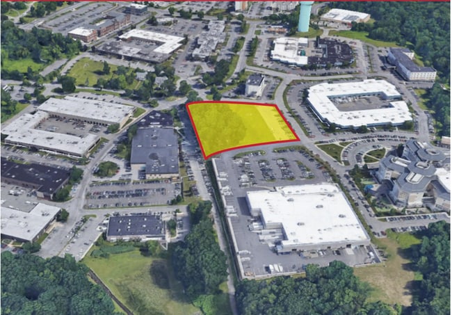

This Property Is For Sale
NEARBY LISTINGS FOR SALE OR LEASE
-
-
-
-
-
-
No Photo
-
-
View all Yonkers listings for sale on LoopNet.com
Property Detail
225 Corporate Blvd S
1800-003-000-03455-000-0013
Westchester
Commercialacreage
New York
X
13.000
34003C0210H
2.71 AC
2025
Southwest
2024
Westchester/So Connecticut
000501
New York-Jersey City-White Plains, NY-NJ
DEMOGRAPHICS near 225 Corporate Blvd S
1 Mile
3 Mile
5 Mile
2024 Total Population
17,048
148,815
411,049
2029 Population
16,372
145,827
400,748
Pop Growth 2024-2029
(3.97%)
(2.01%)
(2.51%)
Average Age
44
41
41
2024 Total Households
6,555
56,656
154,033
HH Growth 2024-2029
(4.00%)
(2.12%)
(2.70%)
Median Household Inc
$108,002
$80,190
$92,155
Avg Household Size
2.40
2.50
2.50
2024 Avg HH Vehicles
2.00
1.00
1.00
Median Home Value
$439,580
$518,333
$614,407
Median Year Built
1958
1959
1954
Nearby Places
Map Layers
Map Styles
 Street
 Aerial
- Restaurants
- Banks
- Shops
- Fitness
- Groceries
PUBLIC TRANSPORTATION
COMMUTER RAIL
Greystone Station (Hudson Line - Metro-North Commuter Railroad Company (Metro-North))
DRIVE
WALK
Distance
Greystone Station (Hudson Line - Metro-North Commuter Railroad Company (Metro-North))
3 min
17 min
0.9 mi
Glenwood Station (Hudson Line - Metro-North Commuter Railroad Company (Metro-North))
DRIVE
WALK
Distance
Glenwood Station (Hudson Line - Metro-North Commuter Railroad Company (Metro-North))
8 min
2.3 mi
AIRPORT
Westchester County
DRIVE
WALK
Distance
Westchester County
27 min
19.0 mi
LaGuardia
DRIVE
WALK
Distance
LaGuardia
30 min
19.2 mi
John F Kennedy International
DRIVE
WALK
Distance
John F Kennedy International
41 min
27.8 mi
Freight Ports
NY - Red Hook Container Terminal
DRIVE
WALK
Distance
NY - Red Hook Container Terminal
43 min
27.4 mi
Nearby Properties
Address
Land Use
TOTAL SIZE
Lot Size
Zoning
Address
Land Use
TOTAL SIZE
Lot Size
Zoning
1,125 SF
542.62 AC
RA
Address
Land Use
TOTAL SIZE
Lot Size
Zoning
689 SF
423.72 AC
P
Address
Land Use
TOTAL SIZE
Lot Size
Zoning
88.45 AC
Address
Land Use
TOTAL SIZE
Lot Size
Zoning
289.02 AC
P
Address
Land Use
TOTAL SIZE
Lot Size
Zoning
201,590 SF
4.13 AC
BA
Address
Land Use
TOTAL SIZE
Lot Size
Zoning
229.55 AC
P
Address
Land Use
TOTAL SIZE
Lot Size
Zoning
185.35 AC
P
Address
Land Use
TOTAL SIZE
Lot Size
Zoning
166.61 AC
P
Address
Land Use
TOTAL SIZE
Lot Size
Zoning
101.99 AC
Address
Land Use
TOTAL SIZE
Lot Size
Zoning
23.97 AC
Address
Land Use
TOTAL SIZE
Lot Size
Zoning
134.16 AC
RA
Address
Land Use
TOTAL SIZE
Lot Size
Zoning
Address
Land Use
TOTAL SIZE
Lot Size
Zoning
68,911 SF
16.31 AC
Address
Land Use
TOTAL SIZE
Lot Size
Zoning
97,600 SF
136.28 AC
R-40
Address
Land Use
TOTAL SIZE
Lot Size
Zoning
11.68 AC
Address
Land Use
TOTAL SIZE
Lot Size
Zoning
Address
Land Use
TOTAL SIZE
Lot Size
Zoning
Address
Land Use
TOTAL SIZE
Lot Size
Zoning
14.92 AC
Address
Land Use
TOTAL SIZE
Lot Size
Zoning
54.65 AC
P
Address
Land Use
TOTAL SIZE
Lot Size
Zoning
18.72 AC
Address
Land Use
TOTAL SIZE
Lot Size
Zoning
28.77 AC
Address
Land Use
TOTAL SIZE
Lot Size
Zoning
14.31 AC
Address
Land Use
TOTAL SIZE
Lot Size
Zoning
47.14 AC
P
Address
Land Use
TOTAL SIZE
Lot Size
Zoning
41.23 AC
P
Address
Land Use
TOTAL SIZE
Lot Size
Zoning
13.35 AC
Address
Land Use
TOTAL SIZE
Lot Size
Zoning
11.70 AC
R-30
Address
Land Use
TOTAL SIZE
Lot Size
Zoning
28.31 AC
Address
Land Use
TOTAL SIZE
Lot Size
Zoning
Address
Land Use
TOTAL SIZE
Lot Size
Zoning
15.94 AC
Address
Land Use
TOTAL SIZE
Lot Size
Zoning
30.29 AC
P
The World's #1 Commercial Real Estate Marketplace
Connect with us
© 2026 CoStar Group
The information above has been obtained from sources believed reliable. While we do not doubt its accuracy we have not verified it and make no guarantee, warranty or representation about it. It is your responsibility to independently confirm its accuracy and completeness. Any projections, opinions, assumptions, or estimates used are for example only and do not represent the current or future performance of the property. The value of this transaction to you depends on tax and other factors which should be evaluated by your tax, financial, and legal advisors. You and your advisors should conduct a careful, independent investigation of the property to determine to your satisfaction the suitability of the property for your needs.