Property Record
225 E 8Th Ave, Durango, CO 81301


Property Detail
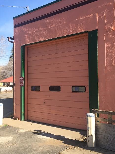
225 E 8Th Ave
Durango, CO
SUBDIVISION: MOUNTAIN VIEW ADD BLOCK: 7 LOT: 1 THRU:- LOT: 11 M V ADD (#1 225 8TH AVE) 225 E 8TH AVE DURANGO 81301
R000878
La Plata
Commercialbuilding
Colorado
B and X Area of moderate flood hazard, usually the area between the limits of the 100-year and 500-year floods.
1,11
2024
0.95 AC
2025
Downtown Durango
971100
Other Market Areas
9,070 SF
NEARBY LISTINGS FOR SALE OR LEASE
DEMOGRAPHICS near 225 E 8Th Ave
1 mile
3 mile
5 mile
2025 Total Population
2,891
17,118
24,355
2030 Population
2,891
17,110
24,397
Pop Growth 2025-2030
0.00%
(0.05%)
+ 0.17%
Average Age
39
38
40
2025 Total Households
1,468
7,079
10,263
HH Growth 2025-2030
(0.20%)
(0.45%)
(0.15%)
Median Household Inc
$59,752
$88,321
$89,792
Avg Household Size
1.90
2.10
2.10
2025 Avg HH Vehicles
2.00
2.00
2.00
Median Home Value
$724,063
$703,877
$713,173
Median Year Built
1955
1980
1987
Nearby Places
Map Layers
Map Styles
 Street
 Aerial
Transit
 Traffic
 Biking
Places
Listings with unknown addresses are not visible on the map
- Restaurants
- Banks
- Shops
- Fitness
- Groceries
PUBLIC TRANSPORTATION
AIRPORT
Durango-La Plata County
Drive
Walk
Distance
Durango-La Plata County
23 min
14.0 mi
Freight Ports
Port of San Diego
Drive
Walk
Distance
Port of San Diego
930 min
799.2 mi
SALE & LEASE HISTORY
LISTING DATE
SALE/LEASE

Sep 25, 2016
For Lease
Sep 24, 2016
For Sale
Nearby Properties
Address
Land Use
TOTAL SIZE
Lot Size
Zoning
Address
Land Use
TOTAL SIZE
Lot Size
Zoning
1,237,361 SF
230.69 AC
Address
Land Use
TOTAL SIZE
Lot Size
Zoning
277,165 SF
16.47 AC
Address
Land Use
TOTAL SIZE
Lot Size
Zoning
174,631 SF
32.10 AC
Address
Land Use
TOTAL SIZE
Lot Size
Zoning
108,918 SF
27.44 AC
Address
Land Use
TOTAL SIZE
Lot Size
Zoning
68,857 SF
21.03 AC
Address
Land Use
TOTAL SIZE
Lot Size
Zoning
153,242 SF
11.62 AC
Address
Land Use
TOTAL SIZE
Lot Size
Zoning
30,443 SF
0.65 AC
Address
Land Use
TOTAL SIZE
Lot Size
Zoning
108,697 SF
13.51 AC
Address
Land Use
TOTAL SIZE
Lot Size
Zoning
112,681 SF
1.12 AC
Address
Land Use
TOTAL SIZE
Lot Size
Zoning
159,163 SF
5.50 AC
Address
Land Use
TOTAL SIZE
Lot Size
Zoning
180,591 SF
13.50 AC
Address
Land Use
TOTAL SIZE
Lot Size
Zoning
87,592 SF
10.30 AC
Address
Land Use
TOTAL SIZE
Lot Size
Zoning
48,369 SF
0.63 AC
Address
Land Use
TOTAL SIZE
Lot Size
Zoning
58,393 SF
10.20 AC
Address
Land Use
TOTAL SIZE
Lot Size
Zoning
45,824 SF
4.55 AC
Address
Land Use
TOTAL SIZE
Lot Size
Zoning
78,166 SF
6.73 AC
Address
Land Use
TOTAL SIZE
Lot Size
Zoning
51,923 SF
Address
Land Use
TOTAL SIZE
Lot Size
Zoning
45,340 SF
3.74 AC
Address
Land Use
TOTAL SIZE
Lot Size
Zoning
65,704 SF
2.27 AC
Address
Land Use
TOTAL SIZE
Lot Size
Zoning
23,667 SF
1.91 AC
Address
Land Use
TOTAL SIZE
Lot Size
Zoning
60,809 SF
3.02 AC
Address
Land Use
TOTAL SIZE
Lot Size
Zoning
51,561 SF
37.58 AC
Address
Land Use
TOTAL SIZE
Lot Size
Zoning
29,546 SF
4.14 AC
Address
Land Use
TOTAL SIZE
Lot Size
Zoning
23,503 SF
14.22 AC
Address
Land Use
TOTAL SIZE
Lot Size
Zoning
112,292 SF
9.21 AC
Address
Land Use
TOTAL SIZE
Lot Size
Zoning
45,481 SF
5 AC
Address
Land Use
TOTAL SIZE
Lot Size
Zoning
72,094 SF
0.57 AC
Address
Land Use
TOTAL SIZE
Lot Size
Zoning
48,258 SF
3.30 AC
Address
Land Use
TOTAL SIZE
Lot Size
Zoning
49,001 SF
7.61 AC
Address
Land Use
TOTAL SIZE
Lot Size
Zoning
52,704 SF
1.73 AC
The World's #1 Commercial Real Estate Marketplace
Connect with us
© 2026 CoStar Group
The information above has been obtained from sources believed reliable. While we do not doubt its accuracy we have not verified it and make no guarantee, warranty or representation about it. It is your responsibility to independently confirm its accuracy and completeness. Any projections, opinions, assumptions, or estimates used are for example only and do not represent the current or future performance of the property. The value of this transaction to you depends on tax and other factors which should be evaluated by your tax, financial, and legal advisors. You and your advisors should conduct a careful, independent investigation of the property to determine to your satisfaction the suitability of the property for your needs.