Property Record
225 Milliken St, Drayton, SC 29333

Save to a Folder
{{folder.Name}}
{{folder.ListingIds.length}} Properties
{{folder.ListingIds.length}} Property
Create a New Folder
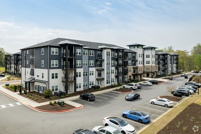
Property Detail
225 Milliken St
7-08-16-043.00
S SIDE DRAYTON RD & E OF MILLIKEN ST RD RW TAKEN 42.118A TR 30
Commercialnec
SPARTANBURG
AE The base floodplain where base flood elevations are provided. AE Zones are now used on new format FIRMs instead of A1-A30 Zones.
South Carolina
2024
24.56 AC
2025
Drayton
021403
Greenville/Spartanburg
106,100 SF
Spartanburg, SC
NEARBY LISTINGS FOR SALE OR LEASE
DEMOGRAPHICS near 225 Milliken St
1 mile
3 mile
5 mile
2025 Total Population
4,958
44,886
96,756
2030 Population
5,496
50,111
107,961
Pop Growth 2025-2030
+ 10.85%
+ 11.64%
+ 11.58%
Average Age
38
39
39
2025 Total Households
2,230
18,791
38,813
HH Growth 2025-2030
+ 11.12%
+ 11.90%
+ 11.82%
Median Household Inc
$55,017
$50,474
$51,793
Avg Household Size
2.10
2.20
2.30
2025 Avg HH Vehicles
2.00
2.00
2.00
Median Home Value
$191,102
$195,969
$198,025
Median Year Built
1966
1972
1975
Nearby Places
Map Layers
Map Styles
 Street
 Aerial
Layers
 Traffic
 Biking
Places
Listings with unknown addresses are not visible on the map
- Restaurants
- Banks
- Shops
- Fitness
- Groceries
PUBLIC TRANSPORTATION
COMMUTER RAIL
Spartanburg Amtrak Station (Crescent - Amtrak)
Drive
Walk
Distance
Spartanburg Amtrak Station (Crescent - Amtrak)
6 min
2.5 mi
AIRPORT
Greenville Spartanburg International
Drive
Walk
Distance
Greenville Spartanburg International
34 min
23.0 mi
Freight Ports
North Charleston Terminal
Drive
Walk
Distance
North Charleston Terminal
227 min
196.6 mi
Nearby Properties
Address
Land Use
TOTAL SIZE
Lot Size
Zoning
Address
Land Use
TOTAL SIZE
Lot Size
Zoning
9,312 SF
9.06 AC
Address
Land Use
TOTAL SIZE
Lot Size
Zoning
5,672 SF
10.20 AC
Address
Land Use
TOTAL SIZE
Lot Size
Zoning
27,491 SF
2.95 AC
Address
Land Use
TOTAL SIZE
Lot Size
Zoning
141,112 SF
3.38 AC
Address
Land Use
TOTAL SIZE
Lot Size
Zoning
15,108 SF
16.27 AC
Address
Land Use
TOTAL SIZE
Lot Size
Zoning
18,600 SF
3.41 AC
Address
Land Use
TOTAL SIZE
Lot Size
Zoning
2,100 SF
10.12 AC
Address
Land Use
TOTAL SIZE
Lot Size
Zoning
19,876 SF
0.03 AC
Address
Land Use
TOTAL SIZE
Lot Size
Zoning
12,740 SF
1.48 AC
Address
Land Use
TOTAL SIZE
Lot Size
Zoning
13,160 SF
1.62 AC
Address
Land Use
TOTAL SIZE
Lot Size
Zoning
6,517 SF
6.68 AC
Address
Land Use
TOTAL SIZE
Lot Size
Zoning
12,069 SF
0.03 AC
Address
Land Use
TOTAL SIZE
Lot Size
Zoning
44,301 SF
7.47 AC
Address
Land Use
TOTAL SIZE
Lot Size
Zoning
40,995 SF
0.74 AC
Address
Land Use
TOTAL SIZE
Lot Size
Zoning
31,913 SF
1.03 AC
Address
Land Use
TOTAL SIZE
Lot Size
Zoning
31,054 SF
0.48 AC
Address
Land Use
TOTAL SIZE
Lot Size
Zoning
9,146 SF
51.62 AC
Address
Land Use
TOTAL SIZE
Lot Size
Zoning
8,872 SF
0.03 AC
Address
Land Use
TOTAL SIZE
Lot Size
Zoning
2,022 SF
3.50 AC
Address
Land Use
TOTAL SIZE
Lot Size
Zoning
6,110 SF
6.01 AC
Address
Land Use
TOTAL SIZE
Lot Size
Zoning
2,864 SF
3.72 AC
Address
Land Use
TOTAL SIZE
Lot Size
Zoning
6,798 SF
31.44 AC
Address
Land Use
TOTAL SIZE
Lot Size
Zoning
83,698 SF
18.14 AC
Address
Land Use
TOTAL SIZE
Lot Size
Zoning
89,435 SF
5.33 AC
Address
Land Use
TOTAL SIZE
Lot Size
Zoning
109,024 SF
2.30 AC
Address
Land Use
TOTAL SIZE
Lot Size
Zoning
19,796 SF
3.56 AC
Address
Land Use
TOTAL SIZE
Lot Size
Zoning
5,693 SF
0.03 AC
Address
Land Use
TOTAL SIZE
Lot Size
Zoning
3,648 SF
20.77 AC
Address
Land Use
TOTAL SIZE
Lot Size
Zoning
18,443 SF
0.58 AC
The World's #1 Commercial Real Estate Marketplace
Connect with us
© 2026 CoStar Group
The information above has been obtained from sources believed reliable. While we do not doubt its accuracy we have not verified it and make no guarantee, warranty or representation about it. It is your responsibility to independently confirm its accuracy and completeness. Any projections, opinions, assumptions, or estimates used are for example only and do not represent the current or future performance of the property. The value of this transaction to you depends on tax and other factors which should be evaluated by your tax, financial, and legal advisors. You and your advisors should conduct a careful, independent investigation of the property to determine to your satisfaction the suitability of the property for your needs.