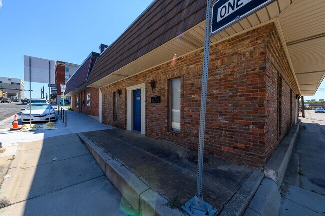
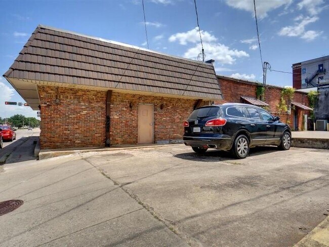
Property Record
225 N Locust St, Denton, TX 76201

Property Detail
225 N Locust St
Dallas-Fort Worth-Arlington, TX
O T DENTON BLK 16 LOT 3(N32 OF E88)
R32926
Denton
Commercialnec
Texas
B and X Area of moderate flood hazard, usually the area between the limits of the 100-year and 500-year floods.
3
2024
0.07 AC
2025
Denton
021100
Dallas/Ft Worth
1,798 SF
NEARBY LISTINGS FOR SALE OR LEASE
DEMOGRAPHICS near 225 N Locust St
1 mile
3 mile
5 mile
2025 Total Population
21,208
101,524
153,772
2030 Population
23,619
114,371
173,420
Pop Growth 2025-2030
+ 11.37%
+ 12.65%
+ 12.78%
Average Age
31
35
36
2025 Total Households
8,347
41,883
59,731
HH Growth 2025-2030
+ 12.04%
+ 13.06%
+ 13.14%
Median Household Inc
$42,602
$57,346
$69,254
Avg Household Size
1.90
2.20
2.40
2025 Avg HH Vehicles
2.00
2.00
2.00
Median Home Value
$261,538
$316,026
$348,905
Median Year Built
1981
1987
1994
Nearby Places
Map Layers
Map Styles
 Street
 Aerial
Transit
 Traffic
 Biking
Places
Listings with unknown addresses are not visible on the map
- Restaurants
- Banks
- Shops
- Fitness
- Groceries
PUBLIC TRANSPORTATION
AIRPORT
Dallas-Fort Worth International
Drive
Walk
Distance
Dallas-Fort Worth International
38 min
27.0 mi
Dallas Love Field
Drive
Walk
Distance
Dallas Love Field
50 min
36.8 mi
SALE & LEASE HISTORY
LISTING DATE
SALE/LEASE

Aug 12, 2020
For Sale
Nearby Properties
Address
Land Use
TOTAL SIZE
Lot Size
Zoning
Address
Land Use
TOTAL SIZE
Lot Size
Zoning
594,945 SF
139.10 AC
Address
Land Use
TOTAL SIZE
Lot Size
Zoning
515,375 SF
24.39 AC
Address
Land Use
TOTAL SIZE
Lot Size
Zoning
490,000 SF
27.69 AC
Address
Land Use
TOTAL SIZE
Lot Size
Zoning
337,730 SF
65.39 AC
Address
Land Use
TOTAL SIZE
Lot Size
Zoning
394,618 SF
12.29 AC
Address
Land Use
TOTAL SIZE
Lot Size
Zoning
347,844 SF
14.09 AC
Address
Land Use
TOTAL SIZE
Lot Size
Zoning
576,664 SF
189.26 AC
Address
Land Use
TOTAL SIZE
Lot Size
Zoning
398,028 SF
18.89 AC
Address
Land Use
TOTAL SIZE
Lot Size
Zoning
272,599 SF
4.01 AC
Address
Land Use
TOTAL SIZE
Lot Size
Zoning
361,731 SF
15.96 AC
Address
Land Use
TOTAL SIZE
Lot Size
Zoning
343,800 SF
10.95 AC
Address
Land Use
TOTAL SIZE
Lot Size
Zoning
409,957 SF
5.91 AC
Address
Land Use
TOTAL SIZE
Lot Size
Zoning
373,498 SF
54.27 AC
Address
Land Use
TOTAL SIZE
Lot Size
Zoning
184,710 SF
16.82 AC
Address
Land Use
TOTAL SIZE
Lot Size
Zoning
278,316 SF
17.81 AC
30G
Address
Land Use
TOTAL SIZE
Lot Size
Zoning
347,845 SF
15.53 AC
Address
Land Use
TOTAL SIZE
Lot Size
Zoning
262,008 SF
11.11 AC
Address
Land Use
TOTAL SIZE
Lot Size
Zoning
144,771 SF
Address
Land Use
TOTAL SIZE
Lot Size
Zoning
285,578 SF
42.28 AC
Address
Land Use
TOTAL SIZE
Lot Size
Zoning
334,834 SF
11.95 AC
Address
Land Use
TOTAL SIZE
Lot Size
Zoning
350,457 SF
4.25 AC
Address
Land Use
TOTAL SIZE
Lot Size
Zoning
338,378 SF
11.89 AC
Address
Land Use
TOTAL SIZE
Lot Size
Zoning
352,862 SF
47.44 AC
Address
Land Use
TOTAL SIZE
Lot Size
Zoning
362,191 SF
6.81 AC
Address
Land Use
TOTAL SIZE
Lot Size
Zoning
216,314 SF
22.10 AC
Address
Land Use
TOTAL SIZE
Lot Size
Zoning
310,078 SF
18.22 AC
29G
Address
Land Use
TOTAL SIZE
Lot Size
Zoning
611,770 SF
44.56 AC
Address
Land Use
TOTAL SIZE
Lot Size
Zoning
138,000 SF
2.91 AC
Address
Land Use
TOTAL SIZE
Lot Size
Zoning
352,950 SF
21.43 AC
Address
Land Use
TOTAL SIZE
Lot Size
Zoning
294,021 SF
30.81 AC
The World's #1 Commercial Real Estate Marketplace
Connect with us
© 2026 CoStar Group
The information above has been obtained from sources believed reliable. While we do not doubt its accuracy we have not verified it and make no guarantee, warranty or representation about it. It is your responsibility to independently confirm its accuracy and completeness. Any projections, opinions, assumptions, or estimates used are for example only and do not represent the current or future performance of the property. The value of this transaction to you depends on tax and other factors which should be evaluated by your tax, financial, and legal advisors. You and your advisors should conduct a careful, independent investigation of the property to determine to your satisfaction the suitability of the property for your needs.