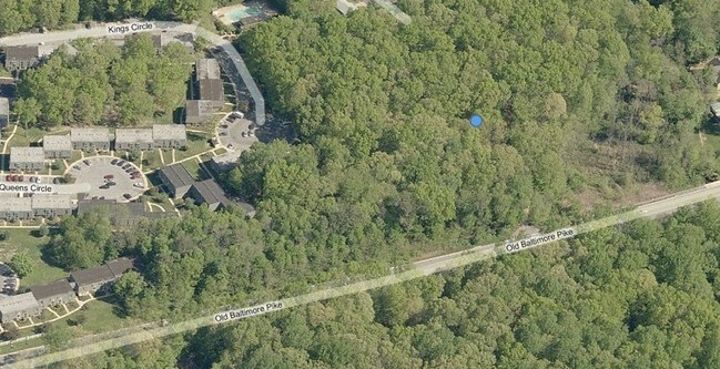
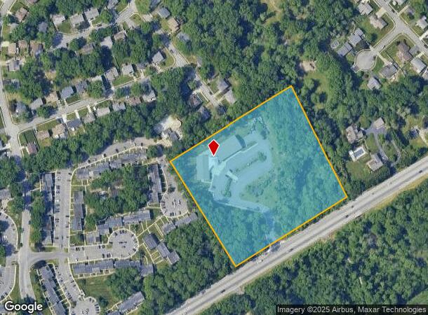
Property Record
225 Old Baltimore Pike, Newark, DE 19702


NEARBY LISTINGS FOR SALE OR LEASE
Property Detail
225 Old Baltimore Pike
09-034.00-014
Girl Scouts Of Chesapeake Bay
Recreationalentertainmentgeneral
New Castle
A
Delaware
10003C0145K
7.27 AC
2024
South New Castle County
2024
Philadelphia
013906
Philadelphia-Camden-Wilmington, PA-NJ-DE-MD
1,575 SF
DEMOGRAPHICS near 225 Old Baltimore Pike
1 Mile
3 Mile
5 Mile
2024 Total Population
11,480
93,182
183,466
2029 Population
11,542
94,296
186,717
Pop Growth 2024-2029
+ 0.54%
+ 1.20%
+ 1.77%
Average Age
38
39
39
2024 Total Households
4,447
35,902
70,110
HH Growth 2024-2029
+ 0.63%
+ 1.26%
+ 1.87%
Median Household Inc
$79,274
$68,721
$68,883
Avg Household Size
2.50
2.50
2.50
2024 Avg HH Vehicles
2.00
2.00
2.00
Median Home Value
$272,910
$250,769
$262,235
Median Year Built
1992
1983
1981
Nearby Places
Map Layers
Map Styles
 Street
 Aerial
- Restaurants
- Banks
- Shops
- Fitness
- Groceries
PUBLIC TRANSPORTATION
COMMUTER RAIL
Churchmans Crossing (R2 - Southeastern Pennsylvania Transportation Authority Regional Rail (SEPTA Regional Rail))
DRIVE
WALK
Distance
Churchmans Crossing (R2 - Southeastern Pennsylvania Transportation Authority Regional Rail (SEPTA Regional Rail))
8 min
4.0 mi
Newark (R2 - Southeastern Pennsylvania Transportation Authority Regional Rail (SEPTA Regional Rail))
DRIVE
WALK
Distance
Newark (R2 - Southeastern Pennsylvania Transportation Authority Regional Rail (SEPTA Regional Rail))
10 min
7.2 mi
AIRPORT
Philadelphia International
DRIVE
WALK
Distance
Philadelphia International
42 min
31.4 mi
Freight Ports
Port of Wilmington, RI
DRIVE
WALK
Distance
Port of Wilmington, RI
17 min
11.3 mi
Nearby Properties
Address
Land Use
TOTAL SIZE
Lot Size
Zoning
Address
Land Use
TOTAL SIZE
Lot Size
Zoning
525,757 SF
189.70 AC
NCPUD
Address
Land Use
TOTAL SIZE
Lot Size
Zoning
488,637 SF
229.83 AC
NCPUD
Address
Land Use
TOTAL SIZE
Lot Size
Zoning
803,690 SF
155.50 AC
NCPUD
Address
Land Use
TOTAL SIZE
Lot Size
Zoning
467,262 SF
28.74 AC
CR
Address
Land Use
TOTAL SIZE
Lot Size
Zoning
Address
Land Use
TOTAL SIZE
Lot Size
Zoning
62,498 SF
132.23 AC
I
Address
Land Use
TOTAL SIZE
Lot Size
Zoning
33,790 SF
45.17 AC
S
Address
Land Use
TOTAL SIZE
Lot Size
Zoning
Address
Land Use
TOTAL SIZE
Lot Size
Zoning
Address
Land Use
TOTAL SIZE
Lot Size
Zoning
735,703 SF
49.15 AC
NCAP
Address
Land Use
TOTAL SIZE
Lot Size
Zoning
276,191 SF
54.91 AC
BP
Address
Land Use
TOTAL SIZE
Lot Size
Zoning
242,811 SF
38.77 AC
CR
Address
Land Use
TOTAL SIZE
Lot Size
Zoning
187,286 SF
24.20 AC
CR
Address
Land Use
TOTAL SIZE
Lot Size
Zoning
113,545 SF
22.21 AC
OR
Address
Land Use
TOTAL SIZE
Lot Size
Zoning
247,122 SF
30.25 AC
S
Address
Land Use
TOTAL SIZE
Lot Size
Zoning
76,357 SF
145.10 AC
CR
Address
Land Use
TOTAL SIZE
Lot Size
Zoning
3,150 SF
11.90 AC
NC6.5
Address
Land Use
TOTAL SIZE
Lot Size
Zoning
26,443 SF
9.31 AC
CR
Address
Land Use
TOTAL SIZE
Lot Size
Zoning
4,676 SF
42.81 AC
NCAP
Address
Land Use
TOTAL SIZE
Lot Size
Zoning
Address
Land Use
TOTAL SIZE
Lot Size
Zoning
Address
Land Use
TOTAL SIZE
Lot Size
Zoning
216,689 SF
16.44 AC
CR
Address
Land Use
TOTAL SIZE
Lot Size
Zoning
117,727 SF
19.17 AC
NCAP
Address
Land Use
TOTAL SIZE
Lot Size
Zoning
51,286 SF
15.60 AC
CR
Address
Land Use
TOTAL SIZE
Lot Size
Zoning
203,570 SF
83.85 AC
OR
Address
Land Use
TOTAL SIZE
Lot Size
Zoning
150,729 SF
1.60 AC
CR
Address
Land Use
TOTAL SIZE
Lot Size
Zoning
351,528 SF
24.88 AC
NCAP
Address
Land Use
TOTAL SIZE
Lot Size
Zoning
281,611 SF
26.39 AC
NCAP
Address
Land Use
TOTAL SIZE
Lot Size
Zoning
268,661 SF
28.38 AC
NCAP
Address
Land Use
TOTAL SIZE
Lot Size
Zoning
145,312 SF
CR
The World's #1 Commercial Real Estate Marketplace
Connect with us
© 2026 CoStar Group
The information above has been obtained from sources believed reliable. While we do not doubt its accuracy we have not verified it and make no guarantee, warranty or representation about it. It is your responsibility to independently confirm its accuracy and completeness. Any projections, opinions, assumptions, or estimates used are for example only and do not represent the current or future performance of the property. The value of this transaction to you depends on tax and other factors which should be evaluated by your tax, financial, and legal advisors. You and your advisors should conduct a careful, independent investigation of the property to determine to your satisfaction the suitability of the property for your needs.