Property Record
225 Pamela Dr, Mountain View, CA 94040
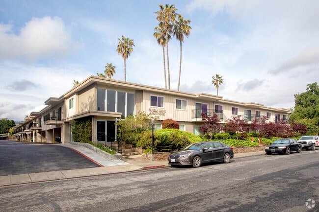

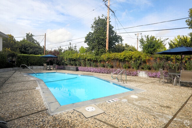

Property Detail
225 Pamela Dr
193-12-017
Santa Clara
Multifamilydwelling
California
R3-1*
c,d
2024
1.66 AC
2025
Cuesta Park
509902
South Bay/San Jose
39,310 SF
San Jose-Sunnyvale-Santa Clara, CA
NEARBY LISTINGS FOR SALE OR LEASE
DEMOGRAPHICS near 225 Pamela Dr
1 mile
3 mile
5 mile
2025 Total Population
25,164
190,250
385,569
2030 Population
25,951
197,018
397,814
Pop Growth 2025-2030
+ 3.13%
+ 3.56%
+ 3.18%
Average Age
40
40
40
2025 Total Households
10,140
74,702
145,886
HH Growth 2025-2030
+ 3.25%
+ 3.66%
+ 3.26%
Median Household Inc
$191,148
$198,052
$196,596
Avg Household Size
2.40
2.50
2.60
2025 Avg HH Vehicles
2.00
2.00
2.00
Median Home Value
$1,124,682
$1,130,259
$1,125,380
Median Year Built
1969
1972
1973
Nearby Places
Map Layers
Map Styles
 Street
 Aerial
Layers
 Traffic
 Biking
Places
Listings with unknown addresses are not visible on the map
- Restaurants
- Banks
- Shops
- Fitness
- Groceries
PUBLIC TRANSPORTATION
COMMUTER RAIL
Mountain View Caltrain Station Southbound (Express - Caltrain (Caltrain), Limited - Caltrain (Caltrain), Local Weekday - Caltrain (Caltrain), Local Weekend - Caltrain (Caltrain))
Drive
Walk
Distance
Mountain View Caltrain Station Southbound (Express - Caltrain (Caltrain), Limited - Caltrain (Caltrain), Local Weekday - Caltrain (Caltrain), Local Weekend - Caltrain (Caltrain))
4 min
1.3 mi
Sunnyvale Caltrain Station Southbound (Express - Caltrain (Caltrain), Limited - Caltrain (Caltrain), Local Weekday - Caltrain (Caltrain), Local Weekend - Caltrain (Caltrain))
Drive
Walk
Distance
Sunnyvale Caltrain Station Southbound (Express - Caltrain (Caltrain), Limited - Caltrain (Caltrain), Local Weekday - Caltrain (Caltrain), Local Weekend - Caltrain (Caltrain))
7 min
3.0 mi
AIRPORT
Norman Y Mineta San Jose International
Drive
Walk
Distance
Norman Y Mineta San Jose International
14 min
9.7 mi
San Francisco International
Drive
Walk
Distance
San Francisco International
34 min
26.8 mi
Metro Oakland International
Drive
Walk
Distance
Metro Oakland International
47 min
35.5 mi
Freight Ports
Port of Redwood City
Drive
Walk
Distance
Port of Redwood City
19 min
13.7 mi
Nearby Properties
Address
Land Use
TOTAL SIZE
Lot Size
Zoning
Address
Land Use
TOTAL SIZE
Lot Size
Zoning
42.28 AC
PF
Address
Land Use
TOTAL SIZE
Lot Size
Zoning
499,360 SF
31.95 AC
MM40
Address
Land Use
TOTAL SIZE
Lot Size
Zoning
0.33 AC
PF
Address
Land Use
TOTAL SIZE
Lot Size
Zoning
450,575 SF
3.73 AC
P(9)
Address
Land Use
TOTAL SIZE
Lot Size
Zoning
355,490 SF
26.49 AC
P39
Address
Land Use
TOTAL SIZE
Lot Size
Zoning
440,173 SF
25.33 AC
P39
Address
Land Use
TOTAL SIZE
Lot Size
Zoning
73,425 SF
14.20 AC
MS
Address
Land Use
TOTAL SIZE
Lot Size
Zoning
4 AC
DSP/1
Address
Land Use
TOTAL SIZE
Lot Size
Zoning
584,389 SF
5.25 AC
P(40)
Address
Land Use
TOTAL SIZE
Lot Size
Zoning
431,256 SF
12.43 AC
PPSP
Address
Land Use
TOTAL SIZE
Lot Size
Zoning
595,000 SF
7.42 AC
P(34)
Address
Land Use
TOTAL SIZE
Lot Size
Zoning
350,633 SF
1.08 AC
MPTOD
Address
Land Use
TOTAL SIZE
Lot Size
Zoning
350,633 SF
1.08 AC
MPTOD
Address
Land Use
TOTAL SIZE
Lot Size
Zoning
587,826 SF
2.54 AC
DSP/1
Address
Land Use
TOTAL SIZE
Lot Size
Zoning
353,745 SF
14.82 AC
PPSP
Address
Land Use
TOTAL SIZE
Lot Size
Zoning
233,124 SF
9.18 AC
P(7)
Address
Land Use
TOTAL SIZE
Lot Size
Zoning
531,132 SF
21.33 AC
R4PD
Address
Land Use
TOTAL SIZE
Lot Size
Zoning
23,709 SF
7.48 AC
PPSP
Address
Land Use
TOTAL SIZE
Lot Size
Zoning
312,510 SF
23.46 AC
P41
Address
Land Use
TOTAL SIZE
Lot Size
Zoning
372,859 SF
4.71 AC
P
Address
Land Use
TOTAL SIZE
Lot Size
Zoning
298,463 SF
7 AC
P(19)
Address
Land Use
TOTAL SIZE
Lot Size
Zoning
63,131 SF
4.73 AC
P41
Address
Land Use
TOTAL SIZE
Lot Size
Zoning
287,644 SF
10.04 AC
PPSP
Address
Land Use
TOTAL SIZE
Lot Size
Zoning
203,098 SF
7.90 AC
PPSP
Address
Land Use
TOTAL SIZE
Lot Size
Zoning
640,105 SF
7.90 AC
R3-2*
Address
Land Use
TOTAL SIZE
Lot Size
Zoning
340,913 SF
15.64 AC
ML
Address
Land Use
TOTAL SIZE
Lot Size
Zoning
224,505 SF
5.15 AC
CORE
Address
Land Use
TOTAL SIZE
Lot Size
Zoning
33,964 SF
3.95 AC
PPSP
Address
Land Use
TOTAL SIZE
Lot Size
Zoning
20,160.50 AC
P
Address
Land Use
TOTAL SIZE
Lot Size
Zoning
322,264 SF
3.92 AC
P
The World's #1 Commercial Real Estate Marketplace
Connect with us
© 2026 CoStar Group
The information above has been obtained from sources believed reliable. While we do not doubt its accuracy we have not verified it and make no guarantee, warranty or representation about it. It is your responsibility to independently confirm its accuracy and completeness. Any projections, opinions, assumptions, or estimates used are for example only and do not represent the current or future performance of the property. The value of this transaction to you depends on tax and other factors which should be evaluated by your tax, financial, and legal advisors. You and your advisors should conduct a careful, independent investigation of the property to determine to your satisfaction the suitability of the property for your needs.