Property Record
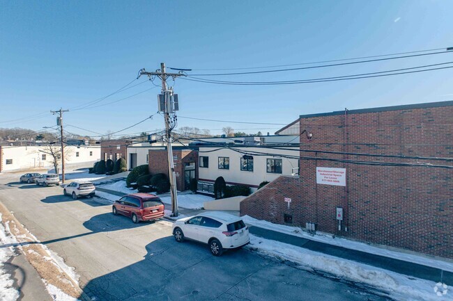
225 Riverview Ave, Auburndale, MA 02466


Current Lease Availabilities
Property Detail
225 Riverview Ave
NEWT-000041-000032-000005
Middlesex
Manufacturinglight
Massachusetts
MAN
5
AE The base floodplain where base flood elevations are provided. AE Zones are now used on new format FIRMs instead of A1-A30 Zones.
1.07 AC
2025
Newton/Dover
2025
Boston
374700
Boston-Cambridge-Newton, MA-NH
31,072 SF
NEARBY LISTINGS FOR SALE OR LEASE
DEMOGRAPHICS near 225 Riverview Ave
1 mile
3 mile
5 mile
2025 Total Population
21,859
121,976
308,616
2030 Population
22,502
126,242
318,601
Pop Growth 2025-2030
+ 2.94%
+ 3.50%
+ 3.24%
Average Age
38
41
41
2025 Total Households
8,896
47,443
116,795
HH Growth 2025-2030
+ 2.99%
+ 3.63%
+ 3.42%
Median Household Inc
$125,789
$138,315
$145,665
Avg Household Size
2.30
2.40
2.40
2025 Avg HH Vehicles
2.00
2.00
2.00
Median Home Value
$948,588
$983,002
$1,017,165
Median Year Built
1948
1949
1952
Nearby Places
Map Layers
Map Styles
 Street
 Aerial
Layers
 Traffic
 Biking
Places
Listings with unknown addresses are not visible on the map
- Restaurants
- Banks
- Shops
- Fitness
- Groceries
PUBLIC TRANSPORTATION
COMMUTER RAIL
Drive
Walk
Distance
5 min
1.6 mi
West Newton (Framingham/Worcester Line - Massachusetts Bay Transportation Authority Commuter Rail (Purple Line))
Drive
Walk
Distance
West Newton (Framingham/Worcester Line - Massachusetts Bay Transportation Authority Commuter Rail (Purple Line))
12 min
6.5 mi
AIRPORT
General Edward Lawrence Logan International
Drive
Walk
Distance
General Edward Lawrence Logan International
24 min
14.3 mi
Worcester Regional
Drive
Walk
Distance
Worcester Regional
58 min
39.8 mi
Nearby Properties
Address
Land Use
TOTAL SIZE
Lot Size
Zoning
Address
Land Use
TOTAL SIZE
Lot Size
Zoning
447,312 SF
62.01 AC
Address
Land Use
TOTAL SIZE
Lot Size
Zoning
165,986 SF
4.32 AC
Address
Land Use
TOTAL SIZE
Lot Size
Zoning
105,982 SF
4.50 AC
Address
Land Use
TOTAL SIZE
Lot Size
Zoning
30,170 SF
19 AC
SR2
Address
Land Use
TOTAL SIZE
Lot Size
Zoning
387,965 SF
3.90 AC
Address
Land Use
TOTAL SIZE
Lot Size
Zoning
21.52 AC
Address
Land Use
TOTAL SIZE
Lot Size
Zoning
317,256 SF
17.48 AC
Address
Land Use
TOTAL SIZE
Lot Size
Zoning
234,814 SF
4.06 AC
Address
Land Use
TOTAL SIZE
Lot Size
Zoning
293,084 SF
5.01 AC
1
Address
Land Use
TOTAL SIZE
Lot Size
Zoning
238,065 SF
1.79 AC
Address
Land Use
TOTAL SIZE
Lot Size
Zoning
272,445 SF
6.40 AC
Address
Land Use
TOTAL SIZE
Lot Size
Zoning
179,834 SF
8.57 AC
PUB
Address
Land Use
TOTAL SIZE
Lot Size
Zoning
269,692 SF
15.37 AC
Address
Land Use
TOTAL SIZE
Lot Size
Zoning
402,419 SF
73.98 AC
BB
Address
Land Use
TOTAL SIZE
Lot Size
Zoning
6.51 AC
PSCD
Address
Land Use
TOTAL SIZE
Lot Size
Zoning
293,195 SF
11.55 AC
BU5
Address
Land Use
TOTAL SIZE
Lot Size
Zoning
391,781 SF
8.22 AC
Address
Land Use
TOTAL SIZE
Lot Size
Zoning
3.86 AC
Address
Land Use
TOTAL SIZE
Lot Size
Zoning
164,072 SF
43.80 AC
Address
Land Use
TOTAL SIZE
Lot Size
Zoning
212,684 SF
54.49 AC
Address
Land Use
TOTAL SIZE
Lot Size
Zoning
30.69 AC
Address
Land Use
TOTAL SIZE
Lot Size
Zoning
124,950 SF
1.69 AC
Address
Land Use
TOTAL SIZE
Lot Size
Zoning
36,868 SF
3.41 AC
MAN
Address
Land Use
TOTAL SIZE
Lot Size
Zoning
144,584 SF
4.86 AC
PUB
Address
Land Use
TOTAL SIZE
Lot Size
Zoning
197,400 SF
4.29 AC
Address
Land Use
TOTAL SIZE
Lot Size
Zoning
11.17 AC
Address
Land Use
TOTAL SIZE
Lot Size
Zoning
15.60 AC
Address
Land Use
TOTAL SIZE
Lot Size
Zoning
288,975 SF
5 AC
Address
Land Use
TOTAL SIZE
Lot Size
Zoning
64.56 AC
Address
Land Use
TOTAL SIZE
Lot Size
Zoning
72,748 SF
31.39 AC
A
The World's #1 Commercial Real Estate Marketplace
Connect with us
© 2026 CoStar Group
The information above has been obtained from sources believed reliable. While we do not doubt its accuracy we have not verified it and make no guarantee, warranty or representation about it. It is your responsibility to independently confirm its accuracy and completeness. Any projections, opinions, assumptions, or estimates used are for example only and do not represent the current or future performance of the property. The value of this transaction to you depends on tax and other factors which should be evaluated by your tax, financial, and legal advisors. You and your advisors should conduct a careful, independent investigation of the property to determine to your satisfaction the suitability of the property for your needs.