Property Record
225 S Grove St, Hendersonville, NC 28792
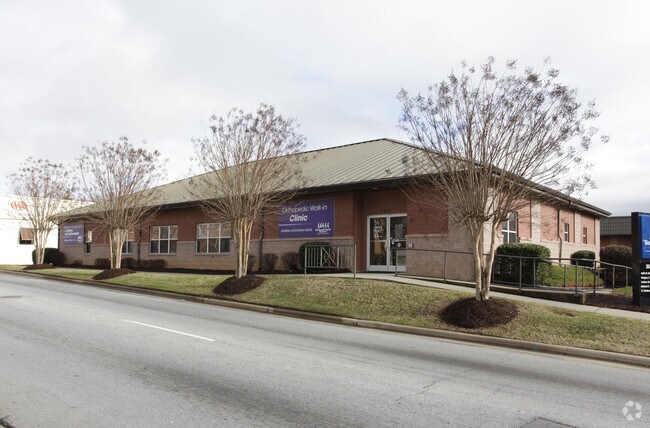


Property Detail
225 S Grove St
1010621
KING ST ON
Storebuilding
Henderson
1010621~C-
North Carolina
B and X Area of moderate flood hazard, usually the area between the limits of the 100-year and 500-year floods.
7846
2025
2 AC
2025
Henderson County
931200
Asheville
3,834 SF
Asheville, NC
NEARBY LISTINGS FOR SALE OR LEASE
DEMOGRAPHICS near 225 S Grove St
1 mile
3 mile
5 mile
2025 Total Population
6,118
33,458
62,549
2030 Population
6,385
34,652
64,728
Pop Growth 2025-2030
+ 4.36%
+ 3.57%
+ 3.48%
Average Age
43
47
47
2025 Total Households
2,711
14,937
27,443
HH Growth 2025-2030
+ 4.61%
+ 3.70%
+ 3.61%
Median Household Inc
$51,973
$56,852
$59,911
Avg Household Size
2.10
2.20
2.20
2025 Avg HH Vehicles
2.00
2.00
2.00
Median Home Value
$315,333
$350,877
$374,487
Median Year Built
1968
1978
1984
Nearby Places
Map Layers
Map Styles
 Street
 Aerial
Layers
 Traffic
 Biking
Places
Listings with unknown addresses are not visible on the map
- Restaurants
- Banks
- Shops
- Fitness
- Groceries
PUBLIC TRANSPORTATION
AIRPORT
Asheville Regional
Drive
Walk
Distance
Asheville Regional
17 min
12.1 mi
Greenville Spartanburg International
Drive
Walk
Distance
Greenville Spartanburg International
60 min
39.4 mi
SALE & LEASE HISTORY
LISTING DATE
SALE/LEASE

May 27, 2021
For Lease
Jul 14, 2022
For Lease
Nearby Properties
Address
Land Use
TOTAL SIZE
Lot Size
Zoning
Address
Land Use
TOTAL SIZE
Lot Size
Zoning
8,728 SF
8.84 AC
9970930~PC
Address
Land Use
TOTAL SIZE
Lot Size
Zoning
60,582 SF
9.54 AC
10010646~R
Address
Land Use
TOTAL SIZE
Lot Size
Zoning
60,582 SF
9.53 AC
9948805~R-
Address
Land Use
TOTAL SIZE
Lot Size
Zoning
96,084 SF
13.96 AC
1013416~PI
Address
Land Use
TOTAL SIZE
Lot Size
Zoning
97,776 SF
0.92 AC
1009121~MI
Address
Land Use
TOTAL SIZE
Lot Size
Zoning
2,888 SF
26.93 AC
10006080~I
Address
Land Use
TOTAL SIZE
Lot Size
Zoning
5,625 SF
15.53 AC
10007593~P
Address
Land Use
TOTAL SIZE
Lot Size
Zoning
29,233 SF
83.09 AC
10005104~O
Address
Land Use
TOTAL SIZE
Lot Size
Zoning
172,244 SF
18.87 AC
9968664~R-
Address
Land Use
TOTAL SIZE
Lot Size
Zoning
223,395 SF
29.32 AC
9968634~PC
Address
Land Use
TOTAL SIZE
Lot Size
Zoning
12,309 SF
6.52 AC
10005105~O
Address
Land Use
TOTAL SIZE
Lot Size
Zoning
105,179 SF
5.20 AC
1008855~PC
Address
Land Use
TOTAL SIZE
Lot Size
Zoning
44,485 SF
38.89 AC
9906409~OI
Address
Land Use
TOTAL SIZE
Lot Size
Zoning
70,136 SF
3.33 AC
10000154~O
Address
Land Use
TOTAL SIZE
Lot Size
Zoning
102,649 SF
7.08 AC
9904585~PI
Address
Land Use
TOTAL SIZE
Lot Size
Zoning
88,754 SF
4 AC
1003459~OI
Address
Land Use
TOTAL SIZE
Lot Size
Zoning
97,368 SF
6.66 AC
1000569~PI
Address
Land Use
TOTAL SIZE
Lot Size
Zoning
92,512 SF
3.38 AC
9968665~PR
Address
Land Use
TOTAL SIZE
Lot Size
Zoning
73,500 SF
16.40 AC
10010073~I
Address
Land Use
TOTAL SIZE
Lot Size
Zoning
135,809 SF
13.87 AC
9967831~PC
Address
Land Use
TOTAL SIZE
Lot Size
Zoning
51,166 SF
5.43 AC
9962201~R1
Address
Land Use
TOTAL SIZE
Lot Size
Zoning
94,066 SF
15.21 AC
9970994~PC
Address
Land Use
TOTAL SIZE
Lot Size
Zoning
40,975 SF
1.15 AC
9904361~C-
Address
Land Use
TOTAL SIZE
Lot Size
Zoning
72,560 SF
7.23 AC
10000067~P
Address
Land Use
TOTAL SIZE
Lot Size
Zoning
59,072 SF
6.62 AC
10008042~R
Address
Land Use
TOTAL SIZE
Lot Size
Zoning
68,080 SF
2.30 AC
1001184~PC
Address
Land Use
TOTAL SIZE
Lot Size
Zoning
690,212 SF
105.90 AC
1010645~I-
Address
Land Use
TOTAL SIZE
Lot Size
Zoning
33,419 SF
1.56 AC
10005796~R
Address
Land Use
TOTAL SIZE
Lot Size
Zoning
9,947 SF
1.67 AC
9948806~C-
Address
Land Use
TOTAL SIZE
Lot Size
Zoning
11.77 AC
10009504~I
The World's #1 Commercial Real Estate Marketplace
Connect with us
© 2026 CoStar Group
The information above has been obtained from sources believed reliable. While we do not doubt its accuracy we have not verified it and make no guarantee, warranty or representation about it. It is your responsibility to independently confirm its accuracy and completeness. Any projections, opinions, assumptions, or estimates used are for example only and do not represent the current or future performance of the property. The value of this transaction to you depends on tax and other factors which should be evaluated by your tax, financial, and legal advisors. You and your advisors should conduct a careful, independent investigation of the property to determine to your satisfaction the suitability of the property for your needs.